Grant County is usually told one town at a time. This chapter tells the county as a whole, and it takes a narrow path: every fact below comes from a source that was checked line by line for the Grant County Atlas, and each paragraph ends with links to the sources it rests on. Where the sources disagree, the disagreement stays in the story. Where they are silent, the story says so.
The sources are of several kinds. Territorial laws, census reports, Army records and National Register nominations were written by people with a job to do, sometimes long after the events. Booster reports were written to bring settlers and money, and they are quoted as what they claimed. Newspapers reported what reached them. Apache historians and Apache voices speak for themselves where the record holds them. Each is named as it appears.
Silver City, Pinos Altos, the ancient peoples and Spanish and Mexican Grant County have their own histories in the Atlas and in this site’s series; this chapter links to them rather than repeating them. Each part below is also an Atlas page, where every sentence is tied to its checked fact.
A county made and remade, 1868 to 1969
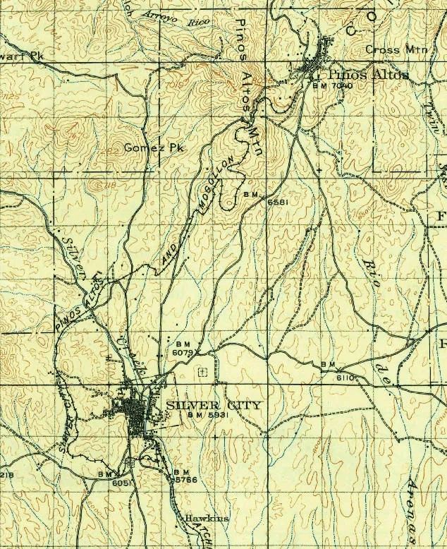
A detail of the 1909 USGS Silver City topographic map shows Silver City, Pinos Altos and the Silver City, Pinos Altos and Mogollon railroad line winding between them. U.S. Geological Survey; public domain. Resized. Holder’s record.
A new county and its first seat
This page follows Grant County as a unit of government: how it was made, where its seat stood, how its borders were drawn and redrawn, who held its offices, how it fared before the judges and how its people were counted, precinct by precinct. The histories of Silver City and Pinos Altos are told in their own pages, so the towns appear here mostly as the county saw them. Many of the sources below are governors’ reports and booster publications, and this page quotes them as claims, not as fact.
Even the year the county began depends on which source you open. Grant County’s own comprehensive plan of 2017, in its short history summary, says the county was founded in 1868 and named for Ulysses S. Grant, who would become the 18th president of the United States the following year. The same summary dates the Town of Silver City to 1870. (Sources: Grant County Comprehensive Plan, p. 16.)
Older accounts give 1870 for the county itself. An Illustrated History of New Mexico, published in 1895, says the county was organized by act of the legislature in 1870, during Grant’s first presidential term, and received its name in his honor. A county report of 1881 agreed: ‘Organized in 1870, and named in honor of the Silent Hero.’ That report also claimed 18,000 square miles for the county. (Sources: An Illustrated History of New Mexico ……, p. 188; W. H. Lawrence, p. 5.)
Two other sources bear on the question. The Newberry Library’s Atlas of Historical County Boundaries dates Grant County’s creation to January 30, 1868, when the territory formed it from parts of Dona Ana and Socorro counties; it cites the territorial session laws of 1867-68, chapter 20, page 88. The census office offers a different kind of evidence. Its official 1880 table of county populations lists Grant County at the 1870 count as well as the 1880 one, with 1,143 people in 1870 and 4,539 in 1880, and it notes that the county’s boundary with Dona Ana had changed since 1870. This page gives both founding years, 1868 and 1870, with their sources, and does not choose between them. (Sources: New Mexico: Individual County Chronologies; Tenth Census, page 31.)
Where did settlement begin? A governor’s report of 1898 claimed that Grant County ‘dates its settlement from the disbanding of the California column’ at the close of the Civil War, and that its real prosperity dated from the arrival of the Santa Fe and Southern Pacific railroads. A memorial passed by the New Mexico House of Representatives in 2015, proclaiming a ‘Grant County Day’, points to another early presence: it says Company B of the 125th U.S. Colored Infantry was established at Fort Bayard in 1866. George B. Anderson’s History of New Mexico, published in 1907, traces some of the county’s earliest settlements to the Ralston mining camp of 1870, on the ground where the town of Shakespeare later stood. (Sources: Report of the Governor of New Mexico to the…, p. 210; House Memorial 22; George B. Anderson, p. 723.)
The 1881 report likewise said that Shakespeare, a mining town two miles from Lordsburg, was originally named Ralston. The governor’s report of 1903 spelled the old name ‘Rawlston’, said it honored a wealthy San Francisco bank president, and noted that the place came back only after 1899, when copper prices rose. The Ralston boom also had a London chapter. Anderson says the New Mexico Mining Company, organized in London, was capitalized at 6,000,000 pounds sterling on the strength of the district, and that 500,000 pounds of its stock was actually sold at par, that is, at face value. (Sources: W. H. Lawrence, p. 25; Report of the Governor of New Mexico to the…, pp. 71-72; George B. Anderson, p. 724.)
One account of the county’s first courts comes from S. M. Ashenfelter. According to Anderson, Ashenfelter edited and published the Grant County Herald, the New Southwest and the Daily Southwest, the last of which Anderson calls the only daily newspaper ever published in Grant County. In a recollection printed by Anderson, Ashenfelter said that federal judges, ‘hearing of our Indian troubles in Grant county,’ took the early coach home. As a result, he recalled, the Third Judicial District held no courts in 1869 and 1870 except two brief terms at Mesilla. The phrase ‘Indian troubles’ is his, written from the settlers’ side of a conflict that had more than one side. (Sources: George B. Anderson, p. 319; George B. Anderson, p. 721.)
The territorial legislature had complaints of its own about the bench and about the county’s link to the outside world. A memorial of the 1868-69 session asked the President to remove Judge Joab Houghton of the Third Judicial District, partly because he did not live in his district or hold court there, and to appoint John D. Bail of Grant County in his place. In January 1869 the same legislature asked the Postmaster General to make U.S. mail route No. 17,408, which ran from La Mesilla through Pinos Altos and Tucson to Los Angeles, a daily route instead of a three-times-a-week one. Its reason was plain: all the mail coming from the East for Grant County and the Territory of Arizona passed over that route. (Sources: Laws passed by the Legislative Assembly of…, pp. 28-29, pp. 11-12.)
Ashenfelter also remembered how the county seat moved. Judge D. B. Johnson, he said, held the 1871 term at Pinos Altos and then ‘left the country never to return,’ and the next legislature changed the county seat to Silver City. He gave no year for the change. The 1962 revised edition of the WPA guide to New Mexico does: it says Silver City became the seat of Grant County, ‘formerly a part of Dona Ana County,’ in 1874. The same guide said Silver City was the first town of its kind in New Mexico to be incorporated, in 1876. (Sources: George B. Anderson, p. 722; New Mexico: A Guide to the Colorful State, p. 417.)
The new seat also needed a clear title to its lots. A territorial act approved January 8, 1874, printed in the Spanish-language edition of that session’s laws, empowered Grant County’s probate judge to carry out a trust for the occupants of the Silver City townsite. The former probate judge, Richard Hudson, had entered the townsite on their behalf under the federal townsite act of March 2, 1867. According to the act, Hudson’s entry covered about 639 acres and was recorded at the General Land Office as certificate number 187. Anyone with a claim to a lot was given ninety days after the first notice to file a statement, or lose the claim for good. (Sources: Leyes … de la Asamblea Legislativa del…, pp. 68-69, sec. 4.)
Then came Judge Warren Bristol. The 1895 history says Bristol, appointed an associate justice in 1872, reached Mesilla on June 6 of that year and the following week opened his first term of court in Grant County. The same history places Grant in the Third District with Dona Ana and Lincoln counties under an arrangement it dates to ‘1860’, an evident error, since neither Grant nor Lincoln county existed yet. In 1884 the legislature set Grant County’s district-court terms for the fourth Monday of July and the first Monday of December. The following year, Anderson writes, Governor Edmund G. Ross appointed Ashenfelter district attorney for the Third Judicial District, which then took in Grant, Dona Ana and Lincoln counties. (Sources: An Illustrated History of New Mexico ……, p. 252, p. 77; Acts of the Legislative Assembly of the…, ch. XXII; George B. Anderson, p. 319.)
Anderson also compiled a list of county officials from the county’s records, and it shows who held the main offices in these first years. James G. Crittenden was sheriff from 1870 to 1872, and Charles McIntosh in 1873 and 1874. Harvey H. Whitehill followed, serving as sheriff from 1875 through 1882 and again in 1889 and 1890. The board of county commissioners held its first regular meeting on April 2, 1876. In 1877 the commissioners were Isaac N. Cohen, the chairman, with J. S. Cardwell and John R. Magruder. (Sources: George B. Anderson, p. 722.)
The call to join Arizona
In 1876 some voices in Grant County wanted to leave New Mexico altogether. That September the Grant County Herald urged the county to join Arizona. As reprinted in the Arizona Citizen of Tucson, the Herald complained that the county had ‘been denied by New Mexico equal representation in the legislative assembly’ and was regarded ‘as a mere appendage to her body politic.’ It argued that Arizona’s English-speaking mining legislators would serve the county better. The Herald laid the blame on ‘a few men in Santa Fe’ who, it said, ran the Territory in their own interest. If New Mexico lost ‘her richest county,’ the paper warned, it could charge the loss to ‘the dictatorial and corrupt spirit’ of those men. (Sources: Arizona Citizen, p. 4.)
The idea soon moved from the newspaper to a public meeting. The Arizona Citizen reported that citizens of Grant County held an annexation meeting at Burns’ Hall in Silver City on October 4, 1876, with J. M. Ginn in the chair and James Corbin as secretary. The question then reached Congress. In November 1877 the Las Vegas Gazette, citing the Congressional Record, reported that ‘Mr. Stevens, delegate from Arizona,’ had introduced a House bill to separate Grant County from New Mexico and annex it to Arizona, and that the bill had been referred to the Committee on Territories. The Gazette itself argued that the county belonged to New Mexico by geography. The 1895 history’s chronology of congressional measures records the step in one line: an 1877 bill to attach Grant County to Arizona, referred to a House committee. (Sources: Arizona Citizen, p. 1; Las Vegas Gazette, November 17, 1877, p. 4, p. 4; An Illustrated History of New Mexico ……, p. 64.)
The boosters’ county in 1881
The county the boosters described at the start of the 1880s had just been trimmed. According to the Newberry atlas, on February 13, 1880, an act of the 24th Legislative Assembly took territory from Grant County and gave it to Dona Ana. The census of that year also showed how small a share of New Mexico’s people lived in Grant. The territory as a whole counted 119,565 people in 1880, up from 91,874 in 1870, so Grant County held under 4 percent of them. (Sources: New Mexico: Individual County Chronologies; Tenth Census, p. 72.)
By 1881 the county was advertising itself. A report on Grant County prepared that year for the Bureau of Immigration set out its virtues, and it should be read as promotion. It described the county as bounded on the north by Socorro County, on the east by Dona Ana County, on the south by the Mexican state of Chihuahua and on the west by the Arizona counties of Pima and Yavapai. It gave the county’s assessed valuation for 1880 as $882,000 and counted 15,000 head of cattle and not less than 12,000 sheep. The 1895 history later added that when New Mexico’s counties began building modern courthouses after 1880, Grant County was the first to build, quickly followed by Dona Ana. (Sources: W. H. Lawrence, p. 5; An Illustrated History of New Mexico ……, p. 85.)
The report’s portrait of Silver City, the county seat, was proud. It gave the town 2,435 people ‘by the census taken this season’ and called it the only city in the Territory with a charter and a government of mayor and common council. It counted 3 newspapers, 4 stamp mills (machines that crush ore under heavy iron stamps), 2 smelters, 3 banks, 12 saloons and 3 churches. The town’s charter dated from 1878, and in 1884 the legislature amended it to make the town marshal an elected office, voted on each year along with the other town officers. (Sources: W. H. Lawrence, p. 24; Acts of the Legislative Assembly of the…, pp. 206-207.)
The railroad was new to the county. The 1881 report described Lordsburg as a new town that had sprung up since the railroad came along, and the principal point from which copper from the Clifton mines was shipped. Deming, too, was a town ‘that has recently sprung up on the railroad in this county,’ where the two railroad companies had built what the report called a very fine hotel. In the hills, Georgetown’s boosters described their camp as ‘600 strong,’ with two stamp mills on the Mimbres and a new school building run with county funds. The report even reached for ground claimed by a neighbor: ownership of the Lake Valley district was disputed, and since the engineers’ report on the line had not come, it said the county would ‘claim all of the principal mines as a portion of Grant county.’ (Sources: W. H. Lawrence, p. 25, p. 26, p. 23, p. 21.)
The report’s treatment of Mexican residents shows whose county it imagined. It described San Lorenzo on the Mimbres as the county’s bean-raising district, where most people were Mexicans, whom it called frugal and industrious and credited with growing all the cereals. Yet the same report declared that the time when ‘the most characteristic element of our society was formed by the Mexican population’ had ‘long ago passed away,’ and it called Grant ‘the only real and genuine American county’ in the Territory. Those are the booster’s words, not the Atlas’s. They are ethnic framing: they treat the county’s Mexican residents, including the San Lorenzo farmers the same report called frugal and industrious, as a passing element rather than as part of an American county. (Sources: W. H. Lawrence, p. 26, p. 6.)
Sierra County, silver and gold
The county’s borders did not hold for long. An act approved April 3, 1884, created Sierra County from parts of Grant, Dona Ana and Socorro counties. Its line began at Mule Springs, in Mule Pass in the Cook’s Canyon range in Grant County, and ran northwest along the summit of the Mimbres Mountains to Grant’s northern boundary. Splitting a county meant splitting its debts as well as its land. The act divided Grant and Dona Ana counties’ debts with Sierra in proportion to the taxable property each had lost, judged by the last assessment, and attached the new county to Grant for its representation in the territorial House. (Sources: Acts of the Legislative Assembly of the…, sec. 1, p. 223, p. 225.)
The legislature of 1884 also appropriated $250 a month to the Grant County Charity Hospital Society, to be audited monthly and paid on requisitions countersigned by the chairman of the county commissioners. Anderson’s list shows the county board and sheriff’s office changing hands through these years. Hamilton C. McComas and M. W. Bremen each appear as chairman among the commissioners for 1883 and 1884, with Charles S. Welles and J. L. Vaughn. As sheriffs Anderson lists James B. Woods for 1883 to 1886, A. B. Laird for 1887 and 1888, James A. Lockhart for 1891 and 1892, Laird again for 1893 and 1894, Baylor Shannon for 1895 and 1896, and William G. McAfee for 1897 and 1898. (Sources: Acts of the Legislative Assembly of the…, sec. 5; George B. Anderson, p. 722, pp. 722-723.)
One county bill from these years ended up before the territorial Supreme Court. In April 1888 the commissioners issued a county warrant, a written promise to pay from the county treasury, for $1,246.24 to A. B. Laird, endorsed ‘Feeding prisoners, etc.’ Its holder did not sue the county until May 1897. The court, deciding the case in 1898, affirmed that the six-year statute of limitations barred the claim. (Sources: Cross v. Board of County Commissioners.)
According to the governor’s report of 1890, the county’s mines led the Territory in 1889. The governor’s report of 1890 called Grant County much the largest producer of precious metals in New Mexico in 1889, with over half a million dollars in gold and three-quarters of a million in silver. That same year, according to the 1895 history, Grant County unanimously elected Judge Warren Bristol as its delegate to New Mexico’s constitutional convention, the last public service of his life. Anderson adds that Bristol had moved to Deming in 1882 and died there on January 12, 1890. (Sources: Report of the Governor of New Mexico to the…, p. 33; An Illustrated History of New Mexico ……, p. 253; George B. Anderson, p. 317.)
The 1890 census, as tabled in the 1895 history, credited Grant County with 9,657 people. Those numbers decided representation. Because the 1891 legislature failed to pass an apportionment act, Governor Prince apportioned the seats himself under the 1890 census. His plan gave Grant County a House district of its own, the Thirteenth, with one representative, and shared other districts with Dona Ana and neighboring counties, such as the Fourteenth, made up of Dona Ana and Grant. (Sources: An Illustrated History of New Mexico ……, p. 67; Report of the Governor of New Mexico to the…, pp. 11-12.)
Then silver crashed. The 1895 history says that when silver was depressed in 1893 and the mines producing it shut down, Grant County’s miners turned to gold leads, or veins, and the county’s output, by then almost entirely gold with some silver and lead, nearly doubled. The same history counted the miners at work camp by camp: 200 at Central City, a gold producer; 130 at Georgetown; 100 each at Pinos Altos and Cook’s Peak; 75 at Lordsburg, Pyramid and Shakespeare together; 50 at Hadley, a silver camp; and 25 each at Victorio and Hachitas. Silver City still built during 1893: about twenty-five business houses and residences went up within the city limits, and the history noted that its water works delivered a normal pressure of 144 pounds to the inch at the fire hydrants. (Sources: An Illustrated History of New Mexico ……, p. 191, p. 193.)
One western camp shows up again and again in the governors’ reports. The report of 1888 listed Carlisle among the camps that had ‘especially increased their output’ of gold that year, and said the Carlisle was ‘held in high esteem by its London owners.’ In 1896 the county’s report said that ‘Carlisle, or Steeple Rock,’ had been more active in the past year than any other camp in Grant County, and that a French and English syndicate had bought nearly all the best claims in the district. By 1903 the governor’s report said the old Carlisle district had not produced much for ten years, though the company now controlling the old Carlisle Mining Company’s properties planned to resume work. Other pages of this Atlas set out differing accounts of Carlisle and Steeple Rock; the 1896 report, for its part, treated the two names as one camp. (Sources: Report of the Governor of New Mexico to the…, p. 10, p. 72; Report of the Governor of New Mexico to the…, p. 73.)
The 1896 report, written for Grant County by D. C. Hobart, gave a wider view of the county in the middle of the decade. It put the county’s assessment at $3,332,670, including 93,185 cattle valued at $7 a head, 3,000 horses and 15,000 sheep, and it gave the county’s bonded debt as $218,300. Hanover’s iron mines, Hobart wrote, had been worked for months that year, but they stood idle because washouts on the Silver City and Northern Railroad had cut off shipping. In the Hachita, or Hatchet, Mountains, turquoise had been found within the past two years, and the report said a New York company working the deposits had shipped $200,000 worth of stones in a year. (Sources: Report of the Governor of New Mexico to the…, p. 71, p. 72.)
The 1895 history also measured the county. It gave Grant 9,234 square miles, 114 miles from north to south and 81 miles from east to west, bounded on the east by Dona Ana and Sierra counties. Farms fed the camps. The history said the Mimbres River supplied water for over 100 farms, from about 10 to 200 acres in size, which furnished most of the vegetable food of Silver City and the surrounding mining camps, with the water shared through community ditches. (Sources: An Illustrated History of New Mexico ……, p. 188, p. 189.)
The governors’ reports kept up the promotional tone. The report of 1898 gave the county 9,524 square miles, ‘an empire within itself capable of supporting a population of 50,000 people.’ It called Silver City, the county seat, ‘by far the most important town of southern New Mexico’ and ‘the most thoroughly Americanized of any city in the Territory,’ built of brick and stone with iron and glass fronts. A year later the 1899 report put Silver City at 3,500 inhabitants, ‘the American element largely predominating.’ ‘Americanized’ and ‘the American element’ are the reports’ own words. They are an ethnic yardstick, and the Atlas names them as such rather than adopting them. (Sources: Report of the Governor of New Mexico to the…, p. 209, p. 210; Report of the Governor of New Mexico to the…, p. 314.)
The 1899 report found much else to praise. It called Deming, then still part of Grant County, the county’s second town, with 2,000 inhabitants and a port of entry for cattle and other imports from Mexico. It said the county’s cattle shipments in 1898 came to about $1,000,000, and that Silver City was the largest cattle-shipping point in southern New Mexico. It even claimed the first producing farm in the United States for canaigre, a root used in tanning leather, on the Mimbres, where the Rio Mimbres Dam and Irrigation Company had 200 acres in the crop. (Sources: Report of the Governor of New Mexico to the…, p. 314, p. 312.)
Visitors, too, were courted. The 1899 report described the Hudson Hot Spring, about midway between Silver City and Deming on the Santa Fe line, as a resort whose water registered 142 degrees F, and Gila Hot Springs, 50 miles north of Silver City, as a stop for hunting parties, with poorer lodgings. The county’s own voices joined in. The Hon. W. H. Jack of Silver City told the governor that ‘We Grant County people still claim the banner’ as New Mexico’s leading mining section, and that hundreds of mining men from Colorado and California had arrived within six months. (Sources: Report of the Governor of New Mexico to the…, p. 313, p. 256.)
Luna County is cut away
In 1901 the map changed again. An act of the Territorial Legislative Assembly approved March 16, 1901, created Luna County and readjusted the boundaries of Grant and Dona Ana counties. The new county’s lines were drawn on the federal survey grid of townships and ranges. They began at the northwest corner of township 21 south, range 13 west, and ran east along township lines, with a jog north to township 20 south between ranges 10 and 5 west. From there they ran south along the east line of range 5 west to the Mexican border, west along the border to the line between ranges 13 and 14 west, and north to the starting point. The land came from Grant and Dona Ana counties. The act made Deming the county seat and directed the territorial governor to appoint Luna’s first officers on April 1, 1901, to serve until successors were elected. (Sources: Laws passed by the General Assembly of the…, ch. XXXVIII, p. 70, ch. XXXVIII.)
Once again the debt had to follow the land. The Luna act kept property in the part taken from Grant County liable for Grant’s existing debt: Luna’s collector would gather the tax levied by Grant’s commissioners and pay it to Grant’s treasurer. According to the governor’s report of 1903, a commission set up by the legislature certified that Luna County owed Grant County $51,654.83 as of April 1, 1901, its share of the old county’s debt. The new lines also left Grant an odd shape. After 1901, as the governor’s report of 1903 described it, a narrow extension of Grant County ran between Luna County and the Arizona line down to the Mexican border. The same report said Grant had lost about a third of its original area, part to Sierra County in 1884 and part to Luna in 1901. (Sources: Laws passed by the General Assembly of the…, ch. XXXVIII; Report of the Governor of New Mexico to the…, p. 101, section, p. 96, p. 63.)
The governors’ reports put numbers on the loss, and they did not all agree. The report of 1901 said that within the past four months Grant County had lost $1,310,808.65 of taxable property to the newly created county of Luna, ‘and yet comes up smilingly with an assessment roll for 1901 of $3,186,827.50.’ The report of 1902 gave a slightly different figure for the same year, saying the 1901 assessment showed $3,108,427.50 of taxable wealth, over $300 per person. The 1902 report measured what was left at 4,750,614 acres, about two-thirds of the county’s original area and about the size of New Jersey, with nearly 4,000,000 acres still open to entry under the federal land laws. (Sources: Report of the Governor of New Mexico to the…, p. 449; Report of the Governor of New Mexico to the…, p. 504, p. 503.)
Representation followed the new map. W. B. Walton sat in the 1901 legislature for the Thirteenth district, which Anderson describes as comprising what became Grant and Luna counties, and in 1902 he was elected Grant County probate clerk. Luna County, created largely from Grant, was counted on its own at the 1910 census, which found 3,913 people there. The Census Bureau’s compiled county series shows no separate count for it in 1900. (Sources: George B. Anderson, pp. 340-341; New Mexico: Population of Counties by….)
The boosters at the turn of the century
The governor’s report of 1901 described the land in broad strokes. The Continental Divide, it said, cut the county from north to south into two very unequal parts. The larger was the Mimbres basin, which ‘has no ocean drainage’: its floodwaters flowed toward Palomas Lake, which the report spelled ‘Polomas’, south of the Mexican line, while the Gila drained the north and west toward the Gulf of California. Over 50,000 sheep grazed the county’s hills, the report said, and its livestock was assessed at over $1,200,000, with cattle assessed at only $11 a head, less than half their range value. About $1,000,000 worth of cattle, it added, were shipped every year. (Sources: Report of the Governor of New Mexico to the…, p. 448.)
The same report gave space to the county’s towns and their backers. It described Silver City as a town of over 3,000 people, with four hotels, the Sisters’ Hospital, waterworks, electric lights, a telephone system and two weekly newspapers. From Lordsburg, then part of Grant County, Don Kedzie wrote that the three industries supporting the people of his section were stock raising, mining and railroading. (Sources: Report of the Governor of New Mexico to the…, p. 449, p. 450.)
The report’s claims about the mines reached for famous names. It said that J. Pierpont Morgan, John D. Rockefeller, George Gould and Russell Sage were among the men interested in the copper and iron mines around Santa Rita. It said the Hearst estate of California owned the Pinos Altos gold properties and ran a smelter at Silver City able to handle 240 tons a day, and that iron ore from Hanover was shipped daily to Pueblo, Colorado, to be made into Bessemer steel. These are the report’s statements, and the Atlas records them as such. (Sources: Report of the Governor of New Mexico to the…, p. 449.)
The governor’s report of 1902 turned to public business. It reported that the territory’s irrigation commission had approved a contract granting 50,000 acres of land to promoters represented by A. R. Burkdoll of Faywood Springs, who were to build irrigation works and reservoirs along the Mimbres in Grant and Luna counties. The same report also gave court figures for the county. From July 1901 to June 1902 Grant County’s district court took in 133 new criminal cases and recorded 70 convictions, the most of the Third Judicial District counties listed; Dona Ana had 118 new criminal cases, Otero 38 and Luna 32. The Grant County Charity Hospital in Silver City reported receipts of $3,041.81 for the year to June 30, 1902, about $1,679.84 of it from the territory, $1,312.15 from paying patients and $49.82 from other sources, and it spent $1,327.05 on salaries. (Sources: Report of the Governor of New Mexico to the…, p. 505, pp. 163-164, p. 237.)
A portrait from 1903 to 1907
The governor’s report of 1903 gives a detailed picture of the county two years after Luna’s creation. Its officials that year were commissioners W. D. Murray, J. C. Cureton and O. R. Smythe; probate judge L. H. Rowlee; probate clerk W. B. Walton; sheriff James K. Blair; treasurer J. W. Fleming; and school superintendent Alvan N. White. The county’s newspapers, it said, were the Silver City Independent and the Silver City Enterprise in Silver City and the Western Liberal in Lordsburg. Anderson’s list shows the sheriff’s office moving back and forth: after James K. Blair in 1899 and 1900 came Arthur S. Goodell in 1901 and 1902, then Blair again in 1903 and 1904, and Charles A. Farnsworth in 1905 and 1906. Anderson also records that when assessor Samuel H. McAninch died in office in 1905-1906, Governor Otero appointed A. B. Laird to succeed him. (Sources: Report of the Governor of New Mexico to the…, p. 63; George B. Anderson, p. 723.)
Two officeholders of these years show the party lines. R. Marvin Turner, a Republican, was elected to the territorial legislature in 1903, was chosen Grant County district attorney the same year, and sat on the county committee of the non-partisan statehood league. Colin Neblett, a Silver City lawyer and a Democrat, was elected in 1904 to the territorial House for the Thirteenth district of Grant and Luna counties, and for four years he chaired the Democratic county central committee. (Sources: George B. Anderson, pp. 333-334, pp. 343-344.)
By 1903 railroads crossed the county. The governor’s report of that year counted 212 miles of standard-gauge railroad. A branch of the Atchison, Topeka and Santa Fe connected Silver City with Deming, with a spur from Whitewater Station to Hanover, Fierro and Santa Rita. In the south, the El Paso and Southwestern Railroad, built by Phelps, Dodge & Co., crossed the county with about 77 miles of track, and the new town of Hachita had become a cattle-shipping point and a division point of the lines. The report described Lordsburg as a Southern Pacific division point of about 1,200 people at the junction of three railroads: the Southern Pacific, the Arizona and New Mexico, and the Lordsburg and Hachita. By 1905, the governor’s report said, a narrow-gauge railroad had just been completed from Silver City to Pinos Altos, and the Lordsburg-Hachita Railway lay entirely within the county. (Sources: Report of the Governor of New Mexico to the…, p. 78, pp. 78-79, p. 291; Report of the Governor of New Mexico to the…, p. 84.)
The same report described the county’s work, land and schools. Citing the census, it credited Grant County with 33 manufacturing establishments employing 221 people, whose products were worth $944,576. Much land remained open. In the fiscal year ending June 30, 1903, 18,031 acres were entered in the county under the federal land laws, 15,150 of them as homesteads, and the report said almost 4,000,000 acres were still open to entry. The report said each of the county’s 24 school districts had a schoolhouse and the school population was 3,073, and it placed one of the Territory’s two normal schools, the colleges that trained teachers, at Silver City. (Sources: Report of the Governor of New Mexico to the…, p. 64, p. 63, p. 78.)
The report also listed the county’s people place by place. Santa Rita, with 1,874 people, was next to Silver City in size; Pinos Altos had 1,118 and Central 1,008, all three of them mining camps, and Hanover and Fierro together had about 1,000. The smaller precincts at the 1900 census included Upper Gila with 375 people, San Lorenzo with 329, Lower Gila with 306, Mimbres Mill with 295, Red Rock with 186 and Hachita with 93. Georgetown counted only 88. (Sources: Report of the Governor of New Mexico to the…, p. 79.)
In the copper camp of Santa Rita, the company store became a federal case. The Santa Rita Mining Company and the Santa Rita Store Company, both New Jersey corporations doing business at Santa Rita, were indicted under the Sherman Antitrust Act, the federal law against combinations in restraint of trade. The indictment charged that on January 10, 1905, they had ordered their employees, lessees and tenants to stop trading with C. L. Turner & Son, a competing Santa Rita firm, on threat of being discharged or having their leases go unrenewed. The companies were convicted. In January 1911, however, the territorial Supreme Court reversed the conviction, holding that a single agent could not by himself form a conspiracy between two corporations. (Sources: United States v. Santa Rita Store Co., 16 N.M. 3.)
Two years after the 1903 report, the governor’s report of 1905 called Grant County ‘by far the heaviest mineral producer’ in New Mexico, and one of its leading stock counties. It gave the county 7,403 square miles, about 14,000 people and an assessed valuation of $2,810,950. Anderson’s history of 1907 gave a larger area, 9,327 square miles, which he said was exceeded only by Socorro and Chaves counties and was 22 square miles larger than the state of New Hampshire. The sources give different areas for the county, and the Atlas reports each figure as its source gave it. (Sources: Report of the Governor of New Mexico to the…, p. 84; George B. Anderson, p. 721.)
The 1905 report also looked at cattle and water. The county’s cattle were assessed at $1,000,000, which the report said was only about a third of their real value. The Gila in the northwest and the Mimbres in the east could water about 150,000 acres suited to farming, it said, but fewer than 6,000 acres were under cultivation. It listed 26 post offices, from Bayard, Cliff and Fierro to Hachita, Lordsburg, Rodeo and Steins Pass. Tyrone was not among them. (Sources: Report of the Governor of New Mexico to the…, p. 84.)
Statehood and the railroad bonds
The county carried old obligations into the new century. The governor’s report put Grant County’s total debt at $244,271.08 as of June 30, 1903, a sum that included bonds issued in 1883 for a railroad. Help came with the state constitution. The constitution of 1910 accepted a grant from Congress of one million acres of land to pay the railroad bonds, with their accrued interest, issued by Grant and Santa Fe counties, bonds that Congress had validated on January 16, 1897. (Sources: Report of the Governor of New Mexico to the…, p. 79; Proceedings of the Constitutional Convention…, sec. 10.)
Grant County sent four delegates to the constitutional convention of 1910: W. B. Walton, J. B. Gilchrist, A. H. Harllee and W. D. Murray. Murray, of Silver City, chaired the convention’s committee on state, county and municipal indebtedness, and Harllee sat on it with him. Walton served on the education committee, which reported the article on public schools on October 28, 1910, and on the special committee on liquor traffic. The Grant delegates also brought proposals of their own. Walton and Harllee jointly introduced one relating to primary elections, Gilchrist one on the election of United States senators, and Murray one on the initiative and referendum, the means by which voters can propose and approve laws directly. (Sources: Proceedings of the Constitutional Convention…, p. 5, p. 15, p. 14-15.)
Not every voice from the county came through its delegates. Among the petitions presented to the convention demanding the prohibition of the liquor traffic in New Mexico was Petition No. 9, from residents of Grant County. The printed proceedings leave blank the name of the delegate who presented it ‘by request.’ (Sources: Proceedings of the Constitutional Convention…, p. 80.)
Counting heads, 1890 to 1910
Even the population figures for the county do not always agree from one source to another. The governor’s report of 1903 gave Grant County 9,657 people at the 1890 census and 12,883 at the 1900 census, estimated 12,500 for 1903, and put its area at 7,423 square miles, with Silver City as county seat. Yet another passage of the same report said the 1900 census population was 10,246, which made Grant ninth among the Territory’s twenty-four counties in people, though fourth in area. The Census Bureau’s compiled county series gives 12,883 for 1900 and 14,813 for 1910. (Sources: Report of the Governor of New Mexico to the…, p. 63; New Mexico: Population of Counties by….)
Two more sources bear on that disagreement. The 1910 census volume gave 9,657 people in 1890, 12,883 in 1900 and 14,813 in 1910, with Silver City town growing from 2,102 to 2,735 to 3,217. The governor’s report of 1901 went much higher, putting the county’s population at ‘about 19,000’, even though the same report printed the 1900 census figure of 12,883 and complained that the census had undercounted the territory. The Atlas gives each figure with its source and leaves the reader to weigh them. (Sources: Thirteenth Census, p. 164; Report of the Governor of New Mexico to the…, p. 447.)
The census also counted the county precinct by precinct, the small election districts into which it was divided. Its tables show some camps rising and others fading over twenty years. Pinos Altos precinct had 1,015 people in 1890 and 1,118 in 1900, but only 393 in 1910. Santa Rita precinct jumped from 133 in 1890 to 1,874 in 1900 and 1,951 in 1910. Lordsburg precinct, still part of Grant County, grew from 232 to 796 to 1,323. (Sources: Thirteenth Census, p. 164.)
New precincts were carved out in these years. The iron camp of Fierro became a precinct in 1901 and had 721 people in 1910. Hachita precinct grew from 93 people in 1900 to 678 in 1910, even after Rodeo and Animas precincts were cut from it in 1907. Oak Grove precinct, enlarged in 1907, had 974 people in 1910, up from 172 in 1900, while Swartz fell from 814 to 308, and Whitewater precinct, created in 1908, counted 193. (Sources: Thirteenth Census, p. 164.)
Even the names moved. Between 1900 and 1910, the census noted, Cliff had been returned as ‘Upper Gila’, Dwyer as ‘Lower Mimbres’, Mimbres as ‘Mimbres Mill’, Steeplerock as ‘Carlisle’ and Swartz as ‘San Juan’. That footnote links the names Carlisle and Steeplerock, whose history other pages of this Atlas discuss. (Sources: Thirteenth Census, p. 164.)
Hidalgo County is born, 1919
In the years before the next split, the county’s lines and seats in the legislature were set down again. A 1917 state law redefined Grant’s boundaries with Socorro and Sierra counties to run on the line between townships 12 and 13 south, a change the Newberry atlas treats as making no difference on the map. After the November 1918 election, the state’s official directory shows Grant County alone forming state Senate district 24, represented by W. D. Murray of Silver City, and House district 22, represented by two Silver City Democrats, Frank Vesely and John W. Turner. Grant also shared Senate district 13 with Luna, Sierra and Socorro counties. (Sources: New Mexico: Individual County Chronologies; Official directory (of the) state officers….)
The next division came in 1919, and newspapers reported its progress. The Albuquerque Morning Journal reported on February 22, 1919, that the proposed ‘Pyramid county’ had ‘died a natural death’ that day, but that Hidalgo county, ‘with the same metes and bounds,’ was born, renamed on an amendment by Dan Padilla. The same report described the party arithmetic behind the bill. Democrats, it said, feared the new county would tip a legislative district Republican, so an amendment by Judge Barnes kept it in representative district 22 with Grant County, where it already was, and in the 13th senatorial district. Under the original bill, the Journal said, it would have been placed with Luna County. (Sources: Albuquerque Morning Journal, p. 2.)
The deal over lines and money followed. On February 25 the Deming Graphic reported that Senator Murray, the Silver City delegation and the Lordsburg delegation had agreed on the boundaries and on dividing Grant County’s existing debt, so that all sides would support the Hidalgo bill. Under the compromise, the Graphic said, Hidalgo got part of the Red Rock and Richmond precincts, while Grant kept a strip three townships wide running south to include Hachita. The paper said this gave Hidalgo a valuation of $9,500,000, less than the $12,000,000 its backers had first sought, and that this was the seventh consecutive session in which the new county had been attempted. When the Graphic went to press, the bill had not yet passed; it was expected in the House on Monday and then on the governor’s desk. (Sources: Deming Graphic, February 25, 1919, p. 1, p. 1.)
According to the Journal, Governor O. A. Larrazolo signed the bill creating Hidalgo County on February 25, 1919, while a moving picture was taken, and the pen was to go to the new county’s archives at Lordsburg. That spring, the New Mexico State Record reported, the governor named Hidalgo’s first officers, among them sheriff Joe Leahy and treasurer Frank R. Coon of Lordsburg, for a county that was to begin business on January 1, 1920. The Journal later noted that all of these appointed officers were Republicans, although the new county was, in its words, ‘overwhelmingly democratic.’ The Newberry atlas dates Hidalgo’s separation from Grant to that same January 1, 1920, under the 1919 session laws, chapter 11, pages 11 and 12. (Sources: Albuquerque Morning Journal, p. 1; New Mexico State Record, April 4, 1919, p. 1, p. 1; Albuquerque Morning Journal, p. 7; New Mexico: Individual County Chronologies.)
On the eve of separation the Journal reported that Hidalgo County held $16,000,000 of taxable property, about five times what any earlier new county had started with. The paper said Lordsburg was its seat and that the Knights of Pythias building there had been leased as a temporary courthouse. The 1920 census counted 4,338 people in Hidalgo County. (Sources: Albuquerque Morning Journal, p. 7; New Mexico: Population of Counties by….)
A smaller county, counted in 1920
The 1920 census caught Grant County just after Hidalgo was split off. It counted 21,939 people in 21 election precincts. The largest was not Silver City but Tyrone, with 4,064 people, followed by Santa Rita with 3,565. The Silver City precinct, town included, counted 2,977, and Hurley precinct already had 2,959. Central precinct counted 2,262, but the census noted that this figure included 1,334 people at the Fort Bayard Military Reservation. (Sources: Fourteenth Census, page 136, p. 526.)
The rest of the county lived in smaller places. Fierro, with 753 people, and Hanover, with 598, were separate precincts. Cliff precinct had 961 people and Hachita 777. Rural precincts included Pinos Altos with 315, Mimbres with 307, Pine Cienega with 306, Dwyer with 291, San Lorenzo with 273 and White Signal with 254. The smallest were Whitewater with 198, Redrock with 196, Steeplerock with 186, Separ with 167 and Mangas with 87. (Sources: Fourteenth Census, p. 526.)
A business directory published in Denver in 1921 gave its own figures for the county’s places, and they are the publisher’s figures, not the census’s. It credited Hurley’s neighborhood with 6,000 people and named farming, stock raising and mining as its industries. It gave Central about 1,000 people, Pinos Altos 600, Hanover 300, Buckhorn 200, Hachita 200 and Mule Creek 50. Mule Creek, it said, was a post office 75 miles northwest of Silver City, living by stock raising and farming, whose nearest railroad point was Clifton, Arizona, 25 miles away. The directory described Hachita as a station at the junction of the El Paso & Southwestern and the Arizona & New Mexico railroads, 38 miles east of Lordsburg, and said automobiles made a daily trip from Silver City to Mogollon by way of Gila. (Sources: New Mexico State Business Directory.)
The county before the judges
In the twentieth century the county’s powers and borders were tested in the state’s highest court. On February 5, 1918, Grant County’s commissioners contracted with the J. E. Fancher Company, a partnership, for a record index system for the county clerk and a land classification and index system for tax assessment. In 1921 the New Mexico Supreme Court held the contract beyond the board’s powers, because the law committed those duties to the county clerk and the taxing officers, and it held to that ruling on rehearing in 1922. The firm, the court said, had ‘no right of recovery upon the contract,’ nor any claim for the value of its work, ‘because the contract is invalid and entire.’ (Sources: Fancher v. Board of Commissioners, 28 N.M. 179.)
A much larger fight began in 1927. According to the Newberry atlas, in March of that year the legislature passed acts to abolish Catron and Socorro counties, creating a proposed Rio Grande County and enlarging Grant County with part of Catron. The law, chapter 185 of the 1927 laws, would have abolished Catron County and made a ‘Rio Grande’ County out of all of Socorro and part of Catron. Its section 7 moved Grant County’s north line to take in the rest of Catron, effective June 30, 1928. Catron’s property was to be divided, and its debts apportioned, between Grant and the new Rio Grande County. (Sources: New Mexico: Individual County Chronologies; State ex rel. Dow, para 2.)
Catron County went to court. Its commissioners and county officers, joined by the state’s attorney general, sued Grant County’s commissioners and officials, among others, to stop the merger. The Newberry atlas says the attorney general argued that the act tried to get around the state constitution’s ban on changing county lines by special or local law. The district court dismissed the suit, but on April 3, 1928, the New Mexico Supreme Court reversed, in the case known as State ex rel. Dow v. Graham. The changes were struck down, and Grant gained nothing from Catron. (Sources: State ex rel. Dow; New Mexico: Individual County Chronologies.)
Justice Watson’s opinion explained why. The constitution, in article 4, section 24, forbids changing county lines by a special law except when creating new counties, and the court held that renaming Socorro did not make Rio Grande a new county. The judges, he wrote, had ‘been unable to escape the conclusion that its result is to change county lines, and not to create a new county.’ He added that the same argument that made Rio Grande a new county would make Grant a new county too, so that all three existing counties would in effect be abolished. Chief Justice Parker dissented. In his view only political rights, not property rights, were at stake, so a court of equity had no power to hear the case. (Sources: State ex rel. Dow.)
The courts also settled who ran the county’s roads. William H. Bard, Grant County’s elected county surveyor, sought a writ of mandamus, a court order directing officials to do their duty, to make the commissioners give him the county’s road engineering and the post of road superintendent, which was held by an employee they had hired. In February 1935 the Supreme Court affirmed the quashing of the writ. It ruled that under the road law of 1921, whose road-superintendent plan Grant County followed, the 1891 statute giving road engineering to the county surveyor stood repealed. (Sources: State ex rel. Bard v. Board of County….)
Redrawn precincts, 1920 to 1940
From 1920 to 1940 the county’s count fell and then rose again, though not back to its 1920 level. The 1940 census gave Grant County 20,050 people, against 19,050 in 1930 and 21,939 in 1920. It also warned readers that the county had been redistricted in 1932, so it showed comparative figures only where it could; for the county’s 1940 precincts it gave no 1930 or 1920 figures, only for the town of Silver City. That town had grown from 2,662 people in 1920 and 3,519 in 1930 to 5,044 in 1940, and part of precinct 3 had been annexed to the town in 1938. (Sources: Sixteenth Census, p. 698, page 6.)
The 1940 precincts show where the mining country’s people lived. Santa Rita precinct had 2,948 people, Hurley 2,386, Hanover 970 and Fierro 586. Tyrone precinct had only 165, but the census’s own warning applies: the 1920 Tyrone precinct, with 4,064 people, had different boundaries. The newly drawn Gila precinct counted 1,081, with nearby Buckhorn at 229, Redrock at 166 and Mule Creek at 105. (Sources: Sixteenth Census, p. 698.)
Smaller precincts filled out the map. The 1940 census counted 476 people in San Lorenzo, 349 in Mimbres, 322 in Pinos Altos, 237 each in Dwyer and San Juan, 202 in Hachita, 105 in Separ, 81 in Whitewater and 77 in Steeplerock. Steeplerock’s 77 was the lowest of these counts. (Sources: Sixteenth Census, p. 698.)
One new town appears in these tables. The City of Bayard says on its history page that it began as Bayard Station, a small depot on the Santa Fe Railroad, and that the first depot, called Hall’s Station, stood near the present one. The city gives August 20, 1938, as the date it was incorporated. The 1940 census confirms that Bayard was incorporated as a village in 1938, and it counted 764 people in the village, within a Bayard precinct of 1,252. (Sources: City of Bayard: history page; Sixteenth Census, p. 698.)
The Census Bureau’s compiled county series carries the count forward: 21,939 people in 1920, 19,050 in 1930, 20,050 in 1940 and 21,649 in 1950. The 1950 census described a county of 3,970 square miles of land, with 5.5 people per square mile. Of its 21,649 people, 7,022, the people of Silver City, were counted as urban. (Sources: New Mexico: Population of Counties by…; 1950 Census of Population.)
Copper towns and ranch homes
Some of the rest lived in copper towns. In 1950 the unincorporated towns of Santa Rita, with 2,135 people, and Hurley, with 2,079, were among New Mexico’s places of 1,000 or more, along with Bayard at 2,119 and Central at 1,511. The revised WPA guide of 1962 described Hurley as a company village owned by the Chino Mine Division of the Kennecott Copper Company, made up of 468 company houses. It was the site of the concentration mill for the Santa Rita mine, where crushed ore was processed into a richer concentrate. (Sources: 1950 Census of Population; New Mexico: A Guide to the Colorful State, p. 416.)
A federal study of home economics extension work in Grant County looked at families rather than towns. Drawing on the 1950 census, it counted 5,775 families: 35 percent urban, in Silver City; 55 percent rural nonfarm; and about 10 percent on farms and ranches. It said the county had 388 farms, that cattle raising was the major farm enterprise, and that farms were large and many miles apart. Farming and mining, it said, were the county’s principal sources of income. (Sources: Home Economics Extension Work in Grant County, pp. 1-2, p. 2.)
The study’s survey of homes in the mid-1950s shows how farm and mine lives overlapped. Nearly half, 46 percent, of the county’s farm and ranch families did some work off the farm, and some of the men in these families worked in the mines. Of the surveyed homes, 96 percent had electricity, 84 percent running water and 71 percent a complete bathroom. Yet very few rural families had television, and over two-thirds of them had no telephone. (Sources: Home Economics Extension Work in Grant County, p. 2, pp. 4-5.)
The 1960 count and a 1962 portrait
By 1960 the census counted 18,700 people in the county. It divided the county into seven census county divisions: Silver City with 6,972 people, Bayard-Santa Rita with 5,043, Hurley with 2,182, Central with 1,460, Pinos Altos with 1,206, Mimbres with 1,153 and Tyrone with 684. Inside them, Silver City town had 6,972 people, Bayard village 2,327, Hurley town 1,851 and Central town 1,075. Santa Rita, still unincorporated, was split between two divisions, with 1,571 people in Bayard-Santa Rita and 201 in Mimbres. (Sources: 1960 Census of Population, p. 33-8.)
The census also recorded how the towns’ own lines had moved since 1950. Hurley had been incorporated as a town since 1950. Bayard and Silver City had annexed land, and territory had been detached from the town of Central. (Sources: 1960 Census of Population, page 10, p. 33-9.)
The 1962 guide’s picture of the county’s other corners was quieter. Tyrone, with 245 people, had been designed by Goodhue and built by Phelps-Dodge interests at a cost of about $1,000,000, and the guide said it was known as the ‘million dollar ghost town.’ On the Gila side of the county, the guide listed Cliff, with 283 people in its area, and Buckhorn, a trading center, with 84. (Sources: New Mexico: A Guide to the Colorful State, pp. 418-419, p. 419.)
Read together, these records show a county defined again and again by lines drawn on paper, by debts divided between neighbors, by contests in court and by the regular counting of its people. They also show how much of that story depends on who was doing the telling. The county’s more recent story continues on its own page.
The checked facts for this part, with their quotes and locators, are on the Atlas page A county made and remade, 1868 to 1969.
The forts and the Apache wars
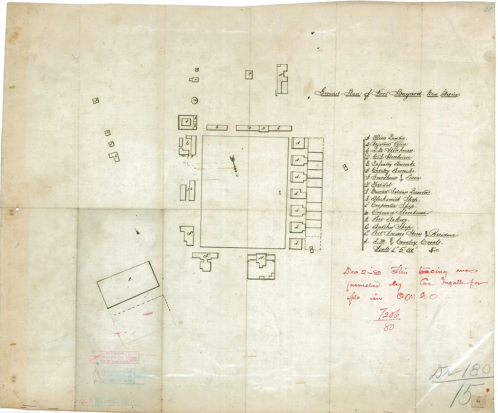
Ground Plan of Fort Bayard, New Mexico, 2 December 1880, War Department, Office of the Chief of Engineers. Shows officers’ quarters, barracks, guardhouse, hospital, storehouses, shops, post trader’s store and corrals. National Archives Identifier 205135466. National Archives; public domain. Resized. Holder’s record.
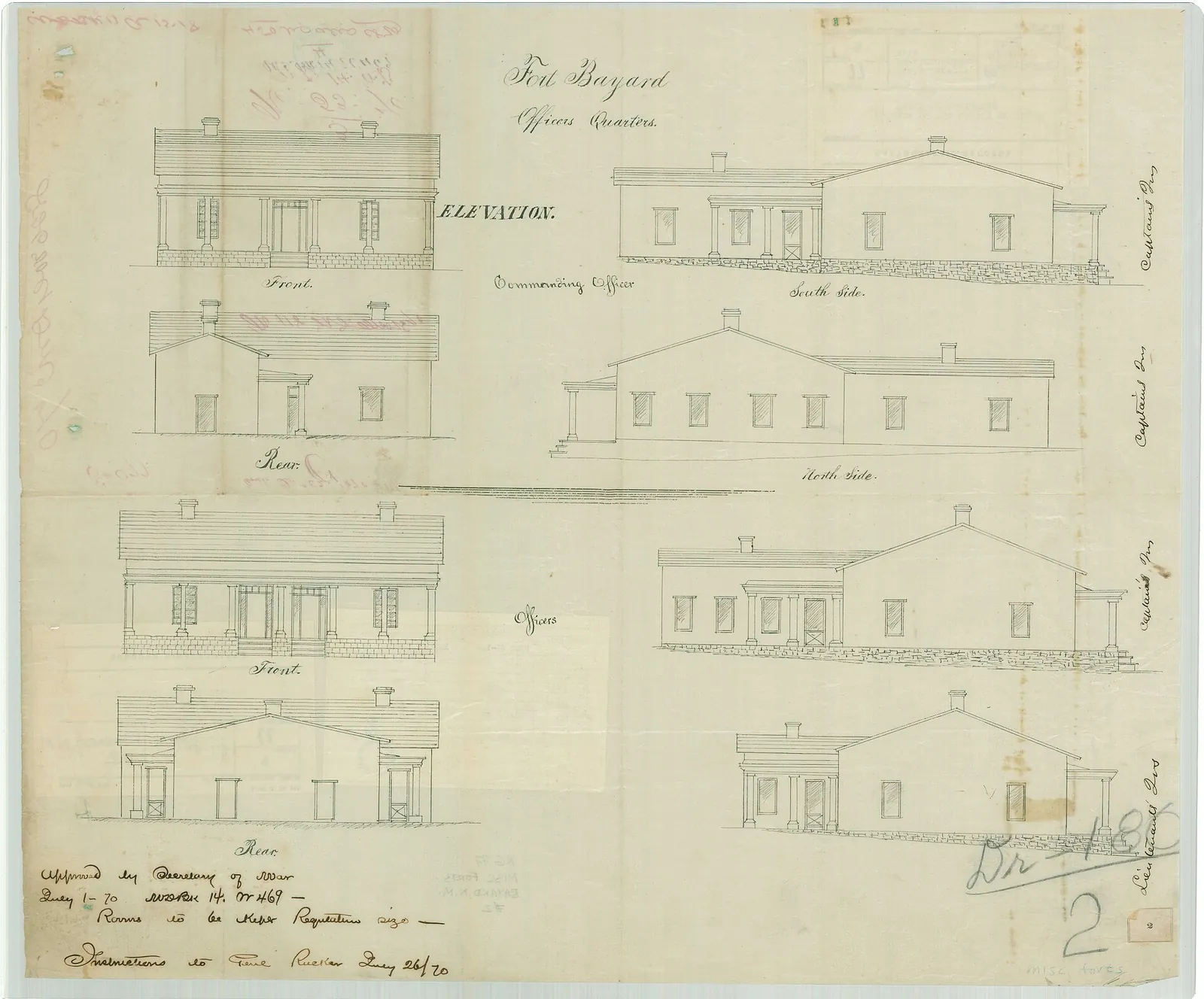
Fort Bayard Officers Quarters, New Mexico, July 1870, War Department, Office of the Chief of Engineers (architectural drawing). National Archives Identifier 205135436. National Archives; public domain. Resized. Holder’s record.
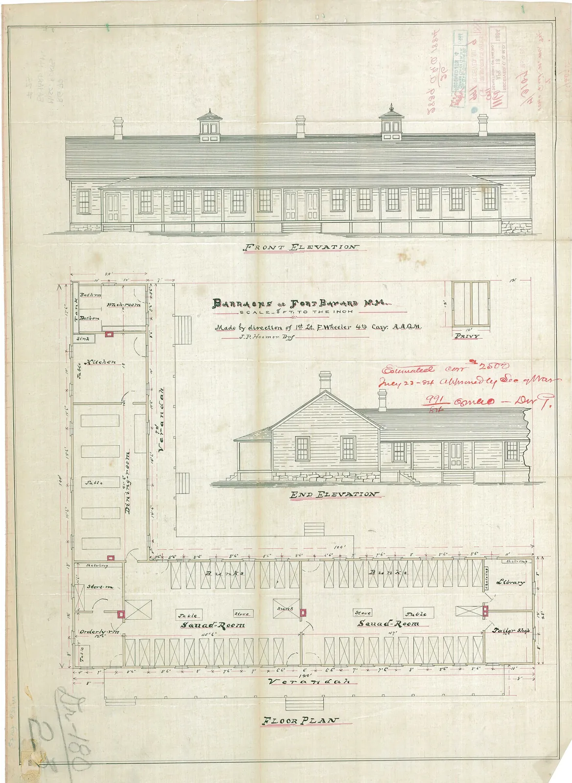
Barracks at Fort Bayard, New Mexico, 23 May 1884, War Department, Office of the Chief of Engineers (architectural drawing). National Archives Identifier 205135482. National Archives; public domain. Resized. Holder’s record.
Before the forts
This page follows the soldiers, the forts and the Apache families of Grant County through the years of war and the long years after. It sets the Army’s own reports, agents’ letters, diaries and memoirs beside what Apache people and their historians have said, and it names who is speaking at each step. Where the accounts disagree, they are given side by side, and the reader is left to weigh them.
Before any fort stood here, Geronimo remembered this country as his people’s fatherland. Geronimo, telling his life story to S. M. Barrett, said he was born in No-doyohn Canyon, Arizona, in June 1829, and raised in the country around the headwaters of the Gila River. ‘This range was our fatherland,’ he said; among these mountains the camps were hidden, and the scattered valleys held the fields. He said that when his grandfather Maco died, Mangas Coloradas became chief of the Bedonkohe Apaches. Barrett adds in a note that Geronimo’s father, a Nedni who had married into the Bedonkohe, could not inherit the chieftainship. (Sources: Geronimo’s Story of His Life, Ch. III, Ch. V.)
In 1851 the Boundary Commission travelled toward the Copper Mines, and John C. Cremony rode ahead of it. In his memoir Cremony recalled being stopped by the Chihenne leader Cuchillo Negro, who asked what he wanted in his country. ‘For many years no white man has penetrated these regions,’ Cremony quotes him as saying, ‘and we do not permit people to enter our country without knowing their purpose.’ When the carriage and the infantry escort came in sight, Cuchillo Negro came forward with his hand out, saying ‘jeunie’, which Cremony explains means friendly. Cremony refused the hand, fearing a trick, but answered ‘Estamos amigos’, we are friends. (Sources: Life Among the Apaches, ch. II, p. 25, ch. II, p. 27.)
Col. Louis S. Craig’s escort then formally took possession of the Copper Mines, which Cremony called the headquarters of Mangas Coloradas. Among the first Apache visitors, he wrote, were Delgadito, Ponce and Coletto Amarillo. Cremony reckoned the Apache force around the mines at four hundred warriors, against about three hundred armed Americans of the commission and its escort, and he said relations stayed friendly for four or five weeks. He also described the limits of Mangas’s power. Mangas, he wrote, could assume no authority his people had not given him; he never spoke for them as a ruler, only promising to use his influence. (Sources: Life Among the Apaches, ch. II, p. 29, ch. IV, p. 48, ch. IV, p. 47.)
He named Mangas’s closest counselors as Delgadito, Ponce, Cuchillo Negro, Coletto Amarillo, El Chico and Pedro Azul, and admitted that these were all names given by Mexicans; he never learned their Apache names. He also claimed that Mangas married his three daughters to a Navajo chief, a Mescalero leader and a Coyotero war chief, and so gained influence with those peoples. Cremony’s is one man’s account, and it is told here as his. (Sources: Life Among the Apaches, ch. IV, p. 48.)
Fort Webster and the Mimbres bands
Fort Webster stood near the copper mine at Santa Rita. The 2002 National Register nomination for the Fort Bayard Historic District says the Santa Rita mine was revitalized when the Army set up nearby Fort Webster in 1852-53, and again from 1857 to 1860. The historian Hubert Howe Bancroft, writing in 1889, says three companies were stationed at Fort Webster, at the copper mines, in 1853, but that the post was abandoned in 1854. An Indian agent, Edward H. Wingfield, was stationed there in 1852-53. Bancroft says he was dismissed in 1853, accused of spending too much and of being absent from his post, and that he published a pamphlet in defense of his conduct. (Sources: Fort Bayard Historic District, Section 8, p. 24; History of Arizona and New Mexico, 1530-1888, p. 663, p. 662.)
Both Bancroft and a later historian describe an early attempt at peace. Bancroft says that in 1852-53 many of the Gila bands gathered at Fort Webster under Wingfield, promised peace and began farming on the promise of supplies for a term of years. Historian Hana Samek Norton writes that in 1853 Governor William Carr Lane persuaded a number of Mimbres Apaches to settle near Fort Webster, which by then had moved to the Mimbres valley. Lane saw it, in Norton’s words, as a first step in ‘weaning these tribes from raiding’, and promised supplies for three years, but the Senate did not ratify the agreement. When the treaty was not confirmed and the supplies stopped, Bancroft wrote, ‘the Indians became worse than ever’; he called the whole effort ‘a costly though somewhat successful experiment’. (Sources: History of Arizona and New Mexico, 1530-1888, p. 669; Hana S. Norton, “Apaches and the mining menace, p. 57.)
Peace was tried again. Bancroft says Governor Merriwether made a treaty with the Mimbres in 1855, and that they kept the peace and planted, though they were harmed by liquor and cheated by citizens. That lasted until Bonneville’s Gila campaign of 1857 scattered them and the Mogollons. Agent Michael Steck, as Bancroft reports, called that campaign through the Mogollon country against the Coyoteros ‘an unfortunate movement’, one that scattered the Mogollon and Mimbres bands and left them, to a considerable extent, hostile. (Sources: History of Arizona and New Mexico, 1530-1888, p. 670.)
The bands came back to peace and to their fields. By 1858, Bancroft writes, many Mimbres and Mogollons had returned to peace and were planting on the Rio Palmas and at Santa Lucia. On May 14, 1860, the Commissioner of Indian Affairs approved Agent Steck’s reservation for the Gila Apaches, meaning the Mimbres, Mogollon and Chiricahua bands. It was a tract fifteen miles square, measured from a spring that the printed record renders ‘Santa Lada’, evidently Santa Lucia Spring, later called Mangas Springs; the record says it was ‘occupied for a short time only, and then abandoned’. Bancroft likewise says a reservation on the upper Gila was authorized and surveyed near the Arizona line in 1860. (Sources: History of Arizona and New Mexico, 1530-1888, p. 670-671; Annual Report of the Commissioner of Indian…, pp. 348-349.)
Norton, citing Thrapp’s 1974 work, tells of Steck’s treaty in another form. In her account it proposed two reservations on the Mimbres River, and the problem was that the Santa Rita mine, held under a private grant claim, lay in the middle of them. The two prominent Mimbres chiefs, Mangas Coloradas and Victorio, stayed away from the talks because they feared being forced to leave their lands, and once again the Senate did not ratify. The records do not make plain how these plans fit together, so they are set side by side here. (Sources: Hana S. Norton, “Apaches and the mining menace, p. 57.)
Geronimo remembered these years as a time of first meetings. Around 1858, he recalled, his people heard of white men measuring land to the south, and went to visit them. They made a treaty by shaking hands, and traded buckskin, blankets and ponies for shirts and provisions; these, he said, were the first white men he saw. Not every meeting would stay so peaceful. (Sources: Geronimo’s Story of His Life, Ch. XIII.)
Without a treaty or a reservation, the Mimbres and Mogollon bands made a start of their own. Norton says they settled down and planted about 150 acres on the Rio Mimbres and on a stream recorded as the ‘Rio Palmos’. They also complained about the new settlements nearby, such as Mowry City with its two whiskey distilleries. Then came the miners. Norton gives the attack of December 4, 1860, as 28 miners, the ‘majority… Texans’, falling on a group of Mimbres Apaches for killing and eating a mule that belonged to one of the Texans. Among the dead, she writes, was a chief friendly to the whites, called Elías. (Sources: Hana S. Norton, “Apaches and the mining menace, p. 57.)
Norton draws a larger conclusion from episodes like this. The so-called ‘Apache problem’ of southwestern New Mexico, she argues, was in fact a ‘miner problem’, one that turned peacefully disposed bands like the Mimbres into enemies. In her reading, the strikes around Santa Rita and Pinos Altos between 1850 and 1860 particularly escalated the conflict. Her argument is a useful lens for the Army reports that follow, which tell the same years from the soldiers’ side. (Sources: Hana S. Norton, “Apaches and the mining menace, p. 55.)
The Army post on the Mimbres went by more than one name. Francis Heitman’s 1903 register of the Army lists Fort Floyd as on the Mimbres River, established as Camp Webster, with its name changed to Fort McLane. The same register records a Capt. George McLane of the Mounted Riflemen as killed on October 13, 1860, at Black Rock, New Mexico. Then a wider war broke in. Bancroft says the Confederate invasion of 1861 ended the civil government’s programs for the Apaches; the agencies broke up, and the bands returned to raiding until 1863. (Sources: Francis B. Heitman, pp. 499-500, p. 30; History of Arizona and New Mexico, 1530-1888, p. 671.)
The California Column at Pinos Altos
In the summer of 1862 the mining camp at Pinos Altos was in trouble. On July 22 General James H. Carleton ordered food sent from Tucson to relieve people described as ‘famishing at that point for want of food’: 3,000 pounds of Sonora flour, 1,500 pounds of pemmican and 1,500 pounds of panocha, a Mexican sugar. In October, Col. Joseph R. West of the First California Infantry, commanding the District of Arizona, reported that he had been on the point of sending Captain Shirland with twenty men to the Pinos Altos mines. ‘Active operations are going on there,’ West wrote; ‘the Indians are troublesome, and disorder prevails among the Mexicans and Americans.’ He proposed stationing Captain Whitlock’s Company F, Fifth California Infantry, either at Fort McLane or at the mines. (Sources: The War of the Rebellion, p. 36, p. 157.)
West soon proposed going further. On November 2, 1862, he reported that an expedition against the Indians near the Pinos Altos mines could succeed if troops could be spared. As guides he named Jack Swilling, who was at the mines, and a Mexican boy taken from Sonora who had spent seven years as a captive of Mangas Coloradas’s band. Writing from Fort Craig on January 2, 1863, Carleton laid out his plan: an expedition to the headwaters of the Gila so that the ‘Pino Alto’ gold mines could be worked in security, followed by a military post near the mines. (Sources: The War of the Rebellion, p. 200, p. 275.)
Carleton’s letter looked beyond the mines as well. He proposed a military road from Socorro or Fort Craig through the copper mines, to meet the road from Mesilla to Tucson at Ojo de la Vaca. That route, he said, would shorten the distance from Santa Fe to Tucson by at least 100 miles. On January 11, 1863, District of Arizona Special Orders No. 4, issued at Mesilla, set the expedition in motion. Companies A and C of the First California Cavalry, with Company D of the First and Company A of the Fifth California Infantry, made up ‘the expedition against the Gila Apaches’, under Capt. William McCleave. (Sources: The War of the Rebellion, p. 275, pp. 281-282.)
The death of Mangas Coloradas
What happened next is told very differently by different witnesses. General West’s own report says Capt. Edmond D. Shirland was sent ahead on January 14, 1863, to find Mangas Coloradas near Pinos Altos. Shirland was ‘to act according to his best judgment in either fighting the chief or getting him into his possession’. He rejoined the command at Fort McLane on January 18, bringing Mangas with him. (Sources: The War of the Rebellion, p. 296.)
West reported that he told his captive that the rest of his days would be spent as a prisoner in the hands of the United States, that his family would be allowed to join him, and that any attempt to escape would cost him his life. A sergeant and three privates of Company A, Fifth California Infantry, became his guard at midnight. In West’s official version, Mangas was shot dead by the guard at one o’clock the next morning, after three attempts to escape. (Sources: The War of the Rebellion, p. 296.)
Geronimo told the story of these days from the side of the people Mangas left behind. He said Mangas Coloradas first went with three warriors to a council at Apache Tejo, where citizens and soldiers promised government blankets, flour and beef if his people would live nearby. Mangas promised to return within two weeks. Geronimo opposed the plan: ‘I did not believe that the people at Apache Tejo would do as they said.’ About half the Bedonkohe went with Mangas, he said, taking almost all of the band’s guns and ammunition, while Geronimo stayed in charge of the rest. (Sources: Geronimo’s Story of His Life, Ch. XIV.)
Other accounts reject the official version. Historian Hana Samek Norton, following Thrapp and Cremony, writes that Mangas, then in his seventies, had come to negotiate under a white flag and was captured. At Fort McLane, she writes, he was killed by guards after he protested being tortured. That is contrary to the official account, which said he was shot ‘while attempting to effect his escape from the guard house’. ‘In fact,’ Norton writes, ‘a couple of his guards shot their prisoner.’ (Sources: Hana S. Norton, “Apaches and the mining menace, p. 58.)
A third account appears in the notes of Barrett. Barrett quotes L. C. Hughes of the Tucson Star, who said that Jack Swilling brought Mangas in, and that ‘the old chief was always for peace, and gladly accepted the proffer’. According to Hughes, Mangas said as he entered the guardhouse: ‘This is my end. I shall never again hunt over the mountains and through the valleys of my people.’ Barrett’s notes also quote a telegram General Miles sent from Whipple Barracks, Arizona, on September 24, 1886, more than twenty years later. In it Miles wrote that Mangas Coloradas ‘had years ago been foully murdered after he had surrendered’. (Sources: Geronimo’s Story of His Life.)
West, for his part, turned at once against the band. Mangas had been expected to return to his people at an appointed time, West wrote, and his detention prevented it. Fearing that his people would scatter when he did not come back, West decided to ‘pursue and punish them at once’. He left the command at Fort McLane on January 23, 1863, preparing a long scout toward the headwaters of the Gila under McCleave. (Sources: The War of the Rebellion, pp. 296-297.)
Among the Apache people, leadership had to be rebuilt. Geronimo said that when no word came back and his people concluded Mangas was dead, the Bedonkohe held a council and elected him tribal chief. The Fort Sill Apache Tribe says that after Mangas Coloradas died, and other chiefs soon after, the main leadership fell to the chiefs Victorio and Loco. Lt. Charles E. Drew, an Indian agent, wrote in 1869 that since Mangas’s death the bands had separated under different chiefs and took their names from the mountains where they ranged, though they knew themselves only as Apaches. (Sources: Geronimo’s Story of His Life, Ch. XIV; Fort Sill Apache Tribe; Annual Report of the Commissioner of Indian…, pp. 104-105.)
The bands also leaned on one another. Geronimo said that after Mangas’s death his hungry people went to Victorio’s Chihenne band at Hot Springs. ‘We easily found Victoria and his band,’ he said, ‘and they gave us supplies for the winter.’ They stayed about a year, and ‘during this stay we had perfect peace’. When his band left, Geronimo recalled, a feast and dance was held about two miles above Hot Springs; it lasted four days, and about four hundred people came. ‘No one ever treated our tribe more kindly,’ he said, ‘than Victoria and his band.’ (Sources: Geronimo’s Story of His Life, Chapter XV.)
Fort West and the Pinos Altos mines
While McCleave’s men were in the field, the Army chose ground for a new post. On February 12, 1863, West forwarded the report of a board of officers appointed to choose a site for Fort West. McCleave, he said, was moving his camp to the recommended site, well advanced into Apache country. That same month, Capt. Joseph Smith’s Company A, Fifth California Infantry, fought a body of Indians at the Pinos Altos mines, and West commended the company’s conduct. Heitman’s list of engagements also records an action at ‘Pinos Altos Mines’ on January 29, 1863. (Sources: The War of the Rebellion, pp. 311-312, p. 312; Francis B. Heitman.)
The new post was to grow some of its own food. In March 1863 West told McCleave, its commander, not to put up permanent buildings until an engineer had surveyed the site, though he left him free to build temporary quarters for his men. He asked the garrison to plant corn, cultivate a garden and gather hay. On March 11, Special Orders No. 16 sent Company B, First California Infantry, to Pinos Altos to relieve Company A, Fifth California Infantry, which had been stationed there. Orders issued at Fort West on April 22 set its garrison at two companies of cavalry and two of infantry, and called Company B, then on detached service at the Pinos Altos mines, into the permanent garrison. (Sources: The War of the Rebellion, p. 339, p. 347, p. 410.)
By spring the Army was planning around the new fort. On May 2, 1863, Carleton urged the Postmaster General to support a mail line from Fort Craig through Pinos Altos and Fort West, ‘at the head of the Gila River’, to Fort Bowie and Tucson. ‘Fort West will be a point where a post-office will be very necessary,’ he wrote. The same day West reported that he had withdrawn the infantry company from the village of Pinos Altos and attached it to the Fort West garrison. Citizens, he wrote, were settling near the fort to farm and to mine, and apart from perhaps a few Indians about the Mimbres and the copper mines, the Apaches had been ‘pretty well cleared out’ from the headwaters of the Gila. (Sources: The War of the Rebellion, pp. 419-420, pp. 421-422.)
That was the commander’s judgment in 1863, and neither fort lasted long. The National Register nomination dates Fort McLane to 1860-1863, south of Fort Bayard, and Fort West to 1863-64, north of present Silver City, and describes both as temporary posts of Carleton’s campaigns. In the early 1870s Lt. Frederick Phelps, on a scout west from Fort Bayard, followed Bear Creek down to Walnut Springs and on to the muddy Gila, where, he recalled, only crumbling chimneys marked the site of old Fort West. Frank Reeve, editing Phelps’s memoirs, placed Fort Floyd, Bonneville’s 1857 depot for his Apache campaign, on the east side of the Gila near the mouth of Bear Creek, and judged that Fort West was probably on the same spot. (Sources: Fort Bayard Historic District, Section 8, p. 24; New Mexico Historical Review, vol. 25, p. 54.)
A new post at Fort Bayard
Talks and plans went on after the Column’s first campaigns. Bancroft’s chronology records a 1865 interview by Gen. Nelson H. Davis with Victorio, Nana and others at the copper mines. It also records that Carleton refused to let Superintendent Steck go to talk with the Mimbres, who ‘must surrender without conditions’. For 1866 Bancroft notes that the Army intended a campaign against the Mimbres and a new post, and that a Gila reservation was spoken of but had no Indians on it. (Sources: History of Arizona and New Mexico, 1530-1888, p. 744-745, p. 745.)
The new post had already been chosen. The National Cemetery Administration, describing Fort Bayard National Cemetery, says the site was chosen in 1863 for its springs and its ‘commanding view of the Apache war trails surrounding the nearby mining camps’. The National Register nomination says Fort Bayard was established on August 21, 1866, by Company B of the 125th United States Colored Infantry, under Lt. James M. Kerr. They acted on a recommendation made by Maj. Nelson H. Davis to General Carleton. The post was named for George D. Bayard, who had served on the frontier as a junior officer with the 4th Cavalry and was mortally wounded at Fredericksburg, Virginia, in 1862, by then a brigadier general of volunteers. (Sources: Fort Bayard National Cemetery; Fort Bayard Historic District, Section 8, p. 23, Section 8, p. 25.)
Life at the new fort began under canvas. Two cavalry companies and one infantry company were first assigned there, living in tents. Their scouts, sometimes of as many as 40 soldiers, ranged to the Rio Grande, to the Mogollon and Chiricahua mountains and at times into Mexico. In 1867 Carleton recommended raising the garrison to four companies of cavalry and two of infantry, though the nomination notes that New Mexico’s total troops fell as low as 884 in the mid-1870s. In 1869 an Executive Order declared a 13-square-mile tract of public land, including the fort and extending northward, the Fort Bayard Military Reservation. (Sources: Fort Bayard Historic District, Section 8, p. 25, Section 8, p. 27, Section 8, p. 23.)
An Army medical survey published in 1870 gives a close look at the young post. The surgeons placed Fort Bayard about 6,000 feet up, between the range they called the ‘Sierra Madre’, the Pinos Altos range, and the Santa Rita range. It lay ten miles from the gold mines of Pinos Altos and eight miles from the copper mines of Santa Rita. ‘It is on no direct line of travel,’ the survey said, ‘the nearest railroad being nine hundred miles distant.’ Its object was ‘to protect the miners against the Apache Indians, whose trail lies through this valley’ from southeastern Arizona to the New Mexico settlements. (Sources: A Report on Barracks and Hospitals, p. 240.)
The same survey shows how hard the early years were. It gave the reservation as two miles square. The only water came from small springs yielding about fifteen barrels an hour, and ‘the officers and men occupy temporary log huts, which are in bad condition’. There was one hospital ward, with room for twelve beds, ‘used alike by white and colored patients’, though the report kept separate sick tables for white and colored troops for 1868-1869. Mail came twice a week, but the surgeons wrote that it was rare for any article of value to reach its destination; letters to publishing or furnishing houses were almost invariably opened on the way, and any money in them removed. (Sources: A Report on Barracks and Hospitals, pp. 240-241, p. 241.)
For a time the fort’s future was in doubt. In summer 1870 General John Pope considered closing Fort Bayard in favor of a new post in the Mimbres Valley. In July 1870, however, Secretary of War Belknap approved $45,000 for permanent quarters. The buildings stayed rough for years. The nomination, quoting Reeve’s 1950 edition, cites 2nd Lt. Frederick E. Phelps, who served at Fort Bayard from 1871 to 1876: ‘The locality was all that could be desired; the Post everything undesirable.’ The nomination itself describes the first buildings as temporary huts of logs, cobbles and adobe. (Sources: Fort Bayard Historic District, Section 8, p. 26, Section 8.)
Clean water was a matter of life and death. Until the summer of 1872 the post drew its water from a spring through a swamp fouled by livestock, and ‘bowel complaints were very numerous, and even some deaths from that cause occurred during the summer of 1871’. The spring was then lined and piped to a filter of charcoal and sand. By 1875 another Army medical report described a four-company post, two of cavalry and two of infantry, at 6,022 feet, on a reservation of almost sixteen square miles; it credited the choice of site to Col. N. H. Davis. Its stone guardhouse was ‘probably the finest building for that purpose in the Territory’, and was being used as a kind of military prison, with about thirty-five inmates on average. The post library held ‘177 well-selected volumes’, and the hospital, of adobe with a shingle roof, had been built in 1869. (Sources: A Report on the Hygiene of the United States…, p. 248, p. 246, p. 247, pp. 247-248.)
Phelps remembered the water problem from the inside. The post’s only water, he wrote, was a small spring that ran several hundred yards through grass trampled by cattle, and in 1872 an epidemic of diarrhea laid up nearly the whole command. The post commander, Lt. Col. Thomas C. Devin, ordered the spring walled up and a long plank trough built, with lumber that cost sixty dollars a thousand. When the vouchers reached Washington, Phelps recalled, they came back disapproved, with directions that the entire cost be charged to Devin, though in the end the government paid. (Sources: New Mexico Historical Review, vol. 25, p. 131, pp. 131-132.)
Settlements grew up around the soldiers. The nomination says the settlement of Santa Clara grew a mile south of the fort on the fort’s business. It was renamed Central City in 1868, shortened to Central in 1947, and took back the name Santa Clara in 1999. The 1875 Army report noted a silver camp of about 200 people, nearly all miners, that had sprung up within two years at Lone Mountain, four miles south of the post. The same report described Silver City, first laid out in 1871, as the county seat, with about 500 American and about as many Mexican residents. It had four quartz mills, which crush ore-bearing rock, and three furnaces at work, while Pinos Altos, the report said, had ‘almost fallen into ruin’. (Sources: Fort Bayard Historic District, Section 8, p. 26; A Report on the Hygiene of the United States…, p. 246.)
Some of the soldiers became miners themselves. The nomination says at least 18 of the miners working Silver City’s early diggings were members of the California Column who had mustered out in New Mexico. Their former commander, General Carleton, was part owner of one of the mines. Silver City’s own story is told in its own pages. (Sources: Fort Bayard Historic District, Section 8, p. 26.)
Officers’ families at the early post
Two memoirs let us see the early post through the eyes of people who lived there. Lt. Frederick E. Phelps recalled that when he came back to his post at Fort Craig on July 3, 1871, from escort duty, he found his troop had been transferred to Fort Bayard. He followed, and ‘one boiling hot day in July rode into old Fort Bayard, which was to be my station for the next five years’. His first quarters were a twelve-by-ten room that had been built as a stable, with each wall of a different stuff: stone from the hillside, adobe, pine logs set on end and slabs from a sawmill, all under a canvas ceiling and a mud roof. The post, he wrote, lay about six hundred miles from the nearest railroad, at Kit Carson, Colorado, and lived on government rations of beef, bacon, coffee, sugar, rice and a few cans of vegetables. (Sources: New Mexico Historical Review, vol. 25, p. 49, p. 51, p. 50-51.)
Frances Boyd told the story from an officer’s household. Her husband, Lt. Orsemus Boyd of the 8th Cavalry, was ordered from Fort Union to Fort Bayard to build the officers’ quarters, at a post then thought ‘a most undesirable locality’, both for its remoteness and because no houses had been built for the officers. The ambulance journey took eighteen days in midwinter. Until the new quarters were done, she wrote, the officers lived in floorless log cabins under straw-thatched mud roofs; summer storms washed straight through the houses, and she remembered two times when a roof fell in. The new quarters were built of adobe bricks, made by Mexican workmen from earth dug in front of the houses, mixed with water and shaped in wooden molds, and they took about a year to finish. (Sources: Cavalry Life in Tent and Field, ch. XIV, p. 211, ch. XV, p. 221, ch. XV, p. 220.)
Boyd made a home there. With careful housekeeping, two cows and many chickens, she said, fifty dollars a month could be laid aside, and in two years the family was entirely out of debt. Silver City, an hour’s drive from the fort, was in her words the only American town in the region, and its balls were held in the courthouse, cleared of benches after the court sessions. Her favorite ride was to the Santa Rita mountains, where she and her husband explored the old copper workings, which she believed had been dug centuries before. She also recorded a local name for a landmark. The fallen rock on the Santa Rita ridge facing the post, she wrote, ‘was called the kneeling nun’, and the people of the country had already given it a story of its own. (Sources: Cavalry Life in Tent and Field, ch. XVI, p. 236, ch. XV p. 220, ch. XVI, p. 238, ch. XV, p. 217.)
Not every memory was a happy one. Boyd recorded two fires at the post that she believed were set: one in shavings in her unfinished double house, and a few weeks later one that burned the post’s whole winter hay supply of six hundred tons. Phelps wrote that before he left Fort Bayard on sick leave, orders had come to rebuild the post, and perhaps sixty military convicts, mostly deserters, had been sent there to serve their sentences and were quarrying stone for the new buildings. Desertion touched Phelps directly. While chasing his own post baker and four other deserters, about 1872, he came to the little town he called ‘Rio Miembres’, the Mimbres: about twenty adobe houses, all lived in by Mexican families, who made no objection when his men searched every house. (Sources: Cavalry Life in Tent and Field, ch. XVII, p. 242; New Mexico Historical Review, vol. 25, p. 193, pp. 132-133.)
In 1875, Phelps noted, the railroad ended at Fort Lyon, Colorado, and the stage fare from there to Fort Bayard was one hundred and fifty dollars. Late that year the 8th Cavalry was ordered to march from New Mexico to Texas; one troop had already left Fort Bayard when Phelps met the colonel at Fort Selden in December. Boyd wrote that after three happy years at the post the regiment was ordered into Texas to exchange stations with the 9th Cavalry. Her family spent Christmas Day in camp and crossed the flooded Rio Grande on a rope ferry. The National Park Service says the 9th Cavalry was moved from Texas to Fort Bayard in 1876. (Sources: New Mexico Historical Review, vol. 25, p. 192, p. 195; Cavalry Life in Tent and Field, ch. XVII, p. 244; Thomas Boyne (People), para. 2.)
Peace talks at Cañada Alamosa
While the soldiers built, the Indian service was trying to make peace. In 1869 the Commissioner of Indian Affairs wrote that the Gila Apaches were two bands, the Mimbres and the Mogollon, numbering 1,600, and that a reservation chosen for them years earlier had never been established. He backed the New Mexico superintendent’s plan to settle them on it, partly because, as he put it, ‘rich mineral and agricultural tracts will be open for settlement’. That year Lt. Charles E. Drew, sent toward Fort Bayard as agent to reach the Southern Apaches, met Loco, chief of the Mimbres, at Fort McRae. Loco said he was willing to leave the war path and could speak for his whole tribe; Drew reported him saying that ‘they want peace, and good peace, and no lie’. (Sources: Annual Report of the Commissioner of Indian…, p. 23, p. 104.)
Loco spoke for others too. Drew reported that Lopez, a chief of the Gila Apaches who ranged in the Burro Mountains, was in Loco’s camp, and that Lopez’s people would come in after they saw how Loco was treated. Loco asked to plant again near the Cuchillo Negro, where his people had farmed before they were driven away, and to hunt along the east side of the Mimbres Mountains. (Sources: Annual Report of the Commissioner of Indian…, p. 104.)
On October 10, 1869, Drew held a council at the edge of Cañada Alamosa with Loco, Victorio, Lopez and two Mogollon chiefs. About forty warriors came, with lookouts on the hills. A son of Mangas Coloradas attended, though Drew noted he was not a chief, and Drew wrote that all these bands had once been under Mangas, ‘who was killed by the California troops while a prisoner’, one more voice on the disputed death described above. In the middle of the council a citizen scout of twenty-five men under Capt. J. M. Bullard, acting under Governor Pile’s General Order No. 1, rode into town; Drew asked it to leave, and it did. Drew judged that Loco meant peace, but that Victorio, who then led only a very small band, was less inclined to keep it. (Sources: Annual Report of the Commissioner of Indian…, pp. 104-105, p. 105.)
Through the winter Drew kept the camp fed on his own authority. From November 1869 he issued corn, and from December 6 half rations of beef, while Washington sent no instructions; the issue was needed, he wrote, to protect the people ‘from great suffering, and, in some instances, starvation’. In January 1870 he counted over 300 people in the camp, mostly Mimbres, with about forty Mogollons under Chastine, all recognizing Loco as head chief. When citizens of San José blamed Loco’s people for stolen stock, Loco sent Salvadore, a son of Mangas Coloradas, with others to follow the trail. Salvadore reported that Navajos or Mexicans had taken the animals, and Drew accepted his report. (Sources: Annual Report of the Commissioner of Indian…, p. 107, pp. 107-108.)
The danger to the camp came from outside. Drew protested that scouting parties from Chihuahua, paid a premium for Apache scalps, were allowed to hunt in New Mexico, and that to them a scalp ‘from a friendly Indian is worth as much as one of any other’. One such party, from a place the report calls ‘Hamas’, probably Janos, threatened the peaceful camp and left the Mimbres meaning to attack it, though Gen. Mason, commanding Fort Bayard, had warned it not to; Drew stayed two days in the camp to prevent an attack. The Apaches, Drew wrote, lived in dread of posses organized under General Order No. 1, and they wanted the bounds of their reservation clearly defined. (Sources: Annual Report of the Commissioner of Indian…, p. 108.)
Loco also carried word of Cochise. He told Drew that Cochise would come in once a treaty was made, but wanted to be sure he would not be ‘betrayed and killed as his people have been in times past’. By August 1870 Agent A. G. Hennisee counted 540 Southern Apaches drawing food at Cañada Alamosa: 87 men, 197 women and 250 children. Only 280 blankets had been issued all year, he wrote, and the daily ration was half a pound each of corn and beef. The whole Mimbres band, chiefs included, had come in, along with 140 Mogollons and 51 Mescaleros since June 21, though no Mogollon or Mescalero chiefs. Early that spring, when their Mexican neighbors began to prepare for a crop, the Apaches had asked for farming tools to raise one of their own. (Sources: Annual Report of the Commissioner of Indian…, p. 108; Annual Report of the Commissioner of Indian…, pp. 159-160, p. 160, pp. 160-161.)
Hennisee drew a plain conclusion. The experience of the past fifteen years, he wrote, was enough ‘to satisfy the Government that it is impracticable to conquer these Indians’ in their wide mountain country, so every reasonable means should be used to keep the peace. Hennisee proposed a reservation at Fort Stanton, but the New Mexico superintendent doubted the Mimbres and Mogollons would accept it, ‘as that is not their country, but the country of the Mescaleros’. (Sources: Annual Report of the Commissioner of Indian…, p. 160, p. 146.)
Cañada Alamosa, Tularosa and Ojo Caliente
Where would the Apache bands be allowed to live? Norton writes that Special Agent W. F. M. Arny favored settling the Mimbres and Mogollon Apaches at Cañada Alamosa, their homeland, if the roughly 200 Hispanic settlers there could be bought out. Supplies were thin: in 1870, Norton notes, ‘the agent could issue only 280 blankets to 540 Indians’. Agent O. F. Piper recorded that Cochise and his band, about two hundred men, women and children, came in to the Cañada Alamosa agency on September 28, 1871. They left about April 1, 1872, when removal to Tularosa began. (Sources: Hana S. Norton, “Apaches and the mining menace, p. 58; Annual Report of the Commissioner of Indian…, p. 306.)
The numbers at Cañada Alamosa kept changing. Bancroft records that in 1871 between 1,200 and 1,900 Apaches gathered there, but ran off when Peace Commissioner Vincent Colyer’s escort appeared. Settlers there, he says, held a public meeting complaining of thefts of cattle and crops and prepared to use force. Colyer himself found Cañada Alamosa unsuitable for a reservation. In 1871 he declared the Tularosa valley, two miles on each side of the river for thirty miles, a reservation for the Southern Apaches, because it lay remote from white settlements. (Sources: History of Arizona and New Mexico, 1530-1888, p. 745; Annual Report of the Commissioner of Indian…, p. 349.)
Tularosa was the government’s choice, not the Apaches’. Superintendent Nathaniel Pope reported that in spring 1872 the Southern Apaches were ordered, under War Department orders, to move from Cañada Alamosa to the new Tularosa reservation by May 1. When Pope and Lt. Col. T. C. Devin reached Tularosa on May 2, ‘there was not an Indian at Tularosa upon our arrival’. Agent Piper reported that the Southern Apaches at Cañada Alamosa had grown from 1,210 to about 1,600 in 1871-72, but fell below 800 once removal was announced, and only 450 went to Tularosa. The people, Piper wrote, ‘claimed that what is known as the Canada Alamosa reservation was the home of their ancestors, and had been promised them by a former agent as their permanent home’. (Sources: Annual Report of the Commissioner of Indian…, p. 297, p. 306.)
Pope set down the Apaches’ objections in September 1872. A former agent, Lieutenant Drew, had promised them they could stay at Cañada Alamosa. Their favorite wild fruits did not grow at Tularosa. The place was unhealthy, the water bad and the weather too cold. Norton, who dates the Tularosa reservation to November 1871, adds that officials admitted the place was unhealthy, with a severe climate and bad water, and that the Apaches asked to go back to Cañada Alamosa. (Sources: Annual Report of the Commissioner of Indian…, p. 297; Hana S. Norton, “Apaches and the mining menace, p. 58.)
Pope drew a different lesson. The removal to Tularosa ‘against the will of many and in spite of the positive refusal of some’, he wrote, ‘has taught these Indians a lesson that will be remembered, as it is the first time they have been forced to obey’. Yet he doubted the district had enough force to hold them on any reservation. (Sources: Annual Report of the Commissioner of Indian…, pp. 297-298.)
Violence went on in these years, though the sources differ over its dates. Norton says John Bullard, who discovered the Silver or Chloride district in 1871, was killed by Apaches west of Silver City a year later. Frank Reeve’s note to Phelps’s memoirs gives a different date. Bullard, who had come from Missouri with his brother James in 1866 to mine and farm near Pinos Altos, was killed pursuing Apaches on February 28, 1871, Reeve writes, and Bullard Peak was named for him. Reeve adds that Maj. William Kelly led a cavalry detachment from Fort Bayard in the same campaign but was not in the fight where Bullard died. (Sources: Hana S. Norton, “Apaches and the mining menace, p. 59; New Mexico Historical Review, vol. 25, pp. 54-55, p. 55.)
The people at Tularosa still tried to make a life there. Agent Ben M. Thomas reported that in spring 1874 many of them began farming corn, beans, potatoes and pumpkins. ‘We helped them make their dam and irrigating-ditch,’ he wrote, ‘and they got a fine start, the old chiefs and the young men taking hold in earnest.’ Frost, and the rumor of a move to Ojo Caliente, ended the effort after June. That year Thomas reported that the agency was being moved back to Ojo Caliente, and when he asked the principal chief whether he was willing to go, the chief answered: ‘Yes; but give us some place and let us remain there.’ (Sources: Annual Report of the Commissioner of Indian…, p. 311.)
For a few years it seemed the answer had been heard. Norton writes that an Executive Order of 1874 finally created a reservation for the Apaches at Ojo Caliente, and that the agent in 1875 reported the Southern Apaches peaceful and farming. Bancroft’s chronology gives numbers. He records 600 to 700 discontented Apaches at Tularosa in 1873, and 1,700 on the Hot Spring reserve in 1875, drawing their rations, farming a little and committing no depredations. (Sources: Hana S. Norton, “Apaches and the mining menace, p. 59; History of Arizona and New Mexico, 1530-1888, p. 745.)
It did not last. The Commissioner of Indian Affairs reported that in May 1877 the Southern Apaches, 453 people, were removed from the Hot Springs (Ojo Caliente) reserve to San Carlos, and that the reserve was restored to the public domain. The executive orders show how often the lines had been redrawn. An order signed by U. S. Grant had redrawn the 1874 reserve in the Cañada Alamosa valley as the ‘Hot Springs Indian Reservation’ for the Southern Apache and other Indians; it is printed with the date December 21, 1876, but the 1877 order cancelling it cites December 21, 1875. That cancelling order, signed by R. B. Hayes on August 25, 1877, restored the lands to the public domain. (Sources: Annual Report of the Commissioner of Indian…, p. XXXIX; Annual Report of the Commissioner of Indian…, p. 349.)
Geronimo remembered the end at Hot Springs in his own words. He said two companies of scouts sent from San Carlos called him and Victorio to town, where soldiers disarmed them and they were tried by court-martial. ‘Victoria was released and I was sentenced to the guardhouse,’ he said. He was put in chains, held prisoner four months and taken to San Carlos. Geronimo gives no year for this; other sources place it in 1877. (Sources: Geronimo’s Story of His Life, Ch. XVI.)
The Victorio years
Victorio’s story is told from every side. Kendall Gott’s 2004 staff history for the Army says little is known of his early life, but that he was probably born in the Black Range of New Mexico around 1820 and raised among the Eastern Chiricahua, often called the Mimbres Apache. Gott also records how Victorio and his followers explained what came next. They held that the Mimbres Apaches would have stayed peaceful and content had they been allowed to remain on the reservation of their choice. (Sources: In Search of an Elusive Enemy, p. 14, p. 42.)
The Warm Springs people did not stay at San Carlos. The National Park Service says the Warm Springs (Chihenne) Apaches were moved to San Carlos in May 1877 and left in September to return to New Mexico. The Commissioner’s 1879 report dates the departure to September 2, 1877, when about 300 Hot Springs Apaches and Chiricahuas suddenly left the San Carlos reserve. Of these, it says, 260 later surrendered and were held at Hot Springs until they were moved to San Carlos again, while 80 escaped to the mountains. The Park Service tells it a little differently: after losing 54 people in fights, the band surrendered and returned to Ojo Caliente, where they remained for about a year. (Sources: Warm Springs Apache; Annual Report of the Commissioner of Indian…, p. XXXIX.)
Victorio made his position plain. In February 1879, the Commissioner reported, he surrendered at the Ojo Caliente post with 39 Hot Springs Apaches, ‘all of whom reiterated their determination to resist to the death any removal to San Carlos’. In July 1879 three indictments were found against Victorio in Grant County, two for horse stealing and one for murder. Then a hunting party that included a judge and a prosecuting attorney passed through the Mescalero reservation. According to the report, Victorio’s people ‘believed the visit to be a preliminary step to the arrest of Victoria, and possibly of his whole band’, and they left; that departure, the report says, began the outbreak of 1879. (Sources: Annual Report of the Commissioner of Indian…, p. XL.)
Gott tells the break a little differently. He says Victorio had returned in February 1879 to what Gott calls the ‘Warm Springs Reservation near Fort Stanton’, in the charge of agent Russell, and fled for the last time on August 21, 1879, with about 80 warriors and their wives and children, believing a new judge and district attorney would try him for old murders and horse stealing. Within days, Gott writes, about 40 Apache warriors struck Company E of the 9th Cavalry near Warm Springs, killing five soldiers and three civilians and taking the company’s 68 horses and mules. Victorio’s fighting force, in Gott’s count, started at almost 80 warriors and never exceeded about 300; with women and children his band never numbered more than 450. (Sources: In Search of an Elusive Enemy, p. 17, p. 18.)
Troops from Fort Bayard had been in the field before that final break. On May 25, 1879, the National Park Service says, Sgt. Thomas Boyne and C Troop of the 9th Cavalry, under Capt. Charles D. Beyer, left Fort Bayard after Victorio. On May 29 they caught the Warm Springs Apaches in a steep, fortified canyon in the Mimbres Mountains and drove them back. (Sources: Thomas Boyne (People), para. 4.)
The fighting that autumn fell hard on the 9th Cavalry. On September 18, 1879, at the head of the Las Animas River, Gott writes, Victorio’s warriors trapped Companies B and E. Eight were killed and a few wounded, and 32 horses were killed; Lt. Robert T. Emmet, Lt. Matthias W. Day and Sgt. John Denny later received the Medal of Honor. The National Park Service tells Denny’s part. In an Apache ambush late in 1879, acting Sgt. Denny of B Troop ran into open ground under fire and carried a wounded private to safety, and in 1891, twelve years later, he received the Medal of Honor for having ‘removed a wounded comrade, under a heavy fire, to a place of safety’. (Sources: In Search of an Elusive Enemy, pp. 20-21; John Denny (People).)
Late in September Maj. Albert P. Morrow’s 9th Cavalry and Apache scouts marched through the Mimbres Mountains and fought Victorio’s band in a deep canyon on September 29-30, withdrawing under fire toward the desert floor near Cuchillo Negro. Gott writes that Sgt. Thomas Boyne and Capt. Francis S. Dodge later received the Medal of Honor, and he names Victorio’s son Washington among the Apache dead. The Park Service tells Boyne’s part with different dates: on September 24, 1879, in the Cuchillo Negro Mountains, Boyne’s detachment charged to free Lt. Henry H. Wright, pinned under his dead horse, and Boyne’s medal, issued January 6, 1882, cites ‘Bravery in action’ on May 29 and September 27, 1879. Morrow wrote of him: ‘I have seen him repeatedly in action and in every instance, he has distinguished himself.’ (Sources: In Search of an Elusive Enemy, pp. 22-24; Thomas Boyne (People), para. 6.)
In October two detachments from Fort Bayard, under Capt. George A. Purington of the 9th Cavalry and 2nd Lt. James A. Maney of the 15th Infantry, joined Morrow’s search for Victorio’s trail. By then the column was worn out. Down to 81 troopers and 18 scouts after marching 117 miles in 79 hours, it fought Victorio near the Corralitas River on October 29, 1879. It limped back to Fort Bayard on November 2, Gott writes, with most of its horses lost, ‘his force completely used up’. (Sources: In Search of an Elusive Enemy, pp. 24-25, p. 25.)
Newspapers of 1879, Gott notes, argued openly over the use of the Black troops of the 9th Cavalry; some editorials doubted them, and others called them saviors of the troubled land. The pattern of hard marches repeated in the new year. After fights in the San Mateo and San Andres mountains in January and February 1880, which cost three soldiers killed, among them Lt. Hansell French, and seven wounded, Morrow’s battalion, short of horses and provisions, had to fall back on Fort Bayard. Bancroft adds a view from the ranches. Until 1879, he wrote, the scattered Mexican herders of southern New Mexico had been spared by the Chiricahuas, whom they aided, but in the Victorio war from 70 to 100 settlers were killed. (Sources: In Search of an Elusive Enemy, p. 19, p. 27; History of Arizona and New Mexico, 1530-1888, p. 745-746.)
Territorial newspapers carried the pursuit to their readers. The Las Vegas Gazette of January 16, 1880, printed a Santa Fe dispatch saying Governor Lew Wallace had ordered the militia companies at Silver City, Las Cruces, La Mesilla and Hillsboro to be ready to take the field and co-operate with the troops should it be necessary. A dispatch of June 1, 1880, quoted O. R. Smyth as saying the country around Silver City was in ‘terror’. It reported that a volunteer company of fifty men, ‘equipped, mounted and rationed by the citizens of Silver City’, had reported to General Hatch under Capt. E. P. Price. Heitman’s register lists engagements in the Black Range on May 29, 1879, and August 16, 1881, and at Cook’s Canyon on June 5, 1880; it also lists fights at Cook’s Canyon as early as July 10 and 24, 1863. (Sources: Daily Gazette, p. 1; Daily Gazette, p. 1; Francis B. Heitman.)
The records also name other soldiers who fought Apaches in these years. Norton says Sgt. James C. Cooney of the 8th Cavalry was sent from Fort Bayard to rescue members of the Wheeler survey under Apache attack. Cooney later located the Mogollon claim, and he was killed during Victorio’s outbreak. The National Register nomination says Corporal Clinton Greaves of the 9th Cavalry won the Medal of Honor for leading a small party to safety through an encirclement by about 40 Apaches in the Florida Mountains in 1877. Between 1877 and 1881, it says, eight other men of the 9th Cavalry received the same medal. (Sources: Hana S. Norton, “Apaches and the mining menace, p. 59; Fort Bayard Historic District, Section 8, p. 27.)
In October 1880, the National Park Service says, Victorio and 78 Apaches were killed at Tres Castillos, and 68 women and children were taken captive; three small groups escaped, one of them led by Nana. Gott’s figures differ. He puts the Apache dead at Tres Castillos, on October 14-15, 1880, at Victorio and 86 warriors, with 89 women and children captured and held in Chihuahua City for several years. Even Victorio’s death is told two ways. Gott reports that a Tarahumara marksman was credited with killing him, while an Apache tradition, as Gott records it, holds that Victorio took his own life with his knife rather than be captured. (Sources: Warm Springs Apache; In Search of an Elusive Enemy, pp. 41-42, p. 42.)
The Fort Sill Apache Tribe’s historian remembers the people behind the numbers. Gouyen, whose name means ‘wise woman’, and her son James Kaywaykla were present at Tres Castillos. Nana, the tribe says, was not a chief but a leader ‘renowned for his skill in military encounters’. After Victorio’s death, when Nana was about 80 and crippled with arthritis, he still rode hundreds of miles to gather the scattered people. The tribe also cautions that no photograph of Victorio has been identified; a picture popularly labelled as Victorio actually shows a San Carlos Apache leader named Victor. (Sources: Fort Sill Apache Tribe.)
The fighting went on into 1881. On August 16 of that year, the Park Service says, a 9th Cavalry detachment under Lt. George Burnett trailed Apaches who had attacked a ranch into the Cuchillo Negro Mountains. When four troopers were cut off, Burnett, Sgt. Moses Williams and Pvt. Augustus Walley went back for them. Walley, born enslaved in Maryland, received the Medal of Honor on October 1, 1890. Williams petitioned for the medal after learning that two others from the fight had received it, and the Army awarded it in 1896, fifteen years after the battle. (Sources: Augustus Walley (People); Moses Williams (People), para. 3.)
The Army remembered these years through its own honors. The National Park Service says Sergeant Brent Woods, born enslaved in Kentucky in 1855, served in B Troop of the 9th Cavalry. He fought Nana’s band at Gavilan Canyon on August 19, 1881, and received the Medal of Honor for that fight on July 12, 1894, thirteen years later. (Sources: Brent Woods.)
Fort Bayard in the 1880s
Meanwhile Fort Bayard had become a busy place. Post records for 1879 list 325 enlisted men in three cavalry and one infantry companies, 14 laundresses, 14 civilian employees, 25 Navajo scouts, 280 cavalry horses and 89 mules. The buildings lagged behind: in 1881 Chief Quartermaster Lee called the enlisted men’s barracks ‘wretched’ and the officers’ quarters ‘barely habitable’. Newcomers did not always agree. The diary of Ephriam Goodale, a civilian at the post, records that Company K of the 23rd Infantry marched from Fort Cummings to Fort Bayard in two days in November 1881 and found it a ‘pretty good post and quarters’. (Sources: Fort Bayard Historic District, Section 8, p. 27, Section 8, p. 26; New Mexico Historical Review, vol. 25, p. 296.)
The post sutler’s store, the licensed trader’s store, run by John A. Miller, gained the reputation of having one of the largest stocks of goods in the Southwest. It served soldiers, and miners outfitting their grubstakes, the supplies a prospector took into the hills. Goodale’s diary shows the traffic. On January 7, 1882, he noted Mexican ox teams bringing loads to the post trader; one cart, loaded with pepper, was made entirely of wood and rawhide, ‘not an ounce of iron’. The same entry says a cattle thief had been shot dead at the sutler’s store, and that four rustlers had been shot twelve miles from the post, the owner recovering his stock. ‘How little human life is valued out here,’ Goodale wrote. (Sources: Fort Bayard Historic District, Section 8, p. 28; New Mexico Historical Review, vol. 25, p. 298.)
The diary also follows the garrison in and out. In February 1882 the post surgeon vaccinated the Goodale family and the whole post, while a case of smallpox was reported in Silver City. On April 18, Company K and two cavalry companies left with twenty days’ rations for Separ, after Apaches on the border of Old and New Mexico, leaving one company behind. A week later the diary recorded rumors of Indian hostilities, and one man killed and four wounded in Lt. Martin’s cavalry company. On April 28 the last company left, and the post was ‘all alone’. (Sources: New Mexico Historical Review, vol. 25, p. 298, p. 299.)
Late in 1882 the headquarters and band of the 4th Cavalry arrived with Col. W. B. Royall. On January 31, 1883, officers and young women of the post put on amateur theatricals at the Company K barracks. The play, ‘Lending a Lover’, ‘went off splendidly’, and a full house followed at the hop room. On March 25 Goodale noted the arrival of ‘Gen’l Angar’, probably Gen. C. C. Augur, with another general, Col. Forsyth and other officers; they were greeted with a 15-gun salute and the band, and Col. Royall gave them a reception. (Sources: New Mexico Historical Review, vol. 25, p. 301, p. 302, p. 303.)
The diary records hard news as well. On New Year’s Day 1883 Goodale wrote that one family at the post had lost four children to diphtheria; the rest of the family were ordered into a tent, their house and furniture were burned, and the school was stopped. In early February he wrote that three of four Chinese men had been killed just above the post. Three Mexican men, the diary says, were arrested and tried for it at Central City. (Sources: New Mexico Historical Review, vol. 25, p. 302.)
In late March 1883 the war came close again. On March 27 Goodale recorded rumors that Indians had killed five or six ranchmen, and he met the pack mules of two cavalry companies sent out from Fort Bayard that morning. On March 29 he wrote, ‘Judge and wife killed by Indians!’, and Capt. Eskridge’s infantry company went out for about a week. Wire reports printed in the Las Vegas Daily Gazette on March 30 said a Silver City judge and his wife had been killed by Apaches in Thompson canyon on their way to Lordsburg, that their young son was missing, and that Captain Black of the volunteer militia was in the field. Barrett, in his own chapter on Apache raids in Geronimo’s book, tells of the same killing but dates it to 1884 and gets the judge’s name wrong. (Sources: New Mexico Historical Review, vol. 25, p. 303; Las Vegas Daily Gazette, March 30, 1883, p. 1, p. 1; Geronimo’s Story of His Life, Ch. X.)
General George Crook’s own summary of his operations against the Apaches from 1882 to 1886 describes the last campaigns. The May 1885 outbreak, he wrote, was that of Mangus and Geronimo, and fewer than a third of the Chiricahua fighting strength left the reservation; over eighty men and 350 women and children stayed on their farms. He cited a raid of just eleven Chiricahuas through Arizona and New Mexico in 1885 to show how a few could keep both territories in terror. (Sources: Resumé of Operations against Apache Indians, p. 6-7, p. 21.)
In the 1885-86 campaign, Forts Thomas, Grant and Bayard, with troops posted on the Gila, at Ash Springs and in the Mogollon Mountains, formed what Crook called ‘a fourth line’ behind the border guard of troops and Apache scouts. During the pursuits of the 1880s, the nomination says, news sometimes reached Fort Bayard by heliograph, a mirror that flashes signals by sunlight, by way of nearby Signal Peak. In the summer of 1886 a newly commissioned 2nd Lt. John J. Pershing reported for duty at the fort, attached to a unit setting up a chain of heliograph stations between Fort Stanton and Fort Bayard. Crook was frank about the results. In sixteen months of operations, he admitted, ‘not a single man, woman or child of the hostiles was killed or captured by the troops of the regular Army’. (Sources: Resumé of Operations against Apache Indians, p. 20; Fort Bayard Historic District, Section 8, p. 28.)
Exile and memory
For the Warm Springs people, the end of the fighting brought exile. The tribe’s historian says Loco and other leaders went to Washington to protect the people living on the reservation. ‘They were given assurances, false assurances as it turned out.’ They were stopped in Kansas and kept at Fort Leavenworth for several months, then sent to Florida as prisoners of war in 1886. The National Park Service says that after Geronimo’s surrender in September 1886 the Warm Springs Apaches were exiled to Florida with the rest of the Chiricahuas; they were moved to Alabama in 1887 and to Indian Territory, now Oklahoma, in 1894. In 1913 the survivors could choose to stay in Oklahoma or to join the Mescalero. (Sources: Fort Sill Apache Tribe; Warm Springs Apache.)
The tribe keeps its own record of who held out longest. Carl Mangus, a son of Mangas Coloradas, left the reservation in 1885. ‘Carl Mangus was the last of our leaders to surrender,’ the tribe says; he came in with a very small group in October 1886. The tribe’s historian, Leland Michael Darrow, also gives the tribe’s own view of some leaders of these years. ‘From our tribe’s perspective, he was not a chief,’ he says of Geronimo, a leader and medicine man: ‘Geronimo was a leader in our tribe, but not a major leader.’ Loco, by contrast, was very highly regarded and sought peace; ‘Loco was the last living chief of the Warm Springs Apaches,’ Darrow writes, and he died on 2 February 1905, at the age of 82. (Sources: Fort Sill Apache Tribe.)
Writers then and later weighed the wars’ cost in different ways. Norton cites the 1890 census as listing 986 incidents of Apache ‘depredations’, valued at $4.186 million, a figure that does not include what was spent on the military campaigns. Bancroft, writing at the end of the decade, judged that ‘the Indian department has much to answer for in the disasters of the last decade’. Most of those disasters, he wrote, could be traced to removals of the Southern Apaches against their wishes. (Sources: Hana S. Norton, “Apaches and the mining menace, p. 59; History of Arizona and New Mexico, 1530-1888, p. 746-747.)
The post’s last soldiers
Some soldiers stayed on in the county. Buffalo Soldier John Crockett Givens remained in the area after his discharge and was elected justice of the peace in Central City in the 1880s. In the later years, the nomination says, life at the post included a school for soldiers’ children run by the chaplain, baseball and football teams, a band, and an entertainment troupe called the Mohawk Minstrels. Some local voices still wanted soldiers in the saddle. The Silver City Enterprise of October 10, 1890, pointing to a small raid by the Apache Kid in the Black Range, argued for keeping cavalry at Fort Bayard and called infantry of ‘no value in this immediate section’. (Sources: Fort Bayard Historic District, Section 8, p. 27, Section 8, p. 29, Section 8, p. 28.)
The territory’s other forts were closing one after another. Fort Cummings closed in 1885, Fort Selden in 1890, Fort Union in 1891 and Fort Stanton in 1896. Fort Bayard was scheduled to close in 1899. (Sources: Fort Bayard Historic District, Section 8, p. 29.)
Sanatorium, hospital and landmark
Fort Bayard’s second life began with an irony. In 1875 the post surgeon had judged the local climate unfavorable for bronchitis, and wrote of the tuberculosis cases he had seen there: ‘They have all gone on from bad to worse.’ Yet instead of closing, the post became a hospital for that very disease. A War Department order of August 28, 1899, authorized the Surgeon General to establish a general hospital there. Major Daniel M. Appel, an Army surgeon, arrived on October 3, 1899, and the last detachment of the 9th Cavalry left the discontinued post on January 12, 1900. (Sources: A Report on the Hygiene of the United States…, pp. 246-247; Fort Bayard Historic District, Section 8, p. 29.)
The sanatorium was to treat Army officers and enlisted men with pulmonary tuberculosis. It was also charged with caring for discharged soldiers entitled to the benefits of the U.S. Soldiers’ Home in Washington, D.C. The nomination links the post’s survival to the interest of Surgeon General George M. Sternberg in tuberculosis. Patients came quickly: by March 1902 the sanatorium had treated over 600 of them, and Appel noted that ‘80 per cent of our patients come from the tropics’. The Surgeon General’s own count was exact. From the opening on October 3, 1899, to June 30, 1902, the hospital admitted 686 tuberculosis cases, of whom 431 were discharged, 105 died and 150 remained. (Sources: Fort Bayard Historic District, Section 8, p. 29, Section 8, p. 32; Report of the Surgeon-General of the Army to…, p. 70.)
Many patients arrived very ill. In the fiscal year ending June 30, 1902, the hospital treated 439 cases, of whom 52 died; they included many Soldiers’ Home beneficiaries and 162 enlisted men who stayed on as beneficiaries after discharge. The Surgeon General pointed to a difference from other sanatoria. Those ordinarily admitted only about a quarter of the cases they examined, but the Army sent patients to Fort Bayard ‘regardless of the extent of their lesion or their desire to come’. Sixty-two, he noted, had come back after discharge with their disease much advanced. (Sources: Report of the Surgeon-General of the Army to…, p. 69, p. 70.)
New buildings changed the old parade ground. An early landmark was a two-story, steel-framed glass solarium, a sunroom, at the northeast corner of the parade ground, nicknamed ‘the birdcage’. Sailors were admitted from 1903 to 1906. Long frame ‘K’ wards and two-story porch wards that patients called ‘ships’ were built, and the sanatorium came to house several hundred patients. (Sources: Fort Bayard Historic District, Section 8, p. 32, Section 8, p. 33.)
In 1903 the Army was building a laboratory, storehouses, a cold-storage plant, infirmary additions and an electric-lighting plant, among other works, and enlarging the reservoir, to make the hospital ‘a model of its kind for the treatment of tuberculosis patients’. Treatment, the commanding officer reported, was ‘simply hygienic and climatic’. All patients who were able stayed outdoors by day, and they were sorted into four classes, with feverish walking cases quartered in tents and made to rest three hours a day. Sleeping outdoors, in framed and floored tents and on porches glassed on the windward side, was encouraged and sometimes ordered, and a solarium completed ‘last March’, apparently March 1903, had been of great advantage to the patients. The hospital treated 644 cases during 1903, with 204 present at the start of the year and 257 at its close. (Sources: Report of the Surgeon-General of the Army to…, p. 13, p. 122.)
Major George E. Bushnell became commanding officer in 1905 and served about 12 years, rising to colonel. Under the sanatorium, the reservation became a working farm. By 1906 it kept a dairy herd of 120 Jersey and Durham cows, watered by a new gravity system from springs north of the post, and by 1919 there were dairy barns, silos, hog and chicken farms and an orchard. In 1910 the military reservation was enlarged to take in springs on land formerly owned by the Comanche Gold Mining Company. Bushnell also planted and reproduced beans found at nearby prehistoric Mogollon sites, which became known as ‘Aztec beans’, and he started a tree nursery for the reservation. (Sources: Fort Bayard Historic District, Section 8, Section 8, p. 34.)
In 1911 the hospital treated 844 patients: 24 officers, 304 enlisted men, one general prisoner, 74 civilians and 441 Soldiers’ Home beneficiaries, with about 221 present on an average day. From April 12, 1912, division commanders could send suitable tuberculous soldiers there, but only men willing, if discharged, to stay three months as Soldiers’ Home beneficiaries; those who did not want treatment there were to be recommended for discharge on certificates of disability. That year the commanding officer reported that rising numbers of Soldiers’ Home beneficiaries had overcrowded the wards. Some patients had to be quartered in an old wooden barrack known as ‘ward 5’, ‘quite unsuited for the purpose’. (Sources: Report of the Surgeon-General of the Army to…, p. 159, p. 75-76, p. 143.)
The farm and the water works kept growing. In 1912 the hospital dug a new electrically pumped well and built a small concrete dam on Cameron Creek, about half a mile below the post, to irrigate about ten acres; 928 cases were treated that year. A later report, covering 1913, said the dairy herd, tested again and again with tuberculin and with reacting animals killed, had grown so fast it had to be cut back. Home-raised beef and pork, it said, had brought a net profit of about $3,500 that winter. (Sources: Report of the Surgeon-General of the Army to…, p. 143, p. 137.)
Even the land was measured differently over the years. The Surgeon General’s report for fiscal 1912 described the original reservation as about 4 by 3 miles, about 13 1/2 square miles, later enlarged by purchase and executive order to protect the watershed and gain water, with land rising north to Black Peak at 9,000 feet; it put the post itself at 6,165 feet. Frank Reeve’s note to Phelps’s memoirs gives the reservation as created by Executive Order on April 19, 1869, with 8,840 acres. Reeve also dates the withdrawal of the last garrison to January 2, 1900. (Sources: Report of the Surgeon-General of the Army to…, p. 158; New Mexico Historical Review, vol. 25, p. 49.)
A nurse, Mrs. E. C. Hamill, described the hospital in 1918 in the American Journal of Nursing. She placed Fort Bayard at 6,300 feet and called it a large tuberculosis hospital for the Army, the Navy and the Soldiers’ Homes, where women nurses served alongside male nurses. Feeble patients, she wrote, were given two beds, one of them outdoors, and patients took daily sun baths until their chests turned copper-colored. Looking out, she named the landmarks of the view: copper flats to the north and ‘a rock resembling a kneeling nun’. (Sources: The Fort Bayard Hospital for Tuberculosis, p. 665, p. 665-666.)
Hamill described the daily routine too. Patients carried paper sputum cups, which were dropped into cans fastened on the porches and later gathered and burned. They were encouraged to eat eggs, milk and butter freely, and some took eight to twelve raw eggs a day. The nurses at the isolated post, ten miles from Silver City, had their own home. When they fined one another for slang and ‘shop’ talk to pay for a piano, she recalled, a check came from the Surgeon General for the piano, with the advice to spend their money on books and other things for their home. (Sources: The Fort Bayard Hospital for Tuberculosis, p. 666, p. 666-667.)
Lessons learned at Fort Bayard also reached the wartime Army. During World War I, Bushnell set out a way to screen draftees for tuberculosis, based on procedures developed at the post’s receiving ward; a man could often be screened within 30 seconds, stripped to the waist, coughing and breathing while his lungs were examined. The U.S. Public Health Service took over Fort Bayard in June 1920. In the summer of 1922 the United States General Hospital at Fort Bayard, as the sanatorium was then known, passed to the new Veterans’ Bureau as United States Veterans’ Hospital No. 55. A project costing over a million dollars built a three-story hospital on an H-shaped plan at the south end of the old parade ground, for the more than 1,000 patients already there and 250 more bed patients. (Sources: Fort Bayard Historic District, Section 8, p. 35, Section 8, Section 8, p. 36.)
The hospital kept ties to the old post. In the summer of 1922 retired General of the Army John J. Pershing returned to his first duty post, amid much fanfare, to dedicate the Masonic Sojourners’ Club, the post’s first building in the Spanish-Pueblo Revival style. Fort Bayard’s baseball team played in the independent ‘outlaw’ Copper League. A local resident’s recollection, cited in the nomination, says that in the early 1920s the team included several members of the 1919 Chicago White Sox, the so-called ‘Black Sox’. (Sources: Fort Bayard Historic District, Section 8, Section 8, p. 38.)
The hospital served others too. During the 1930s many Civilian Conservation Corps enrollees were brought there for treatment of minor ailments unrelated to tuberculosis. After 1965 the State of New Mexico used Fort Bayard for geriatric care and for drug and alcohol rehabilitation and orthopedic programs. (Sources: Fort Bayard Historic District, Section 8, p. 38, Section 8, p. 39.)
Each tells part of the story, and none tells all of it. Read together, they give more than one view of the people of these mountains.
The checked facts for this part, with their quotes and locators, are on the Atlas page The forts and the Apache wars.
The mining camps beyond Silver City, 1858 to 1899
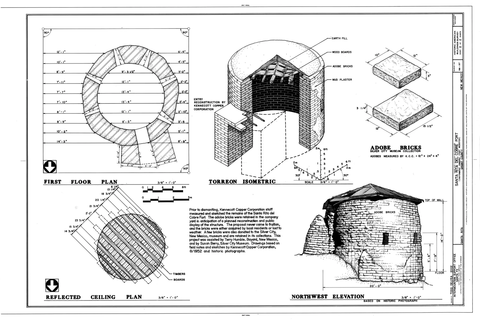
First Floor Plan, Reflected Ceiling Plan, Northwest Elevation, Adobe Bricks, and Torreon Isometric - Santa Rita del Cobre Fort, Santa Rita (historical), Grant County, NM. HABS NM-197, sheet 2 of 2, drawn by Todd Delyea, 2002. Library of Congress; public domain. Resized. Holder’s record.
A 1915 photograph shows a miner working with machinery at Santa Rita. University of Colorado Boulder Libraries; public domain. Resized. Holder’s record.
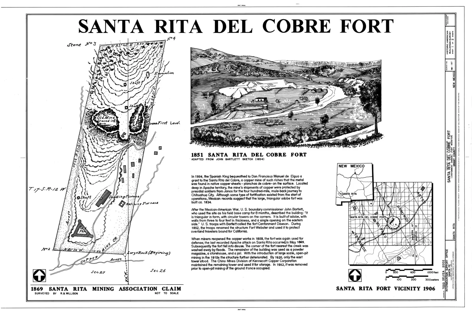
In 2002 the Historic American Buildings Survey drew site plans and an isometric of the vanished Santa Rita del Cobre fort and its torreón (HABS NM-197), filed under ‘Santa Rita (historical)’. Library of Congress Prints and Photographs Division; public domain. Resized. Holder’s record.
Copper at Santa Rita and Hanover
This page visits the mining camps of nineteenth-century Grant County one place at a time, together with the valley villages that grew up beside them. It follows copper at Santa Rita and Hanover, iron at Fierro, silver in the hills around Silver City and farther west, and the turquoise of the Burro Mountains. Silver City and Pinos Altos have their own stories elsewhere in the Atlas, so they appear here only in passing.
Santa Rita’s copper has an origin story, and it comes in more than one version. Spencer and Paige, in their Geological Survey bulletin on the Santa Rita area, relate that about the year 1800 a friendly Apache chief showed the copper croppings, the places where ore shows at the surface, to a Spanish officer, Lt. Col. Jose Manuel Corrasco. They are careful to add that perhaps no more than traditional value attaches to the story. A second telling comes from a pamphlet published in 1891 by J. Parker Whitney, then president of the company that owned the Santa Rita mines. As Graton reported it in 1910, Whitney’s pamphlet says an Apache discovered the croppings of native copper in the latter part of the eighteenth century and reported them to Colonel Carrasco. In both versions it is an Apache who knew where the copper lay, and the Atlas tells them as stories, side by side, as their tellers did. (Sources: Geology of the Santa Rita Mining Area, p. 5; The Ore Deposits of New Mexico, p. 306.)
Later writers placed Santa Rita high in the country’s mining history. Graton ranked it next only to the Lake Superior district of Michigan as the earliest known important copper district in what is now the United States. A 1958 Bureau of Mines circular by W. R. Hardwick, citing a 1938 Bureau of Mines bulletin, called the Chino mine at Santa Rita the oldest of the large copper mines in the western United States. (Sources: The Ore Deposits of New Mexico, p. 306; Information Circular 7837, p. 5.)
Santa Rita had already seen the Boundary Commission by the middle of the century. The Mimbres Valley nomination to the National Register of Historic Places says the Boundary Commission settled into the old fort at Santa Rita in January 1852 and renamed it Fort Webster. In September the post moved to a point across the river from present-day San Lorenzo. It was abandoned about a year later, the nomination says. (Sources: Historic Resources of the Mimbres Valley in…, Section 8.)
At Hanover, copper was being made before the Civil War. Citing Raymond’s 1870 report, Fayette Jones’s history of New Mexico mining credits the Hanover mine with about 1,000,000 pounds of copper between 1858 and 1861, smelted on site at ten cents a pound. Jones says the copper was cast into pigs, bars of 100 to 120 pounds each, and hauled by mule teams through Mesilla to the Texas port of Lavaca. From there schooners carried it to New York. (Sources: New Mexico Mines and Minerals, p. 41.)
Then the war reached the mine. Jones says that at the time of the Confederate invasion work stopped suddenly, and the machinery and equipment, with 187,000 pounds of copper, were taken to San Antonio, Texas, and confiscated by Southern troops. A 1910 Geological Survey report by L. C. Graton adds that in the middle of the century the Hanover mine was said to be producing more than the Santa Rita mines. It was closed shortly after the Civil War began, Graton wrote, and for many years it stood idle. (Sources: New Mexico Mines and Minerals, p. 41; The Ore Deposits of New Mexico, p. 306.)
Geologists today give the district deep roots. Virginia McLemore’s survey for the New Mexico Bureau of Geology and Mineral Resources dates the start of mining in the Fierro-Hanover district to 1850 and in the Bayard district to 1858. She dates the Steeple Rock district to 1860, a date this page returns to below. The Civil War, she says, then halted most mining in New Mexico. A Geological Survey bulletin by A. C. Spencer and Sidney Paige agrees on the early start. It says the Central mining district, sometimes called the Hanover district, appears to have been organized about 1860, at about the same time as the Pinos Altos district. (Sources: Mining districts and prospect areas in New…, p. 3; Geology of the Santa Rita Mining Area, p. 5.)
Central and new owners
After the war, claims piled up quickly. Jones reports that as early as 20 September 1869, fifty-seven mining claims had been recorded in the Central district at Fort Bayard, most of them at Hanover, Santa Rita and San Jose. San Jose was no newcomer: Graton’s 1910 report says the San Jose mine, near the south end of the Hanover district, had been an important producer of copper, gold and some silver before 1870. McLemore’s table lists the Central district as discovered in 1858 and credits it with more than $60 million in metals produced from 1902 to 1969; her Central district includes the Fierro manganese district. (Sources: New Mexico Mines and Minerals, p. 34; The Ore Deposits of New Mexico, p. 318; Mining districts and prospect areas in New….)
Santa Rita itself was smelting copper by the end of the decade. Spencer and Paige say a small blast furnace was at work there in 1869 and that production for eight months of that year was reported at 12,600 pounds. A few years later, they note, Raymond’s 1875 report mentioned the Chino and Yosemite mines at Santa Rita and the San Jose mine, two miles to the west. (Sources: Geology of the Santa Rita Mining Area, p. 6, p. 7.)
H. A. Thorne of the U.S. Bureau of Mines picks up Santa Rita’s story in 1873. He says M. D. Hayes, acting for Denver interests, bought the Santa Rita mining claims that year and obtained title from the scattered Elguea heirs in October 1873. Hayes later secured U.S. patents, the federal titles to mining ground. For a number of years he ran a small smelter at Santa Rita and shipped high-grade ore and black copper, a crude smelted copper, to the nearest railroad station in Colorado. (Sources: Mining practice at the Chino mines, pp. 2-3, p. 3.)
In 1880 the property was sold to J. Parker Whitney of Boston, and in 1881 a stamp concentrating mill, which crushed ore with heavy stamps and separated out the richer mineral, was built near the Romero shaft Hayes had sunk. Spencer and Paige describe the works as they stood in 1882: a stamp mill fitted with jigs, which sorted heavy ore from waste by shaking it in water, a water-jacketed blast furnace and a reverberatory furnace for refining. Under Whitney, they say, the mines were worked mainly by tributers, miners who worked on their own account for a share of the ore they raised. The ground was also split along Santa Rita Creek: the Bonanza Development Co. controlled the land on the south side and the Santa Rita Copper and Iron Co. the land on the north. (Sources: Mining practice at the Chino mines, p. 3; Geology of the Santa Rita Mining Area, p. 7.)
In 1897 Whitney leased the mines to the Hearst estate. Under that lease, Spencer and Paige write, development work managed by B. B. Thayer found a large body of sulphide ore in the southwestern part of the Santa Rita basin. In 1899, Thorne says, Whitney sold the mines to a group of capitalists closely associated with the Amalgamated Copper Co., who formed the Santa Rita Mining Co. Spencer and Paige say the new company kept up the old policy of leasing. It bought ore carrying about 10 percent copper from the lessees and treated material from the old dumps in a 90-ton concentrator. The railroad had arrived by then too: a Santa Fe branch from Whitewater reached Hanover and Fierro in 1891, and a spur from San Jose, also called Hanover Junction, to Santa Rita was finished early in 1899. (Sources: Mining practice at the Chino mines, p. 3; Geology of the Santa Rita Mining Area, p. 7.)
Iron ore from Fierro
Not all the ore in the Central district was copper. Fierro, near Hanover, had iron, and its story is told in a Bureau of Mines circular written by the manager of the Hanover Bessemer Iron and Copper Co. and published in 1930. The circular says that soon after the railroad reached Silver City, some iron ‘float’, loose ore picked up from the surface, was shipped to Pueblo. That ore had been hauled from Fierro by ox teams on their return trip, after they had brought supplies to Fort Bayard. Copper was tried at Fierro too: in 1888, the circular says, a water-jacketed copper smelter was built at the Anson mine, but it ran for only one year. (Sources: Information Circular 6361, p. 2.)
The railroad changed what Fierro’s iron was good for. According to the company circular, when the Santa Fe reached Hanover in 1891, iron ore began to be shipped as flux to the copper smelters at Socorro and El Paso, where it helped the copper ore melt. The circular dates the big Pueblo trade later. It says the Hanover Bessemer Iron Ore Association was organized in 1899, when the railroad was built to Fierro, and that a lease was arranged with the Colorado Fuel & Iron Co., after which shipments to Pueblo started. (Sources: Information Circular 6361, p. 2.)
Spencer and Paige tell the start differently. They write that shipments of Fierro iron ore to the Colorado Fuel & Iron furnaces at Pueblo began in 1891, with the Hanover branch railroad, and that more than 100,000 tons were mined each year after that. Their production note gives 44,500 long tons for 1891 to 1896 and 4,685,301 long tons for 1896 to 1931. The company circular puts the Pueblo shipments from 1899, and the bulletin puts them from 1891; the Atlas gives both dates as their authors give them. (Sources: Geology of the Santa Rita Mining Area, p. 7.)
Farms and villages on the Mimbres
The Mimbres River valley drew settlers too. The Butterfield stage crossing of the Mimbres, seven miles south of present-day Dwyer, grew into a community known by several names: Mowry City, Rio Mimbres, Mimbres Crossing or Old Town. According to the Mimbres Valley nomination it had as many as 250 residents at its height in the 1870s, and it faded quickly after the stage line was discontinued in 1880. From 1863 to 1864, California Volunteers at Camp Mimbres, four miles north of Mowry City, dug an irrigation ditch, and some of them, notably George O. Perrault, later returned to settle. In the late 1860s John Brockman of Mowry City built a grist mill near the present NAN Ranch, and by 1869 he had built an irrigation ditch. In 1870, the nomination says, much of the valley from Mowry City to San Lorenzo was settled. (Sources: Historic Resources of the Mimbres Valley in…, Section 8, p. 8.)
San Lorenzo began as a miners’ village. According to its National Register nomination, nineteen miners from Pinos Altos and their families, led by N. Y. Ancheta and most of them from Chihuahua, founded San Lorenzo in 1869 and dug an irrigation ditch that first year. Its census tract had 49 people in 1870, 34 of them born in Mexico, and 284 in 1880, and it peaked at 476 in 1940. The nomination calls San Lorenzo the largest community in the Mimbres valley from 1869 to 1937, and says it supplied food to Pinos Altos, Silver City, Georgetown, Santa Rita and Fort Bayard. Gorgonio Galaz, who had come from Socorro, Texas, by way of Mesilla and had kept a store at Georgetown, moved to San Lorenzo in 1893. There he built one building that held his bar, his store, the post office and his home. (Sources: San Lorenzo Historic District, Section 8, Section 7.)
San Juan grew in a different way. Its nomination says that, unlike San Lorenzo, it grew gradually from the mid-1870s around a few homesteads. One belonged to the Italian Carlos Norero, among the first settlers of Pinos Altos, who homesteaded there in 1872; others belonged to the brothers Luz and Rosalio Leiva from Chihuahua. In 1873 another homesteader, Cosme Guadiana, began an acequia, a community irrigation ditch, that became the Llano or San Juan Ditch, and in 1880 Norero and Celso Gonzales built the San Juan East Ditch. San Juan’s old school dates from 1895 and its church from 1901. (Sources: San Juan Historic District, Section 8, p. 30.)
The valley nomination sees two ways of farming side by side. In the middle valley the Spanish-Mexican pattern held: people lived together in villages, the community built and kept up the ditches, and each family was allotted a long field running from the river to the ditch. At the north and south ends of the valley, the nomination says, Anglo-style individual homesteads and sharecropping were the pattern instead. (Sources: Historic Resources of the Mimbres Valley in…, Section 8, p. 9.)
Georgetown and the Mimbres mill
Georgetown’s silver took a while to pay. McLemore lists the Georgetown district as discovered in 1866 and estimates that it produced silver, lead, gold, copper and zinc worth about $3.5 million from 1866 to 1985. Graton’s 1910 report agrees that silver was discovered in 1866, but says there was little development until about 1873. By 1875, he writes, the camp was booming. It declined after silver slumped in 1892, and by 1905 a single Mexican lessee was working the old stopes, the open chambers left where ore had been dug out. (Sources: Mining districts and prospect areas in New…; The Ore Deposits of New Mexico, pp. 318-319.)
Georgetown’s silver reached the valley through a mill. By 1875 a mill for processing Georgetown’s silver had been built in the valley, and the village of Mimbres grew up around it. According to the Mimbres store nomination, the village prospered through the 1880s and ‘declined somewhat’ after the mill closed in 1893, but it remained the one village at the north end of the valley. With what the valley nomination calls the Apache threat gone by the mid-1880s, the valley’s population rose to about 1,200 in 1890. It held at that level until 1940 and fell to about 800 by 1950. (Sources: George Sibole Store, Mimbres, item 8; Historic Resources of the Mimbres Valley in…, Section 8, p. 10.)
Silver in the hills near Silver City
Silver turned up close to Silver City as well. Graton’s 1910 report says silver ore was discovered at Chloride Flat, about a mile and a half west-northwest of the town, in 1871, though active production did not begin until some years later. The mines were practically abandoned when the price of silver fell in 1893, after a total production that has been variously placed at $3.25 million to $5 million. (Sources: The Ore Deposits of New Mexico, pp. 301-302.)
Lone Mountain, a silver sub-district of Central, was found in or about the same year. Fayette Jones placed it four to five miles from the Central post office, dated its discovery to 1871 and described it as nearly idle by 1904. Citing Jones, Graton’s report credits the find to Frank Bisbee, the man after whom the Arizona copper camp of Bisbee took its name. Paige’s Silver City folio for the Geological Survey says rich silver ore was discovered there about 1871 and that successful work went on for about three years. (Sources: New Mexico Mines and Minerals, p. 44; The Ore Deposits of New Mexico, p. 320; Silver City folio, New Mexico, p. 15.)
Paige’s folio also mentions a smaller place. At a camp called Fleming, about six miles northwest of Silver City, he says silver mining went on until 1893. That year, 1893, which ended silver mining at Fleming, comes up again at the end of this page. (Sources: Silver City folio, New Mexico, p. 15.)
Turquoise and copper in the Burro Mountains
Sidney Paige of the U.S. Geological Survey, in his report on the copper deposits of the Tyrone district, wrote that until the late 1870s and early 1880s the Burro Mountains were ‘the stronghold of the savage Apaches’. That wording is the settler language of his day, not a neutral description of the Apache people who lived there. Paige also noted that Mangas Valley took its name from Mangas Coloradas. (Sources: Copper deposits of the Tyrone district, p. 23.)
Who found the turquoise first is not settled. Paige credits ‘Turquoise John’ Coleman with being in the Burro Mountains in 1879, but says Robert and John Metcalf seem to have made the first locations in the region, about 1871, finding both turquoise and copper. Elliot Gillerman’s survey of western Grant County notes that the sources disagree on when Coleman rediscovered turquoise in some old pits near Tyrone: Zalinski, writing in 1907, says 1875, while Paige says 1879. Gillerman adds that although Coleman is generally considered the discoverer, the names of W. J. Foley and Nicholas C. Rascome are also mentioned in connection with the first find. (Sources: Copper deposits of the Tyrone district, p. 23; Mineral Deposits of Western Grant County, p. 9, p. 42.)
The turquoise soon became a business. Gillerman says Coleman’s claims were acquired in 1882 by M. W. Porterfield and T. S. Parker, who organized the Occidental and Oriental Turquoise Mining Co. The property later passed to the Gem Turquoise and Copper Co. in 1901 and then to the American Gem and Turquoise Co., and it became known as the Parker mine. (Sources: Mineral Deposits of Western Grant County, p. 43.)
Another firm, the Azure Mining Co., was organized in 1891 by C. Armeny of New York and controlled by New York jewellers. In 1893 its superintendent, F. Vogel, opened the ‘Elizabeth pocket’, which Gillerman calls one of the most productive turquoise deposits in the country. Graton’s 1910 report cites Zalinski as saying that the Azure mine had produced turquoise worth several million dollars since 1891. (Sources: Mineral Deposits of Western Grant County, p. 44; The Ore Deposits of New Mexico, p. 296.)
Copper drew a second wave of companies. Paige says the St. Louis copper deposit near Tyrone was discovered in 1879 by James Bullard, John Swisshelm and J. W. Fleming, who shipped surface ore to Denver. Paschal R. Smith and Frank Marshall organized the Val Verde Copper Co. and built a 50-ton reverberatory furnace, a smelting furnace, in Deadman Gulch; the town around the works was called Paschal. But the nearest railroad was at Deming, more than 50 miles away, and the wagon haul cost $50 a ton; the Val Verde company soon failed. Paige says it merged with the Southwestern Copper Co., and that all operations were then suspended ‘on account of marauding Indians’, in his phrase. (Sources: Copper deposits of the Tyrone district, p. 23.)
Others tried and also failed. A second company under Colonel Smith built a smelter at Oak Grove in the Burro Mountains, but Paige says it ran only a short time. Judge Deming’s Alessandro Copper Co., working claims about three miles east of the St. Louis mine, tried leaching, dissolving the copper out of the ore with sulphuric acid that it made on the ground from pyrite. Paige wrote that the low grade of the ore, the lack of a railroad and ‘the attempt to leach 30 years ago’ resulted in failure. Because he did his field work in 1915 and published in 1922, his date points only roughly to the 1880s or early 1890s. (Sources: Copper deposits of the Tyrone district, p. 23.)
The mountains supplied the smelters in another way. Gillerman says that in the early 1880s fluorspar was mined at the Burro Chief mine near Tyrone and at the Foster mine on the Gila. It was used as flux, a material added to help ore melt, in smelters at Oak Grove, Paschal and Silver City. (Sources: Mineral Deposits of Western Grant County, p. 9.)
Tyrone’s twentieth-century story belongs to the copper towns page, but Paige’s report offers a glimpse of it. He notes that a branch of the El Paso & Southwestern Railroad linked Tyrone with Deming. Water for the new town of Tyrone was pumped through prospect drill holes in the valley gravel, he says, while Leopold had pumped its water from Deadman Gulch. Natalie Faith Lord, in her study of Clarence Stein’s work in Goodhue’s office, notes that several sources call Tyrone a ‘million dollar’ mining town, but that Phelps Dodge said it cost much less than this to build. (Sources: Copper deposits of the Tyrone district, p. 2, p. 4; Clarence S. Stein in the office of Bertram…, Chapter 6.)
Silver at Black Hawk, gold at Malone
Prospectors fanned out across new ground in the early 1880s. Gillerman says that extensive prospecting in 1880 and 1881 found gold, silver, lead and copper in the Anderson, Clarks Peak and Telegraph districts near Redrock and in the Steeple Rock district. In 1881 high-grade silver turned up at the Alhambra mine in the Black Hawk district. (Sources: Mineral Deposits of Western Grant County, p. 9.)
That find was float, pieces of ore lying loose on the surface, and it opened the Black Hawk district. Gillerman says nearly all the ore produced there was high-grade silver, with shipments assaying as much as 15,000 ounces of silver a ton, and that mining went on until about 1893. He estimates the silver taken before 1893 at $1,000,000 to $1,500,000. About twice that recorded total is estimated to have been produced but never recorded, he adds, because of extensive high-grading, the pocketing of rich ore by miners. McLemore’s table lists the district as discovered in 1881 and credits it with more than $1 million in production from 1881 to 1960. (Sources: Mineral Deposits of Western Grant County, p. 143; Mining districts and prospect areas in New….)
Gold followed in 1884. Gillerman writes that gold was discovered at Gold Hill and Malone that year, that mining camps were established at Gold Hill, Malone and Black Hawk, and that more than 500 people lived at Gold Hill. According to Jones, as Gillerman reports, David Egelston, a veteran of the 1849 gold rush, found gold on the Gold Chief claim at Gold Hill in 1884, and Foster and Company built the Standard mill there in 1886. Gold Hill, which straddles the line later drawn between Grant and Hidalgo counties, reached its peak in the 1890s with some 500 people. It declined rapidly after its free-milling ore, ore whose gold could be recovered in a simple mill, ran out around 1900. (Sources: Mineral Deposits of Western Grant County, p. 9, p. 116.)
Gillerman names the man who found gold at Malone. Gillerman says John B. Malone discovered gold in the district in 1884, although placer mining, the washing of loose gold from gravel, had gone on for years before that in nearby Gold Gulch and Thompson Canyon. The Malone district produced about $300,000 in gold, most of it before 1900. (Sources: Mineral Deposits of Western Grant County, pp. 111-112.)
Steeple Rock and Carlisle
When mining began at Steeple Rock is a question the sources answer differently. Gillerman cites as the earliest available record a military report that troops were sent from Fort Thomas to the district in 1860 to protect the miners from the Apaches, along with an owner’s statement that the Carlisle mine produced before 1880. Griggs and Wagner, in a Geological Survey report, say government records indicate the large veins of the district were first prospected about 1880, and they repeat the 1860 Fort Thomas troop report as a claim made by Russell in 1947. Fayette Jones says the Steeple Rock district, which he calls the old Carlisle district near the Arizona line, was first prospected by Judge Potter in 1881. Jones also says its English-backed 60-stamp mill stopped in 1897, when heavy sulphide ores were reached. (Sources: Mineral Deposits of Western Grant County, p. 182; Geology and ore deposits of the Steeple Rock…; New Mexico Mines and Minerals, pp. 68-69.)
Griggs and Wagner name the claims they count as the first. They say the Carlisle, Star of the West, Center and Pennsylvania claims were filed on 24 January 1881 by Daniel Remington, James Mounts, William Johns and A. G. P. George, all of whom are reported to have come from Carlisle, Pennsylvania. In February 1882 Mounts sold his quarter interest in the Carlisle claim to a Chicagoan for $10,000, and the Carlisle Gold Mining Co. was formed early that year. Gillerman says that in 1883 the Carlisle was sold to a group of prominent Chicago merchants and capitalists, among them Marshall Field and N. K. Fairbanks, which built a 20-stamp mill by 1887. (Sources: Geology and ore deposits of the Steeple Rock…; Mineral Deposits of Western Grant County, p. 182.)
Ownership then crossed the Atlantic. Gillerman says that in January 1887 the Carlisle Mining Co. was sold, reputedly for $1,000,000, to English interests, the Golden Leaf Mining Company, Limited, and Henry Cameron Richardson, with Rothschild involvement reported. Griggs and Wagner tell the ending differently. They say an English syndicate bought the Carlisle about 1886 and in 1887 built a smelter for its sulphide ore, ore in which copper, lead and zinc are bound up with sulphur, but that the venture was unsuccessful and mining stopped in 1890. (Sources: Mineral Deposits of Western Grant County, p. 183; Geology and ore deposits of the Steeple Rock….)
Gillerman instead carries the mine further: under the Steeple Rock Development Co. it reached 600 feet, ran a 60-stamp mill and its own smelter, and shipped about $4 million in ore, until the great expenses closed it in 1897. Graton’s 1910 report adds another voice. It says the first prospecting in the region was done about 1880 and that the arrival of English capital a little later stirred up activity. It reports that the Carlisle produced $3,000,000 up to 1897, when it closed, a smaller figure than Gillerman’s, and that in October 1905 no work was being done in the district. The Atlas gives both closing dates, 1890 and 1897, and both production figures, as their authors give them. (Sources: Mineral Deposits of Western Grant County, p. 183; The Ore Deposits of New Mexico.)
Shakespeare and old Hachita
South of Lordsburg lay Ralston, later known as Shakespeare. Jones says prospecting there began about 1870, with a boom centred on the area at that time and tied to a San Francisco banker named Ralston. He also repeats a story that swindlers salted the country near Lee’s Peak with diamonds in the early 1870s, planting stones to make the ground look rich. Jones gives no source for the tale, so it is best read as a legend. He also reprints an undated railroad-boom handbill, which he judges must date from 1880, calling Shakespeare ‘the crowning camp of New Mexico’. (Sources: New Mexico Mines and Minerals, p. 57, p. 59.)
Hachita had an old camp of its own. Jones places old Hachita about six miles southwest of the new Hachita post office, and says it flourished a short time in the early days but had been very quiet since 1890. It produced silver-lead ore and fine turquoise from workings older than the American prospectors. McLemore’s table lists the Eureka district, in Grant and Hidalgo counties, as discovered in 1871 and producing about $1,590,000 between 1878 and 1961. (Sources: New Mexico Mines and Minerals, pp. 63-64; Mining districts and prospect areas in New….)
Cattle money and the crash of 1893
Some men made money in mining and moved on to land. The National Register nomination for the L.C. Ranch headquarters at Gila says Tom Lyons and Angus Campbell sold their Cosette mine and Silver City foundry interests in 1880 and went into the cattle business. In 1885 they organized the Lyons and Campbell Ranch and Cattle Co. with $1,500,000 in capital. The nomination calls the L.C. the dominant ranch of southwest New Mexico, at its height in the 1890s under Tom Lyons controlling a million-acre range carrying 60,000 head. The ranch moved its headquarters to the town of Gila, where Lyons built the large adobe ranch house. Its farming employed about 100 Mexican families, most of them brought from Chihuahua, and Lyons’s store at Gila had six clerks. (Sources: L.C. Ranch Headquarters, Gila.)
The silver years did not last. Gillerman says mining boomed in western Grant County through the 1880s and 1890s, but the panic of 1893 and the fall in the price of silver caused many mines to close, some never to reopen. By 1900, he writes, there was little activity left in the area. (Sources: Mineral Deposits of Western Grant County, pp. 9-10.)
What came next, in Santa Rita, Hanover, Tyrone and the other copper towns, is told on the next page.
The checked facts for this part, with their quotes and locators, are on the Atlas page The mining camps beyond Silver City, 1858 to 1899.
The copper towns, 1900 to 1969
Tyrone, New Mexico, May 1940. Photograph by Russell Lee, Farm Security Administration. Library of Congress; no known restrictions on publication. Resized. Holder’s record.
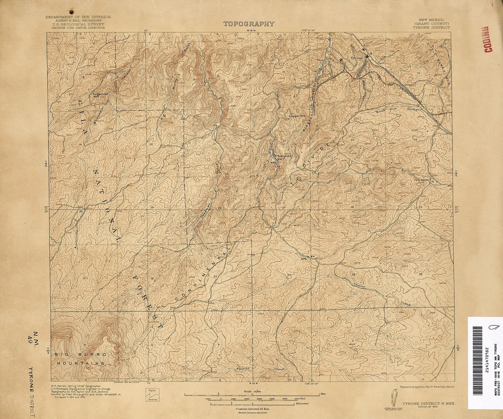
Tyrone District, 1:24,000, 1916. U.S. Geological Survey topographic map of the Tyrone (Burro Mountains) copper district. U.S. Geological Survey; public domain. Resized. Holder’s record.
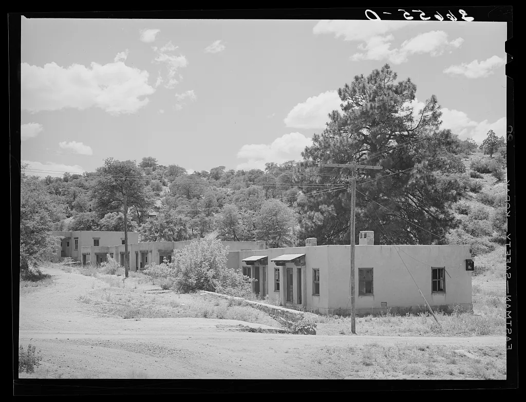
Company housing at Tyrone, New Mexico. Photograph by Russell Lee, 1940 June. Farm Security Administration/Office of War Information. Library of Congress; no known restrictions on publication. Resized. Holder’s record.
A county of mining towns
This page follows Grant County’s copper towns through the first two-thirds of the twentieth century, place by place: who owned them, how they were built and who worked in them. Later sections turn to the open pits, the unions and strikes, and the moving of Santa Rita. Where the sources disagree, both versions are given, each with its author.
At the start of the new century, mining was the county’s business. Waldemar Lindgren, L. C. Graton and their co-authors, in a 1910 Geological Survey report on New Mexico’s ore deposits, described Grant County as covering 7,403 square miles and as having generally held the lead among the territory’s metal-producing counties. Fayette Jones put it more sharply: nearly three-fourths of New Mexico’s metal output in 1902, he said, came from Grant County, and the greater part of that from the Central mining district. Sidney Paige of the Geological Survey, in his 1916 folio on the Silver City area, wrote that every town in it either was or had been a mining center. Besides Silver City he listed Leopold, Tyrone, Pinos Altos, Central, Fierro, Hanover and Santa Rita. Silver City, as the railway terminus, had long been the supply point for the districts around it, and stage lines ran from it to the Mogollon district and between Silver City, Leopold and Santa Rita. (Sources: The Ore Deposits of New Mexico, pp. 295-296; New Mexico Mines and Minerals, p. 43; Silver City folio, New Mexico.)
Rails and smelters tied the camps to the wider world. Paige described the Santa Rita and Hanover branches of the Santa Fe railway joining the Deming and Silver City branch at Whitewater, an El Paso & Southwestern branch linking Tyrone to Deming, and a narrow-gauge line between Pinos Altos and Silver City. Ore also had to be smelted, melted down so the metal could be separated from the rock. Lindgren’s report says that around 1901 and 1902 the smelters at El Paso and Socorro came under ASARCO, that a new copper smelter at Douglas, Arizona, opened as a market for low-grade ore, ore with little metal in it, and that the old Silver City smelter closed. (Sources: Silver City folio, New Mexico; The Ore Deposits of New Mexico.)
In those years, Lindgren’s figures show Grant County’s gold output falling while its copper output rose. Lindgren’s report says Grant County’s gold output ranged from about $100,000 to $500,000 a year in the late nineteenth century, peaking in 1889, but had fallen to $45,682 by 1908. Copper moved the other way. Little was recorded until 1897, when output reached 1.2 million pounds; it climbed to 8 million pounds in 1907 before dipping to 5.24 million in 1908. For Santa Rita alone, the report cites F. A. Jones’s estimate of 80 million pounds of copper produced up to 1 January 1904, with about 5 million pounds a year after that. (Sources: The Ore Deposits of New Mexico, p. 296, p. 306.)
Railroad towns: Hachita and Lordsburg
Railroad news came out of the southern county in 1902. The Bisbee Daily Review reported in July that the new line from Lordsburg to Hachita on the El Paso & Southwestern was finished, extending the Arizona & New Mexico railroad from Clifton. In September the Review, reprinting the El Paso Herald, reported that the railroad’s well at Hachita had struck water the month before. Lots in the town, the paper said, were selling for $50 to $150 apiece. (Sources: Bisbee Daily Review, 25 July 1902, p. 8, p. 8; Bisbee Daily Review, 13 September 1902, p. 5, p. 5.)
The older camps nearby were fading. Jones described them only two years after these reports. He wrote in 1904 that production at old Hachita had been very light for several years, and that the ruins of an old smelter served as ‘a memento of the former glory of the now quiet camp’. He found old Shakespeare, once called Ralston, fast passing into decay. Lordsburg, three miles north at the crossing of two railways, had become the new town. (Sources: New Mexico Mines and Minerals, p. 64, pp. 59-60.)
Santa Rita and the Chino mines
Santa Rita’s old fort still held traces of an earlier war. H. A. Thorne’s 1931 report for the U.S. Bureau of Mines says General Sibley’s Confederates held the Santa Rita area for a short time in 1862. Evidence of their stay turned up in 1910, he says, when part of the old fort was razed to make room for a machine shop. Thorne says that near the end of 1904 the Hermosa Copper Co., a subsidiary of the General Electric Co., became interested in ground outside the Santa Rita basin, and in 1905 and 1906 it spent about nine months examining the Santa Rita Mining Co.’s holdings. (Sources: Mining practice at the Chino mines, p. 2, p. 3.)
A. C. Spencer and Sidney Paige, in their Geological Survey bulletin on the Santa Rita area, describe the same company as affiliated with General Electric and organized in 1905. Within two years, they say, it sank shafts at eight points and opened nearly 3 miles of underground workings near Hanover, but reportedly blocked out, that is, measured and outlined, only 25,000 tons of 3 percent copper ore. Its engineer, J. M. Sully, began in 1906 to study whether the Santa Rita deposits could be worked by the methods Utah Copper had made prominent at Bingham. His first investigation took 2,876 samples weighing 300 to 500 pounds each. After more extensive sampling in 1908, he prepared a report for the owners showing that the property could be worked on a large scale as a low-grade mine. In 1918, Spencer and Paige add, the Hermosa company’s lands were transferred to the Chino Copper Co. (Sources: Geology of the Santa Rita Mining Area, p. 8.)
The company that would remake Santa Rita came next, and Thorne and Spencer and Paige date its organization a month apart. Thorne dates the organization of the Chino Copper Co. to June 1909, says it bought the property, and links it to the backers of Utah Copper. Spencer and Paige date it to May 1909, after the owners dropped a financing plan devised by Thomas W. Lawson and sold the property instead. Thorne has steam shovels, big power diggers, at work by the fall of 1910 and the first ore milled at Hurley a year later; Spencer and Paige put the first steam-shovel work in September 1910 and the start of mill building at Hurley in October. By December 1912, they say, drilling had proved about 90 million tons of ore averaging 1.8 percent copper, and they date large-scale copper mining at Santa Rita to 1912, after about a century of on-and-off production that began in 1804. The Atlas gives both founding dates side by side. (Sources: Mining practice at the Chino mines, p. 3; Geology of the Santa Rita Mining Area, pp. 8-9, p. 9, p. 1.)
The newspapers watched the change. The El Paso Herald reported in August 1910 that the old Santa Rita concentrator had been permanently closed while Chino graded for steam shovels near the Santa Rita depot. In February 1911 the Albuquerque Morning Journal, reprinting the Silver City Independent, reported five Chino steam shovels at work and said the Romero ore body had yielded 82,725 tons of ore averaging over 2 percent copper. (Sources: El Paso Herald, 15 August 1910, p. 2, p. 2; Albuquerque Morning Journal, p. 5.)
Ownership kept changing hands. Thorne says Ray Consolidated Copper absorbed the Chino Copper Co. in 1924, and that in 1926 Nevada Consolidated Copper bought all of Ray Consolidated’s properties. By his reckoning, allowing for a small percentage of error, the Santa Rita mines had produced about 1,204,000,000 pounds of copper up to 1930, including an estimated 41 million pounds before 1845. Spencer and Paige’s figures for the Central district as a whole show how unsteady the trade could be. Copper output there fell from about 77.5 million pounds in 1918 to 9.1 million in the short depression of 1921, then rose to a peak of about 87.4 million pounds in 1929. (Sources: Mining practice at the Chino mines, p. 3, p. 4; Geology of the Santa Rita Mining Area, pp. 9-10.)
In 1931, Thorne notes, the Chino mines paid straight wages and salaries with no bonuses of any kind, and kept a hospital and medical staff at the mine. The jobs, and the wages, reached well beyond Santa Rita itself. The Mimbres Valley nomination to the National Register of Historic Places says that after the mine was revived starting in 1909, Santa Rita, only eight miles east of the valley, became a source of wage work for valley residents. (Sources: Mining practice at the Chino mines; Historic Resources of the Mimbres Valley in…, Section 8.)
Hurley, the mill town
The El Paso Herald reported in July 1910 that Chino would build its mill a mile from Hurley station. Chino’s ore needed a mill, and a mill needed water. The El Paso Herald reported in July 1910 that the mill would stand on the ‘B ranch’, bought from the Victoria Land and Cattle Co. for its water, a mile from Hurley station. The company had platted a townsite, surveying it into streets and lots, near the mill, the paper said, but the town would remain under the company’s control. The same report said a branch of the Santa Rita Store Co. had opened at the mill site and that the grade for a branch railway to the mill was nearly finished. Read together, these items show a company town being laid out before its mill was even built. (Sources: El Paso Herald, 18 July 1910, p. 5, p. 5.)
Chino also raised money through bonds, loans raised from investors. On 9 August 1911 the Herald reported that Chino Copper’s bond issue was fully subscribed and would bring in $2,400,000. That sum, the paper said, would pay off all the company’s debts and enlarge the big concentrator at Hurley, the mill that separated copper minerals from waste rock, from 3,000 to 5,000 tons a day. In the Herald’s telling, the bond money was meant to clear the company’s debts and make its mill bigger. (Sources: El Paso Herald, 9 August 1911, p. 12, p. 12.)
The mill kept changing. Fred Hodges of the Bureau of Mines, describing the Hurley plant in 1930, wrote that two sections were added to the concentrator in 1918 and 1919, bringing it to seven. A rebuilding begun in 1923 replaced its Chilean mills, an older kind of grinding mill, with ball mills, turning drums in which steel balls grind the ore fine. The rebuilding also installed ‘Chino-type’ pneumatic flotation machines, which use air bubbles to lift copper minerals out of the ground ore, and it was finished in 1925. By early 1930, Hodges reported, the concentrator, now belonging to the Nevada Consolidated Copper Co., could handle 13,500 tons of ore a day and recovered about 84 percent of the copper. (Sources: Information Circular 6394, p. 2, p. 3, p. 1.)
Hurley made its own power and found its own water. Hodges describes three Allis-Chalmers turbo-generators, of 7,500, 6,000 and 2,000 kilowatts, whose electricity was sent at 24,000 volts to the mine at Santa Rita. The power plant burned slack coal brought from the Gallup coal fields of northwestern New Mexico. Ore from the Santa Rita pit was weighed on railroad scales at the mine and carried to the concentrator by the Atchison, Topeka & Santa Fe. The main water supply came from three wells at the Apache Tejo station, four miles south of the concentrator, the deepest of them 2,445 feet; more came from stations at the Bolton Ranch, the ‘B’ Ranch, Whiskey Creek and Cameron Creek. (Sources: Information Circular 6394, pp. 1-2, p. 2, p. 13-14, p. 14.)
Hanover, Fierro and Central
Hanover’s earlier story is told on the mining camps page. Around the turn of the century, Spencer and Paige say, the Phelps Dodge Co. took over several properties near Hanover, about 1898 or 1899, among them the Modoc, the Hanover and the Emma; lessees worked the Emma in 1908, and the Copper Queen Consolidated Mining Co. in 1910. Fayette Jones’s history of New Mexico mining traces the Hanover mine from T. B. Catron to C. F. Grayson and Co. of Silver City, which sold it to Phelps, Dodge and Co. in 1902. The two accounts give different years for Phelps Dodge’s arrival at Hanover, and both are kept here. (Sources: New Mexico Mines and Minerals, p. 41; Geology of the Santa Rita Mining Area, p. 8.)
Next door at Fierro, the ore was iron. Jones says the Colorado Fuel & Iron Co. controlled the Fierro iron mines in 1904, and that zinc ore from the Thunderbolt mine near Hanover was shipped to Mineral Point, Wisconsin, for treatment. Lindgren’s report counts somewhat more than a million long tons of magnetic iron ore mined at Fierro from 1900 to 1908. A 1930 Bureau of Mines circular, written by the company’s manager, says the Hanover Bessemer Iron & Copper Co. was incorporated in 1914, built a mill in 1916 and came under the control of the United States Smelting, Refining & Mining Co. in 1919. The circular called it the only operating iron mine in the southwestern United States. According to the circular, nearly all its ore went 694 miles by rail to Pueblo, Colorado, to be smelted by the Colorado Fuel & Iron Co.; shipments ran about 200,000 tons a year, and about 175 men worked there. (Sources: New Mexico Mines and Minerals, p. 43; The Ore Deposits of New Mexico, p. 296; Information Circular 6361, p. 2, p. 1.)
Gold had its own brief moment near Central. On 16 June 1903, Jones says, a very rich strike on the Pactolus claim in Gold Gulch suddenly revived the camp around the Central post office. Lindgren’s report, looking back from a few years later, found that the excitement in Gold Gulch, near Hanover Junction, had been short: by October 1905 the mill machinery had been taken away. A placer venture on Whitewater Creek, an attempt to wash gold out of the stream gravels, found neither water nor gold. (Sources: New Mexico Mines and Minerals, p. 34; The Ore Deposits of New Mexico, p. 318.)
In the 1920s a new mill went up near Hanover. Ira Wright of the Bureau of Mines described the Black Hawk Consolidated Mines Co. concentrator, a mile south of Hanover on the Hanover-Fierro spur of the Santa Fe, built in the summer of 1926 for 100 tons a day and later handling 160 to 180 tons. In 1930 it bought its power from the Texas-Louisiana Power Co., which made it in a diesel plant at Silver City, 16 miles away. In the two months before Wright’s report, about half the ore it treated came from the Ground Hog mine of the Asarco Mining Co., and it also milled custom ore, ore sent in by other mine owners, from the Central district and elsewhere. Virginia McLemore’s 2017 survey for the New Mexico Bureau of Geology says the Ground Hog began production in 1928. By 1950, the Minerals Yearbook reported, one of its shafts had reached 2,210 feet, probably the deepest mine shaft in New Mexico. (Sources: Information Circular 6359, p. 1, p. 2; Mining districts and prospect areas in New…, p. 4; Minerals Yearbook 1950.)
Zinc brought a new mine to the Central district. Walter Storms and Jerry Faust of the Bureau of Mines traced the Kearney mine’s history: the Peru Mining Co. took an option on the Kearney claims in July 1937, its New Mexico Consolidated Mining Co. began sinking two shafts in March 1942, and zinc production began in March 1943. All the Kearney’s ore was shipped to the Peru company’s mill near Deming. When the wartime Premium Price Plan for copper, lead and zinc expired on 30 June 1947, the mine shut for about a month, and the company’s main office moved from Silver City to the Pewabic mine near Hanover. Writing in 1948, the two engineers said copper and zinc output in the Central district was the largest on record. (Sources: Information Circular 7507, p. 3, p. 1.)
New companies in the Burros
In the Burro Mountains, copper brought new companies after 1900. Lindgren’s report says the first recorded mineral discovery there was in 1871, that Indians probably mined turquoise in the district before that, and that interest in copper revived about 1902. Sidney Paige’s 1922 Geological Survey report says that in 1904 Theodore Carter interested the Leopold brothers of Chicago in the St. Louis mine and organized the Burro Mountain Copper Co., which built a mill of 150 to 300 tons at Leopold. The same year Phelps, Dodge & Co. bought a third interest in the company and an option, the right to buy later, on the remaining two-thirds. Lindgren’s report sizes the Leopold mill a little differently: in 1905, it says, the company was enlarging it from 125 to 250 tons. (Sources: The Ore Deposits of New Mexico, pp. 321-322; Copper deposits of the Tyrone district, p. 23.)
About 1905, Paige says, the Comanche Mining & Smelting Co. and the Copper Gulf Development Co. began developing property in the camp, and they later merged as the Savannah Copper Co. In May 1906 the Briggs Oliver Development Co. took an option on Thomas S. Parker’s Burro Chief group and started shafts Nos. 1, 2 and 3 at Tyrone. That company became the Tyrone Development Co. and then the Chemung Copper Co. (Sources: Copper deposits of the Tyrone district, p. 23.)
The El Paso Herald’s mining review of August 1910 reported that the Chemung Copper Co., with an average force of about 150 men, was blocking out ore near Tyrone, opening and measuring the ore body ahead of mining. The Burro Mountain Copper and Copper Gulf companies, it said, were doing the same. Paige’s Silver City folio gives its own list for that year: four companies developing the Burro Mountains’ disseminated copper field, where the copper is scattered in small grains through the rock. They were Burro Mountain Copper, Chemung Copper, Savannah Copper and Mangas Development. (Sources: El Paso Herald, 15 August 1910, p. 2, p. 2; Silver City folio, New Mexico.)
Then Phelps Dodge gathered the district in. Paige says it bought out the Leopold interests in the Burro Mountain Copper Co. and in 1913 purchased the Chemung Copper Co. and several individual claims. Elliot Gillerman’s survey of the mineral deposits of western Grant County says that by 1913 Phelps Dodge owned the whole district except the Azure Mining Co.’s turquoise holdings, purchased in 1959, and some fringe claims, and that it built a 2,000-ton concentrator, a railroad and the new town. By the time Paige wrote, Leopold, a mile southwest of Tyrone, where the Burro Mountain Copper Co. once had its offices and mill, had been abandoned. By 1913, as Gillerman tells it, a district of several competing companies had become one company’s ground. (Sources: Copper deposits of the Tyrone district, p. 24, p. 2; Mineral Deposits of Western Grant County, p. 43.)
Goodhue’s town at Tyrone
At Tyrone the sources give different starting points for the new town. Natalie Faith Lord, in her Cornell master’s thesis on Clarence Stein’s work in the office of the architect Goodhue, says that before the new town Tyrone was a minimal ‘tent city’ with a handful of frame buildings, including a hotel and a hospital. Paige, whose field work ran from August to October 1915, reported that the camp, formerly in St. Louis Canyon near the headwaters of the Mangas, was now nearby in Mangas Valley, where the Burro Mountain Copper Co. had built a model town. Gillerman puts Tyrone’s population at about 5,000 in 1915. (Sources: Clarence S. Stein in the office of Bertram…, Chapter 4; Copper deposits of the Tyrone district, pp. 1-2; Mineral Deposits of Western Grant County, p. 10.)
The dates for the new town’s beginning differ as well. Lord dates the design and planning to about 1915 and the town’s official opening to April 1916. In December 1916, however, the New Mexico State Record reported that Phelps Dodge was planning Tyrone as a model town of 20,000, with Goodhue as architect in charge. The Atlas sets these accounts side by side rather than choosing a single start date; each describes the town at a different moment in its making. (Sources: Clarence S. Stein in the office of Bertram…, Chapter 6; New Mexico State Record, 22 December 1916, p. 1, p. 1.)
Why build a new town at all? Lord offers an argument, and it is hers to make. In her reading, Walter Douglas of Phelps Dodge launched the new Tyrone in 1915 in reaction to the Arizona strikes. He planned to employ only a few American workers, as supervisors, and to make the rest Mexican laborers, so as to avoid unionization. Lord writes that Goodhue put his young associate Clarence Stein, later a noted planner, in charge of the design. Her account of Douglas’s motives is an interpretation built from her research on the town and its designers, and it is given here as hers. (Sources: Clarence S. Stein in the office of Bertram…, Chapter 4, Chapter 5.)
The plan, Lord says, echoed the Spanish Laws of the Indies, the colonial rules for laying out towns, with Mangas Street as the main north-south axis running through a plaza 140 by 250 feet. She compares it with the larger Plaza de Panama, at 200 by 400 feet. In her account the plaza was the only place in Tyrone where Mexican and American workers were meant to be together; their housing was separate and unequal. Lord, citing a later source, says that by 1920 Tyrone was the seventh-largest town in New Mexico and was considered ‘the most beautiful mining town in the world’. (Sources: Clarence S. Stein in the office of Bertram…, Chapter 5.)
After Tyrone closed
The model town ran only a few years. A newspaper article of 18 March 1921, cited by Lord, announced that Tyrone would close as of 1 April. Lord writes that when it closed, Mexican workers were put on trains to Las Cruces and deported across the border. Gillerman records that after the 1921 shutdown the mill was dismantled, and many of the buildings of a town that had held more than 5,000 people in 1920 were torn down or moved. The deportations are Lord’s account; the geological reports cited here describe the closing only through the mill and the buildings. (Sources: Clarence S. Stein in the office of Bertram…, Chapter 5; Mineral Deposits of Western Grant County, p. 43.)
Tyrone found other lives. Lord says the general manager, Phil Lynch, and his wife began running the town as a dude ranch, a ranch resort for paying guests, and that writers and artists lived there until wartime gas rationing ended the resort. Copper still came out of the old workings. Gillerman says leaching, washing copper out of the waste dumps with solutions, ran from shortly after 1921 to 1929 and resumed in the late 1930s; between 1941 and 1950 it produced 30 million pounds of copper. (Sources: Clarence S. Stein in the office of Bertram…, Chapter 5; Mineral Deposits of Western Grant County, p. 43.)
Valley villages and western camps
In the Mimbres valley, the new century began with a flood. The valley nomination says a devastating flash flood on the night of 29 August 1902 washed away irrigation diversion dams, fences, crops, orchards and fields; most ditches were rebuilt by spring 1903. In 1910, it says, 12 percent of Grant County’s farmers were sharecroppers, farmers working land they did not own, usually recent Mexican immigrants who often paid a third of the crop. Most of the county’s irrigated farms lay in the Mimbres valley. (Sources: Historic Resources of the Mimbres Valley in…, Section 8, p. 11.)
Georgetown, the old silver camp, had nearly emptied. The nomination’s census table gives it 540 people in 1880, 683 in 1890 and 88 in 1900, the collapse that followed 1893. Lindgren’s report remembers what the camp had lived on. Its principal mines, the Naiad Queen, Commercial, MacGregor, McNulty and Satisfaction, were owned by the Mimbres Mining Company of New York, and the Naiad Queen shaft reached 600 feet. (Sources: Historic Resources of the Mimbres Valley in…, Section 8, p. 10; The Ore Deposits of New Mexico, p. 319.)
Village life went on around the stores, the church and the school. San Lorenzo’s church dates from 1899, and in 1936 the WPA, the federal Works Progress Administration, built its stone school to replace an older one. At Mimbres, George Sibole built his store in 1912, replacing one he had run with fellow Georgetown merchant John Bragaw that burned late in 1911. In 1922 J. J. Hooks bought a frame building and moved it across the road. Its false-fronted part served as the Mimbres post office and the rest as the store. (Sources: San Lorenzo Historic District, Section 7; George Sibole Store, Mimbres, Item 8; Hooks-Moore Store, Mimbres, Item 8.)
Around Silver City, smaller finds came and went. Lindgren’s report, as quoted by Paige, says the unusually heavy rains of the winter of 1904-5 reworked the stream gravels at Pinos Altos and set off the liveliest placer mining, washing loose gold out of gravel, seen there in many years. Paige described a meerschaum deposit in the canyon of Bear Creek, about 12 miles northwest of Silver City. Little meerschaum was to be seen when he visited, but soon afterward a deposit in the creek bottom yielded blocks several feet long; the Survey geologist D. B. Sterrett visited the deposits in 1907. Lindgren’s report also mentions a large deposit of aluminous sulphates, or alum, said to include bauxite, found in the Gila River canyon about 25 miles north of Silver City and not yet used by 1910. (Sources: Silver City folio, New Mexico; The Ore Deposits of New Mexico, p. 296.)
Out west, the old gold and silver camps had a second act. Gillerman says the Carlisle estate was sold to George H. Utter in 1914, that little ore came out after 1920, and that the East Camp Exploration Syndicate mined gold and silver at East Camp from 1934 to 1942. Griggs and Wagner’s 1966 Geological Survey report says that after gold rose to $35 an ounce in 1933, Steeple Rock’s mines reopened. From 1934 to 1942 they produced about 30,000 ounces of gold and over a million ounces of silver, until government rules restricted gold mining in 1942. Griggs and Wagner put the district’s total production at about $7 million, mostly gold and silver from two mines. A higher gold price, in their account, brought old ground back to work for less than a decade. (Sources: Mineral Deposits of Western Grant County, p. 183; Geology and ore deposits of the Steeple Rock….)
Other minerals had their turns as well. Gillerman says the earliest recorded fluorspar mined in New Mexico came from the Foster mine in the Gila district in the 1880s, and that a mill built at Gila in 1943 boosted wartime mining, which ended in 1955. Turquoise mining in the Burro Mountains ran at the Azure and Parker properties until about 1905 or 1906, and virtually none was mined after about 1911. The White Signal district, centred on the White Signal store southeast of the Big Burro Mountains, produced fluorspar, uranium, radium, gold, copper and other minerals. Its last boom was the uranium rush of the late 1940s and early 1950s, and Gillerman found it essentially idle from 1956. Gillerman’s survey is the source for all three of these stories. (Sources: Mineral Deposits of Western Grant County, pp. 170-171, p. 44, pp. 81-82.)
Chino’s open pit under Kennecott
Hardwick’s account shows that by 1939 Chino’s concentrates went to Kennecott’s own smelter at Hurley. W. R. Hardwick’s study of the Chino Mines Division, published by the Bureau, says that when Chino reopened in January 1937 the crushing plant was moved from Santa Rita to Hurley, and molybdenum, another metal in the ore, was recovered as a byproduct for the first time. Mill capacity rose from 15,000 to 17,500 tons a day. Until March 1939, Hardwick says, Chino’s concentrates, the copper-rich product of the mill, were smelted under a long-term contract at ASARCO’s El Paso smelter. After that all of them went to Kennecott’s own smelter at Hurley, fed by a natural-gas pipeline brought from Deming in 1939. (Sources: Information Circular 7837, p. 7.)
Electricity and then trucks changed the pit itself. A power line from Hurley to the Santa Rita mine was finished in 1940, seven electric locomotives arrived, and by 1941, Hardwick says, haulage in the mine was fully electrified. Wartime additions in 1942 and 1943 raised the Hurley mill to 20,000 tons a day, and work between 1945 and 1948 raised it to 22,500. Myrick’s history of New Mexico’s railroads, as quoted on the UtahRails.net site, says Chino began using trucks in 1952 to supplement its pit railroad, before converting the whole pit to trucks. (Sources: Information Circular 7837, p. 7; Kennecott Chino Mines Division, pp. 185-192.)
The Bureau of Mines counted Chino’s workers at mid-century. The Minerals Yearbook for 1950 called it the largest single mining enterprise in New Mexico, with about 800 men at the mine, 1,000 at the Hurley plants and offices, and 200 more at the company hospital and other company-supported work. A Bureau circular of 1951 described the Santa Rita operations, the open pit, dumps, an underground mine, a precipitating plant and shops, as covering an area about 3 miles across. Over 1,000 men worked there, mining about 50,000 tons of ore and waste rock a day. Two-way radio, adopted after tests in 1948, had become the main way of keeping in touch, with the old whistles and telephones kept for extra use. (Sources: Minerals Yearbook 1950; Information Circular 7626, p. 2.)
The yearbooks tracked the output closely. In 1955 Chino recovered 63,490 short tons of copper from 7 million short tons of ore, which went by rail to the Hurley plants; gold and silver were recovered not from the copper fire-refined at Hurley but from blister copper, a partly refined form, shipped to an electrolytic refinery. Hardwick counted 186 million tons of copper ore and 157 million cubic yards of waste mined from the start of open-pit mining to the end of 1955. In the mid-1950s the ore averaged about 0.84 percent copper, and the smelter turned out about 12 million pounds of copper a month. By 1956 or 1957 the pit was roughly circular and about 5,000 feet across. Mining had stopped in the north pit, which now held storm water used to leach the waste dumps, where copper was washed out with water and recovered on scrap iron. (Sources: Minerals Yearbook 1955, vol. 3, Area Reports; Information Circular 7837, p. 7, p. 17.)
The people who did this work were organized. In the mid-1950s, Hardwick reports, Chino’s employees bargained through five organizations: the Chino Metal Trades Council, the International Association of Machinists, the International Association of Mine, Mill and Smelter Workers, known as Mine-Mill, the Brotherhood of Locomotive Firemen and Enginemen, and the Brotherhood of Railroad Trainmen. Chino ran on straight wages and salaries, with no leasing, contract or bonus systems. Kennecott valued its fringe benefits at almost $1,000 per employee a year. The division’s general offices were at Hurley. (Sources: Information Circular 7837.)
Moving Santa Rita
As the pit grew, the town of Santa Rita itself stood in the way. The Minerals Yearbook for 1955 says Kennecott finished moving the Chino mine shops and part of the town of Santa Rita early that year, to extend the pit; as the company reported it, the freed ground held at least 33 million tons of ore, which it began mining that year. A 1956 mining-journal article, quoted by the Bureau of Mines, put Chino’s reserves at more than 33 million tons and said that was partly because ‘moving Santa Rita town’ had opened up more ore. The moving did not end there. The Yearbook for 1965 listed among Chino’s recent or ongoing improvements the removal of houses at Santa Rita, so that mining could begin there in 1966. These reports measure the move in tons of ore; they do not record what it meant for the people who lived there. (Sources: Minerals Yearbook 1955, vol. 3, Area Reports; Information Circular 7837, pp. 16-17; Minerals Yearbook 1965, vol. 3, Area Reports, p. 571.)
Zinc and the Empire Zinc strike
Zinc came back to the Central district in 1950. The Minerals Yearbook for that year says most New Mexico zinc mines that had closed in 1949 reopened when zinc rose from 9.75 to 17.5 cents a pound, and that the Central district supplied 92 percent of the state’s zinc. That same year the Bureau of Mines recorded a work stoppage that shut the Empire Zinc Division’s Hanover mine and mill on 17 October 1950. Because the mill was shut, the Oswaldo and other mines it served also had to stop shipping ore. (Sources: Minerals Yearbook 1950.)
The stoppage did not end quickly. The Yearbook for 1951, which named the owner as the New Jersey Zinc Co., Empire Zinc Division, recorded that strikes kept the Hanover mine idle throughout that year and briefly stopped several other Central district mines for two weeks. According to the Bureau of Mines, the Hanover mine and mill, closed by the strike since 17 October 1950, reopened in January 1952. They did not run for long. On 11 October 1952 Empire Zinc shut the mine and its 600-ton mill again, the Bureau says, this time because the price of zinc had dropped. (Sources: Minerals Yearbook 1951; Minerals Yearbook 1952, vol. 3, Area Reports.)
Zinc’s troubles went on through the decade. Falling prices in 1953, the Yearbook says, closed the rest of the zinc and zinc-lead mines that had survived 1952, and the state’s zinc output fell 74 percent. In 1957 the Peru Mining Co. closed the Kearney mine and its Deming mill on 7 May because of the low price of zinc, and ASARCO suspended its Ground Hog Unit and its own Deming mill on 15 July because of declining lead and zinc prices. New Jersey Zinc closed its Hanover mine and mill on 1 December 1962. (Sources: Minerals Yearbook 1953, vol. 3, Area Reports; Minerals Yearbook 1957, vol. 3, Area Reports, p. 764; Minerals Yearbook 1962, vol. 3, Area Reports.)
The district’s unions also met the courts. Clinton Jencks was president of the Amalgamated Bayard District Union, Local 890 of Mine-Mill. He was prosecuted for allegedly false statements in the non-Communist affidavit, a sworn statement that he was not a Communist, which he filed with the National Labor Relations Board on 28 April 1950. On 3 June 1957, in Jencks v. United States, the Supreme Court held in an opinion by Justice Brennan that he was entitled to see the FBI reports of the government’s witnesses. (Sources: Jencks v. United States, 353 U.S. 657 (1957).)
Salt of the Earth
In 1953 a film company was working in the district on a picture called Salt of the Earth. The American Film Institute’s catalog records that on 2 March 1953 a citizens’ committee at Central ordered the company to leave, and that the next day, in Silver City, the crew was warned to ‘get out of town…or go out in black boxes’. The pressure reached Hollywood too. According to AFI, Biberman wrote that Pathé Laboratories in Hollywood refused to process the film’s exposed footage. A modern source cited by AFI quotes Howard Hughes of RKO as saying that if the industry refused its skills in processing, dubbing and editing, the picture ‘cannot be completed in this country’. (Sources: Salt of the Earth.)
AFI’s catalog follows the film’s later troubles. In July 1953 Roy Brewer, a leader of the IATSE union, asked studio workers not to work on the film, calling it ‘one of the most anti-American documentaries ever attempted’, and union projectionists later refused to show it. The producers brought an antitrust suit charging Brewer, Representative Jackson, Hughes, RKO and Pathé with an illegal conspiracy against the film; in November 1964 a federal jury found for the defendants, and the film was re-released in 1965. Abroad, AFI says, it was received favorably: it won the grand prize at the Prague Film Festival, and Rosaura Revueltas won an award for her portrayal of Esperanza. A documentary on its making, ‘A Crime to Fit the Punishment’, was released in 1984. (Sources: Salt of the Earth.)
Chino and its neighbours grow
In 1957 the Minerals Yearbook still called the Central district, the mines near Bayard, Central, Fierro, Hanover, Santa Rita and Vanadium, New Mexico’s most important producer of gold, silver, copper, lead and zinc. Copper alone supplied $39.4 million, or 79 percent, of Grant County’s $49.9 million in mineral production. Chino produced 63,454 tons of copper that year and ran a seven-day week except for a 12-day maintenance shutdown, and a $6 million improvement program began. Second only to Chino in county copper was the Bayard group of mines, worked by lessees, miners who rented the right to work the ground, for the U.S. Smelting, Refining and Mining Co., which ran a 600-ton flotation mill at Bayard. (Sources: Minerals Yearbook 1957, vol. 3, Area Reports, p. 763, p. 764.)
The 1960s brought new machinery. A $2.25 million skip ore-haulage system, which lifts ore in large hoisted buckets called skips, went into operation at Chino in January 1962, and a new molybdenite plant costing over $1 million was finished late that year. That year, too, 15 operators sold copper precipitates, copper recovered from water, which they took from the water of Santa Rita Creek below the Chino pit. In 1964, the first full year after the pit converted from rail to truck haulage, it moved 64,000 tons of ore and waste a day, the Yearbook reported. (Sources: Minerals Yearbook 1962, vol. 3, Area Reports; Minerals Yearbook 1964, vol. 3, Area Reports, pp. 703-704.)
Chino’s neighbours were growing as well. On 20 May 1964 U.S. Smelting, Refining and Mining announced a multimillion-ton copper deposit next to its Continental mine near Bayard, and it began sinking new shafts later that year. In 1967 the $15 million Continental copper mine project at Fierro was essentially built, and from August a new mill of 3,000 tons a day treated development ore, the ore taken out while a mine is being opened. At Chino itself, the 1967 Yearbook reported that by January the mine had produced 5 billion pounds of copper from an estimated 250 million tons of ore. That year a new smelter stack 626 feet high was completed at Hurley to supplement the old 500-foot stack. (Sources: Minerals Yearbook 1964, vol. 3, Area Reports, p. 704; Minerals Yearbook 1967, vol. 3, Area Reports, p. 565.)
Strikes and records at Chino
At Chino, too, strikes marked the 1950s and 1960s. A strike shut the mine for two weeks in 1953, the Minerals Yearbook says, in a year when copper’s value in New Mexico was higher than ever before. Another curtailed production from 1 July to 17 August 1954. The Yearbook for 1964 recorded a strike from 9 July to 14 August that directly affected all of Kennecott’s Chino operations, cutting gold and silver output and preventing potential copper production. In 1965 the only interruption to Chino’s work was a short strike in September by trainmen of the Santa Fe railroad. (Sources: Minerals Yearbook 1953, vol. 3, Area Reports; Minerals Yearbook 1955, vol. 3, Area Reports; Minerals Yearbook 1964, vol. 3, Area Reports, p. 704; Minerals Yearbook 1965, vol. 3, Area Reports, pp. 570-571.)
The longest came in 1967. During that year’s national copper strike Chino’s pit stood still, while supervisors kept the leach plant going. By 4 December, the Yearbook noted, the strike had matched the record set by the 1959 Chino strike of 143 days. It went on to last 259 days, the longest in the mine’s history, from 15 July 1967 until operations resumed in March 1968. The Denver Post reported on 2 April 1968, as the Bureau of Mines noted, that the strike had cost the Silver City area more than $18 million, about $73,000 a day in wages, taxes and money for supplies and services. (Sources: Minerals Yearbook 1967, vol. 3, Area Reports; Minerals Yearbook 1968, vol. 3, Area Reports, pp. 519-520.)
Once work resumed, the Yearbook for 1968 recorded that Chino Mines employed nearly 1,500 people. The next summer the Albuquerque Journal reported, on 10 August 1969, that 600 Chino employees had worked two years without a lost-time accident, an injury that keeps a worker off the job. The paper, as cited by the Bureau of Mines, counted that as 1.6 million man-hours of work. (Sources: Minerals Yearbook 1968, vol. 3, Area Reports, p. 520; Minerals Yearbook 1969, vol. 3, Area Reports.)
Tyrone’s open pit
Back at Tyrone, small operators were still taking copper from the ground in the 1960s. In 1964, the Yearbook says, Copper Leaching Co. of Silver City set up a heap-leaching operation, washing copper out of piled-up ore, on the Morgan and Ohio claim group near Tyrone; it started in February and produced copper precipitate from June. Harris Production, working the leased Copper Mountain-Liberty Bell claim group near Tyrone, produced copper precipitate as well. (Sources: Minerals Yearbook 1964, vol. 3, Area Reports, p. 704.)
Phelps Dodge, meanwhile, was preparing an open pit, a mine dug downward from the surface. Gillerman says an intensive ten-year drilling program from 1950, completed in 1959, prepared Tyrone’s low-grade ore body for future open-pit mining. The Minerals Yearbook for 1969 dates the drilling a year earlier, 727 churn-drill holes from 1949 through 1958, and says it led to Phelps Dodge’s decision in 1966 to develop the mine. The two Yearbooks also differ by a month on when stripping began, the removal of the overburden, the waste rock lying over the ore. The 1967 volume says stripping for the $100 million open pit started in April 1967, and that a new townsite between Tyrone and Silver City, with more than 200 homes planned, was started that year. The 1969 volume says the stripping of 99 million tons of overburden ran from May 1967 to August 1969. (Sources: Mineral Deposits of Western Grant County, p. 10; Minerals Yearbook 1969, vol. 3, Area Reports; Minerals Yearbook 1967, vol. 3, Area Reports, pp. 564-565.)
The new Tyrone open-pit mine went on stream, beginning regular production, on 17 July 1969, the 1969 Yearbook says, and the whole project, begun in 1967, cost about $118 million. Phelps Dodge’s own later account counts differently. Its 2006 annual report, Form 10-K, says the Tyrone open pit has been in operation since 1967. The Atlas gives both dates, each with its source. (Sources: Minerals Yearbook 1969, vol. 3, Area Reports; Phelps Dodge Corporation Form 10-K for…, Item 1.)
The camps of the century before, from Santa Rita to Steeple Rock, are told on the mining camps page, and Silver City’s own story has its own pages in the Atlas.
The checked facts for this part, with their quotes and locators, are on the Atlas page The copper towns, 1900 to 1969.
Ranches, farming valleys, the forest and the first wilderness
Irrigation at Fort Bayard Nursery, Gila National Forest. USFS photo by W. R. Mattoon, 1907, FS # 68389. The transplant seedlings are irrigated by running water down small trenches between rows 10 inches apart. USDA Forest Service; public domain. Resized. Holder’s record.
Seedlings, 60 days old, of Western yellow pine. USFS photo by W. R. Mattoon, 1905, FS # 64322. This is at the Fort Bayard Forest Nursery in Grant County, New Mexico. USDA Forest Service; public domain. Resized. Holder’s record.
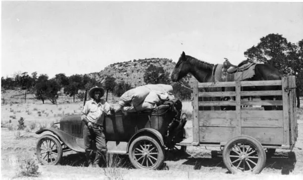
1928, the “universal outfit” for Rangers, Gila National Forest, southwest New Mexico. Photo by F. L. Kirby, FS #225792. USDA Forest Service; public domain. Resized. Holder’s record.
Villages and ditches on the Mimbres
This page follows Grant County’s land rather than its mines: who farmed it, who grazed it, who brought water to its town, who set it aside, who fought its fires and who came to see it. Each part is told through the records, histories and recollections that describe it. Where those sources disagree, they are set side by side and left for the reader to weigh.
This page’s account of farming starts on the upper Mimbres. According to the 1988 National Register nomination for the San Lorenzo Historic District, nineteen miners from Pinos Altos and their families founded San Lorenzo in 1869. They were led by N. Y. Ancheta, who came from Sonora, and most of the other settlers came from Chihuahua. In their first year they dug an irrigation ditch. The nomination calls San Lorenzo the first permanent settlement of the upper Mimbres valley in historic times. Census figures it gives for the San Lorenzo area show 49 people in 1870, 34 of them born in Mexico; 284 in 1880; and a peak of 476 in 1940. When the nomination was written in 1988, about 200 people lived there. (Sources: San Lorenzo Historic District, Section 8, p. 1.)
One of San Lorenzo’s founders came from much farther away. According to the National Register nomination for his house, George O. Perrault, a French Canadian, was the one non-Hispanic among the nineteen Pinos Altos miners who founded San Lorenzo in 1869. That year he surveyed the fields being allotted to the settlers, and in 1870 he set up a homestead five miles down the river. His compound had a galera, a large room, that served as the center for dances and other social events for that part of the valley. Oral tradition holds, the nomination says, that Elizabeth McGregor taught school in it before the first school buildings went up in the 1890s. The nomination’s author also believed that the house, built in the 1870s and 1880s, and two or three others in the valley were the first reported examples in the Southwest of a house type called the I-house, here fused with a Hispanic courtyard plan. (Sources: George O. Perrault Compound, Item 8.)
San Lorenzo fed the mining country around it. The nomination describes it as the largest community in the Mimbres valley from 1869 to 1937, supplying food to Pinos Altos, Silver City, Georgetown, Santa Rita and Fort Bayard. Its church dates to 1899. In 1893 Gorgonio Galaz, originally from Socorro, Texas, who had come by way of Mesilla, moved from Georgetown to San Lorenzo and built a bar, a store and a post office. A later building, the Manuel Galaz dance hall of about 1920, was used for social gatherings and also for rebote, a handball game. The village’s stone school was built by the WPA in 1936, replacing a schoolhouse from the 1890s. (Sources: San Lorenzo Historic District, Section 8, p. 1, Section 7.)
A second village, San Juan, grew up in the 1870s around two homesteads, according to its own 1988 nomination. One belonged to Carlos Norero, an Italian who had been among the first settlers of Pinos Altos and who set up his homestead in 1872. The other belonged to the brothers Luz and Rosalio Leiva, who came from Chihuahua. In 1873 another homesteader, Cosme Guadiana, began an acequia, a community irrigation ditch, that became the Llano or San Juan Ditch. Norero enlarged it in 1874, and in 1880 Norero and Celso Gonzales built the San Juan East Ditch. (Sources: San Juan Historic District, Section 8, p. 30.)
Schools and churches followed the ditches. San Juan’s school was begun in 1895 on land reportedly donated by Luz Leiva and enlarged in 1917, and its church was built in 1901. The 1988 nomination for the Mimbres School, built in the 1890s, says that school and the San Juan school were the first two schools built in the valley. The teachers later got a home of their own. In 1923, according to the nomination for the San Juan Teacherage, homesteader John Entzminger built a teacherage, a house for the San Juan school’s teachers, with state funds, on land donated by Alfred Perrault, son of George Perrault. (Sources: San Juan Historic District, Section 7; Mimbres School, Section 8; Mimbres School, NRHP nomination 88000491, Item 8; San Juan Teacherage, NRHP nomination 88000508, Item 8.)
Silver also made a village. The nomination for the George Sibole Store at Mimbres says the upper reaches of the valley began to be homesteaded in 1870, and that shortly afterward silver was discovered at Georgetown, three miles to the east. By 1875, it says, a mill for processing the Georgetown silver had been set up in the valley, and the community of Mimbres grew up around it. The village prospered through the 1880s. It declined somewhat after the mill closed in 1893, but it remained a small farming village and a center for stores and trade. (Sources: George Sibole Store, NRHP nomination 88000482, Item 8.)
The village’s buildings keep that later life. In 1922, according to the nomination for the Hooks-Moore Store, J. J. Hooks bought a frame building that Raul Sepulveda had built across the road, moved it and added a front section. The false-fronted part served as the Mimbres post office, and the part beside it as the store, run by Hooks and later by Walter Moore. (Sources: Hooks-Moore Store, NRHP nomination 88000490, Item 8.)
The territorial Bureau of Immigration described the valley’s water system in its 1894 report. Mimbres farmers, it said, took water out of the river on a community system of small ditches, and the water was distributed pro rata, in shares, to each cluster of farms. By the report’s account the upper Mimbres supplied water to over 100 farms of about 10 to 200 acres, and these grew most of the vegetables eaten in Silver City and the mining camps. It counted about 5,000 acres under cultivation and noted that apples sold for 5 cents a pound in the camps. The report also described bigger plans: two large companies meant to capture the Mimbres underflow, the water moving beneath the riverbed, and one proposed a bedrock dam across the Mimbres canyon to irrigate about 20,000 acres. (Sources: New Mexico: Its Resources, pp. 225-227, section, p. 226, pp. 226-227.)
Later writers kept returning to the importance of these farms. The WPA Writers’ Program guide to New Mexico, in its revised edition of 1962, credited irrigation and farming in the Mimbres and Gila valleys with giving Silver City new life after its mining decline. In 1988 the San Juan nomination called the Mimbres valley the leading agricultural area of Grant County. It described San Juan as one of the valley’s two typical, well-preserved Hispanic farming villages. (Sources: New Mexico: A Guide to the Colorful State, p. 418; San Juan Historic District, Section 8, p. 30.)
Down the Mimbres valley
Farther down the river, a set of National Register nominations prepared by Chris Wilson for the state Historic Preservation Division follows the homesteads one by one. Simeon Eby received the patent, the title to his homestead, near Dwyer in 1888. Trinidad Andazola homesteaded 40 acres on the east side of the Mimbres, but in 1893 he built his house on the west side so as to be part of the community of Dwyer, now known as Faywood. In 1882 Maria Jesus Trujillo and Juan Evangelista Trujillo homesteaded a site where an older adobe house already stood. Family tradition dates that house to 1836, but the nomination thinks the 1870s more likely. The house keeps its 20-inch adobe walls, its original flat roof under a later pitched roof, and the arches of an open zaguan, or passageway, which the nomination counts among the few historic examples of that detail identified in New Mexico. (Sources: Tom Eby Storage Building, Item 8; Trinidad Andazola House, Item 8; Maria J. and Juan Trujillo House, Item 8.)
These adobe houses changed with their owners. When Ed Baca bought the Soliz house from Alvino Soliz in 1935, he tore down one room and rebuilt it with the same adobe into an L-shaped plan, with a porch in the L. The nomination sees in this how easily the local, vernacular type of house was remodeled. Not every homesteader stayed on the land: Dr. Granville Wood, born in Massachusetts, came to Silver City as a physician in 1880. By 1883, his house’s nomination says, he had a homestead on the Mimbres and had been elected to the Grant County Commission. After patenting his claim in 1887, he traded the property to a health-seeker for land in Texas. (Sources: Soliz-Baca House, NRHP nomination 88000518, Item 8; Dr. Granville Wood House, Item 8.)
One homestead became the center of a large ranch. According to the NAN Ranch nomination, John Brockman, a customs agent at Mowry City ten miles to the south, patented his homestead claim on the Mimbres in 1881. When the archaeologist Adolph Bandelier visited the valley in 1883, he described Brockman’s house as a plazita, a little plaza, and the nomination says three sides of the compound were built before then. It dates the house to about 1880. Like the Perrault compound six miles to the north, the nomination says, the Brockman house mixes the eastern Anglo-American I-house with the Spanish-Mexican courtyard tradition. (Sources: NAN Ranch, National Register nomination, p. 56, p. 57.)
The great flood of 1902 runs through these records. A report on the flood, as the NAN nomination describes it, named the “old Brockman ranch” among the three principal places on the Mimbres. The nomination for William Redding’s house says the farmer and rancher first paid taxes on his property in 1893, and that his ranch is named in reports of the flood. George Perrault, his nomination says, had been a leader in building several irrigation ditches and had served on the Grant County Commission and as school commissioner. His orchard had been the largest in the valley, but the flood ruined 2,000 to 2,500 of his trees. (Sources: NAN Ranch, National Register nomination, p. 56; William Redding House, NRHP nomination 88000483, Item 8; George O. Perrault Compound, Item 8.)
By the time of the flood, the Brockman place had a new owner. In 1901, the nomination says, Brockman sold it to the NAN Ranch and Cattle Company, whose range had grown up Gallinas Canyon in the 1880s and 1890s, and the company moved its headquarters into the Brockman house. El Paso cattleman John T. McElroy bought the NAN in 1927. In 1928, working with the architects Trost and Trost, he began remaking the headquarters, and the centerpiece was to be a new house costing $100,000 out of an anticipated $300,000 in improvements. The nomination reads the 1928 buildings as a map of rank: a bunkhouse for cowboys, a caretaker house for the foreman and married hands, and servants’ quarters designated for Black servants, reflecting the ranch’s social hierarchy. When the NAN changed hands in 1945 it totaled 100,000 acres, and the Silver City Enterprise called its headquarters “one of the show places of Southwest New Mexico.” (Sources: NAN Ranch, National Register nomination, p. 56, pp. 56-57, p. 58, p. 57.)
Cattle, water and the L.C. Ranch
The L.C. Ranch on the Gila was founded by two mining men. According to the 1978 National Register nomination for the L.C. Ranch Headquarters at Gila, Tom Lyons and Angus Campbell sold their Cosette mine and their Silver City foundry interests in 1880 and went into the cattle business. They bought the Nogales, or White House, Ranch ten miles north of Gila and began monopolizing water rights, the legal claims to use streams and springs. In 1885, the nomination says, Lyons organized the Lyons and Campbell Ranch and Cattle Company with $1,500,000 in capital. The company was incorporated in New Jersey and kept its head office in New York City. (Sources: L.C. Ranch Headquarters, Gila, Section 8, p. 1.)
The nomination describes a fast and sweeping growth. Within ten years, it says, the L.C. claimed all the range from the mouth of Duck Creek to above Mule Springs on both sides of the Gila, with every waterhole and meadow within a day’s ride. At its height in the 1890s it controlled a million-acre range carrying 60,000 head, and the nomination says it overshadowed all other ranching in southwest New Mexico. The outfit kept 750 riding horses and up to 75 cowboys in season. Its farming operation employed 100 Mexican families, most of them brought from Chihuahua. (Sources: L.C. Ranch Headquarters, Gila, Section 8, p. 1.)
At its greatest extent, by the nomination’s account, the L.C. range stretched from Silver City to the Arizona line and from Mule Creek to the lower Animas Valley. In 1890 the headquarters moved ten miles south to Gila. There Lyons used an older adobe building, said to have come from a Spanish estancia, or ranch estate. Soon after 1890 he added a fifteen-room wing that gave the house its E shape, with a portal, or covered porch, 187 feet long, and tradition held that the adobe bricks for the addition came from the dismantled Fort West. Around the house stood a saddle house, a barn, a ten-room bunkhouse, a company store and a post office. Lyons’ general store at Gila employed six clerks. (Sources: L.C. Ranch Headquarters, Gila, Section 8, p. 1, Section 7, p. 1.)
The partners also went to court. On August 27, 1885, according to the transcript of record later filed with the U.S. Supreme Court, Thomas Lyons and Angus Campbell, doing business as Lyons & Campbell, joined other Silver City and Deming taxpayers in suing Grant County’s sheriff, assessor and commissioners. Their complaint was over taxes levied for territorial penitentiary and capitol bonds. The record shows they asked the court to stop the sheriff, who was also the tax collector, from collecting the 1885 penitentiary-bond and capitol-building-bond taxes. The case went all the way to the U.S. Supreme Court, where the appeal was filed on October 17, 1890. (Sources: Transcript of Record, pp. 1-2, pp. 1-10.)
The record has more to say about the people involved. The county’s 1885 assessment roll, as given in that record, valued Lyons & Campbell’s assessable property at $158,310, far above the other complainants. One detail in the bill of complaint is curious. It names an Angus Campbell both as a partner in Lyons & Campbell, among those suing, and as one of the three county commissioners being sued, with John Classen and Granville N. Wood; the record does not comment on the overlap. (Sources: Transcript of Record, p. 2, pp. 1-2.)
The WPA guide links one revival of the cattle industry to new mining finds. The WPA guide says that about 1908, when gold was found in the Mogollon Mountains and iron at Fierro, new capital came to Silver City and the cattle industry revived. The L.C. did not last. Its nomination says the ranch began losing money even before Lyons died in El Paso in 1917. After his death the ranch was gradually sold off until only the five-acre headquarters remained. (Sources: New Mexico: A Guide to the Colorful State, p. 418; L.C. Ranch Headquarters, Gila, p. 2.)
Homesteads on the Gila forks
Farther up the Gila, on the river’s forks, settlement came through the homestead laws. Peter Russell’s 1992 administrative history of Gila Cliff Dwellings National Monument, written for the National Park Service, tells this part of the story. James B. Huffman, who settled near the mouth of the Middle Fork, was the first to prove up a homestead on the forks, meaning he met the conditions for title, and he received his patent in 1883. By 1883 the Hill brothers at Gila Hot Springs had built bathhouses and a sixteen-mile road from Sapillo Creek, and they had 25 acres under cultivation and a small herd of cattle; Spencer Hill patented the 160 acres in 1890. In 1884 a government survey laid out the lines of township T12S R14W to open the forks to homestead claims. The surveyors noted the cliff dwellings and a road leading from the settlers’ cultivated fields toward Cliff Dweller Canyon. (Sources: Gila Cliff Dwellings National Monument, Chapter I, p. 15.)
Russell writes that settlers on the upper Gila in 1885 were caught in what he calls the last Apache raids in New Mexico. In his account a band of nine warriors led by Josanie, who had ridden out of the Sierra Madre on a raid of 1,200 miles, killed people in the Mogollons late that year, and one homesteader abandoned his claim after an escape. This page has only Russell’s brief account of those events. The wars themselves, with Apache perspectives, are the subject of the dossier’s page on forts and the Apache wars. (Sources: Gila Cliff Dwellings National Monument, Chapter I, p. 15.)
Cattle followed the homesteaders onto the forks, and Russell is blunt about the result. He writes that the cattle brought to the Gila headwaters between 1885 and 1895 severely damaged the range and the riparian ecology, the life along the streams. By 1927, he adds, there was reportedly scarcely a vestige of grass for miles. Larger outfits gathered up the small claims. In the 1890s C. A. Burdick of the O-Bar-O bought out small homesteads on the forks, which Russell calls marginal, and consolidated them under the TJ brand; the TJ was later sold to John Converse of Philadelphia, reportedly for $80,000. Another Philadelphian, Hugh Hodge, a Princeton graduate, built the Diamond Bar Ranch on the East Fork by buying patented land from homesteaders who were deep in debt. (Sources: Gila Cliff Dwellings National Monument, Chapter I, p. 17.)
Thomas Lyons of the L.C. came to the forks as well. In 1899, Russell writes, Lyons bought a 160-acre homestead on the East Fork and built a $50,000 hunting lodge for 30 or 40 guests, known as Lyons Lodge. The L.C. nomination adds that Theodore Roosevelt accepted an invitation to the lodge but had to cancel at the last moment, for reasons of state. (Sources: Gila Cliff Dwellings National Monument, Chapter I, p. 17; L.C. Ranch Headquarters, Gila, p. 2.)
Henry Woodrow, who later joined the Forest Service, wrote a history of the McKenna Park District that the Forest Service reprinted in The Early Days, and much of what follows is his recollection. Woodrow recalled that his family came from Texas to Silver City on October 1, 1890, and settled near Pinos Altos. In October 1898, he wrote, they moved to the Gila River, took up a small tract and started farming and ranching. Before joining the Forest Service he went out in summer as a guide and packer for Silver City fishing parties on the West Fork of the Gila. He remembered a trapper who came to the upper Gila in the early 1890s and spent nearly 50 years there hunting bear and lion for cattle outfits and sheepmen. Woodrow also noted that the Heart Bar Ranch, where the West and Middle Forks meet, was first called the TJ Ranch, and that Gila Hot Springs and the XSX Ranch had each changed hands four times. (Sources: The Early Days, Book 1, Personal Stories, sec. 6.)
Drought, hay and the railroad
In 1894 the Bureau of Immigration published an official account of New Mexico’s resources, and its Grant County section is full of figures. They are the report’s own estimates and are given here as such. The report put the county at 9,234 square miles, with about 3,500,000 acres available for pasture and possibly 100,000 acres that could be irrigated from water in sight. It named the Animas, the Playas valley, the Florida plains, the Gila plains, the Sapello, the Upper Mimbres, Mule, Mogollon and Duck Creek as the principal range valleys. At what it called a conservative estimate, the report counted 200,000 head of cattle in the county, despite the disastrous droughts of the preceding years. It went further. While other stockmen complained that out of herds of tens of thousands only a few hundred could be found, the report claimed, Grant County “still marshals mighty hosts at the annual round-ups.” (Sources: New Mexico: Its Resources, pp. 225-227.)
The same report admitted that the dry years had been hard on farming. It said a long series of dry years had made crops in the Gila valley precarious for three years. During that dry period, it added, irrigation on the Gila by small farm ditches had increased a great deal. It also described a turn in the hay trade. For the four years before 1893, the report said, the county had imported hay, but in 1893 thousands of tons of wild grama hay were cut on the public domain, the unclaimed government land, and exported at about $19 a ton. (Sources: New Mexico: Its Resources, pp. 225-226, pp. 227-228.)
Rails tied this country to the outside world. The 1894 report noted that Silver City lay at the end of a branch line of the Santa Fe railroad and outfitted dozens of surrounding camps. Details of the lines to the mines come from David F. Myrick’s New Mexico’s Railroads (revised edition, 1990), as excerpted on UtahRails.net, a railroad history website compiled by Don Strack. According to that excerpt, in 1891 an independent group opened the 14-mile Silver City and Northern Rail Road from Whitewater through Hurley to San Jose, a station just east of present-day Hanover Junction. The Santa Fe took the short line over six years later, and in 1898 it extended the branch four miles to Santa Rita under the name of The Santa Rita Railroad Company. (Sources: New Mexico: Its Resources, section, p. 228; Kennecott Chino Mines Division.)
Myrick’s account, as given on the same site, also describes the engines that worked the Chino mine at Santa Rita. Chino’s early motive power in the pit, it says, was 21 H. K. Porter 0-4-0T locomotives, seven of them weighing 50 tons and fourteen weighing 45 1/2 tons. Loaded ore cars were delivered to the Santa Fe interchange at Santa Rita for the nine-mile haul to the concentrator at Hurley. (Sources: Kennecott Chino Mines Division.)
Water for Silver City
Silver City itself needed water. Before it had a water works, according to the National Register nomination for the Silver City Water Works Building, prepared about 1983, the town drew its water mainly from cisterns and hand-dug wells, and a few enterprising people sold mountain stream water to residents. On May 20, 1886, the town council granted George H. Utter a franchise to build a water works, with a contract to run for 50 years. The works had a 60-foot well, a 500-foot tunnel and a reservoir 230 feet above the town. They were accepted in late May 1887. (Sources: Silver City Water Works Building, Section 8, p. 1, Section 8.)
The system soon fell short. The nomination says water shortages were evident within a year, and in June 1890 the council voted to cancel the contract because the company had not provided fire protection. The Silver City Enterprise, it adds, reported that unfiltered flood water had been diverted into the city well. The works stayed in the Foster family until March 6, 1900, when a corporation called the Silver Valley Water Works bought it. That company was placed in receivership, under a court-appointed manager, in 1924, and on July 21, 1925, the water works was sold to the Town of Silver City. (Sources: Silver City Water Works Building, Section 8, Section 8, p. 4.)
Setting aside the high country
At the end of the 1890s the federal government began to set the high country aside. In March 1899, Russell writes, President William McKinley withdrew the Gila River Forest Reserve from settlement; he calls it the sixth such reservation of forested public land in the Southwest and the second in New Mexico. Russell cites the Silver City Enterprise, which reported in July 1900 that M. Belden had arrived in Silver City to manage the new reserve. The U.S. Geological Survey inventoried the reserve in 1903 and published the results in 1905 as Forest Conditions in the Gila River Forest Reserve. In that survey, as quoted in the Forest Service history Timeless Heritage, Rixon reported that logging had been carried on “in a desultory manner” in different parts of the reserve, and that only two small sawmills remained. (Sources: Gila Cliff Dwellings National Monument, Chapter I, p. 18; Timeless Heritage, Chapter 10.)
Rixon, who examined the reserve for the USGS in 1903, measured it at about 3,640 square miles. Of that, he counted 2,593 square miles of merchantable timber, timber fit for sale, along with 90 square miles that had been logged, 2 that had burned and 955 that were naturally without timber. He estimated the standing timber at nearly 5.9 billion board feet. Fire had touched very little of the reserve, he reported. He found only about 550 acres burned on the Mogollon Mountains and no more than 1,090 acres on Eagle Peak. (Sources: Forest Conditions in the Gila River Forest…, p. 21, p. 18.)
Grazing worried him more. Rixon called it the most important industry of the reserve, and he warned that overstocking destroyed the roots of the grass. Where that happened, he wrote, springs that had once flowed continuously were practically dry, and flood water that had once seeped away slowly now rushed off. The country draining to the East Fork of the Gila and the west slope of the Black Range still had fine grass in 1903, but in his judgment the rest of the reserve was carrying too many cattle. His starkest example was sheep country. In one township, T. 9 S., R. 15 W., which had been given over entirely to sheep, about half the land had become barren desert, with blowing sand where, his informants said, rich grass had grown before the sheep came. (Sources: Forest Conditions in the Gila River Forest…, p. 14, p. 15.)
Farming in the reserve, Rixon found, was carried on only to a limited extent, along main streams that rarely ran dry. Because the nearest market was at least 90 miles away, he wrote, putting new land under irrigation would not pay. Farmers along the San Francisco and Gila rivers grew mainly alfalfa and corn. They had sold their produce to the mining camps at Cooney and Mogollon, but that market had narrowed after several camps closed. On the reserve’s western side, Rixon reported Mormon settlers along the San Francisco River near Pleasanton and Alma and at Luna, and mostly Hispanic farmers at Lower Plaza and Frisco, who owned and ran some very fine farms. (Sources: Forest Conditions in the Gila River Forest…, p. 14, pp. 13-14.)
Rixon also noted scattered Hispanic adobe farms along the East Fork of the Gila and at the mouths of its tributaries. His comments on these families were dismissive; he wrote that their “source of existence is a very puzzling question.” He also described Gila Hot Springs, above the junction of the forks, as a summer resort much visited by people suffering from disease. Because of those visitors, he wrote, a small Hispanic settlement with farms had grown up a short distance above the springs. (Sources: Forest Conditions in the Gila River Forest…, p. 14.)
Rangers and the national forest
Fire and reorganization followed. Timeless Heritage cites the Albuquerque Morning Journal of July 5, 1907, which reported that a large area of timber on the Gila National Forest had burned and that rangers were still fighting the fire. In March 1908 a Forest Service redistricting memo listed W. H. Goddard at Silver City as the officer in charge of a proposed combined Gila forest, giving it 1,885,640 acres. A Forest Service news release on the July 1908 executive orders gives a different figure. It says the Gila (S) and Big Burros national forests were made one forest, the Gila National Forest, with 1,762,621 acres and headquarters at Silver City, while the old Gila (N) became the Datil National Forest. Both documents are reprinted in The Early Days, and the two acreages are given here as each states them. (Sources: Timeless Heritage, Chapter 12; The Early Days, sec. 3.)
Henry Woodrow, by his own account, began Forest Service work as a forest guard on May 16, 1909, on what became the McKenna Park District. The work was remote. Russell writes that the McKinney Park district ranger spent winters in his house at Gila, the nearest settlement, 25 miles by trail from the district’s summer cabin. Woodrow’s account of his district work includes counting in the sheep and posting the sheep boundary that divided cattle range from sheep range. His history shows that sheep as well as cattle grazed the upper Gila. (Sources: The Early Days, Book 1, Personal Stories, sec. 6; Gila Cliff Dwellings National Monument, Chapter I, p. 22.)
Timber use changed with the mines. Timeless Heritage reports that cutting had declined considerably on the Gila National Forest because the mines were “turning to oil for fuel.” Earlier demand had left its mark. A photograph of Mogollon taken by W. R. Mattoon on September 1, 1905, reproduced with Woodrow’s history in The Early Days, is captioned as showing the slopes above the town deforested for mining and construction timber and later for firewood. (Sources: Timeless Heritage, Chapter 12; The Early Days, Book 1, Personal Stories, sec. 6.)
Fort Bayard had its own timber story, as retired ranger Samuel Servis told it in an oral history printed in The Early Days. Servis recalled that the Army cut the timber around Fort Bayard for fuel. He remembered wagon-wheel ruts, and even the marks of the hubs, worn deep into soft rock where wood was hauled off the reservation to heat the post. In his telling, an Army officer who was a little bit of a forester persuaded the Department of Agriculture to set up a nursery and replant the reservation with junipers from all over the world. Servis also said that Central City, also known as Central or Santa Clara, began just outside the military reservation to sell whiskey and other goods to the soldiers, because liquor could not be taken onto the reservation. He passed along a local tale, too: a wagonload of whiskey bound for Central bogged down in Arenas Valley and had to be unloaded, and ever since, the story goes, the place has been called Whiskey Creek. (Sources: The Early Days.)
Rangers were learning their trade together. Timeless Heritage says that in October 1912 all officers and rangers of the Apache, Datil and Gila National Forests met, in one of the region’s earliest scheduled ranger programs. Woodrow’s memoir carries the work into the 1920s. He recalled that 1922 was a bad fire year, with four large Class C fires in his district, and that for each one men had to be brought in from Cliff, Buckhorn and Pinos Altos in addition to the guards and trail crew. He wrote that the New Mexico Game and Fish Department started a small fish hatchery on the West Fork of the Gila at the mouth of White Creek in 1923. In 1925, he recalled, he built a telephone line from the Little Creek fire cabin to the Heart Bar Ranch, which gave the upper Gila an outlet to Silver City by way of Gila Hot Springs. (Sources: Timeless Heritage, Chapter 16; The Early Days, Book 1, Personal Stories, sec. 6.)
The cliff dwellings and the dwarf story
The forest also held the cliff dwellings. On November 16, 1907, Russell writes, President Theodore Roosevelt’s proclamation set aside a quarter section of land containing the “Gila Hot Springs Cliff-Houses” as Gila Cliff-Dwellings National Monument. A local tradition later held that Hugh Hodge of the Diamond Bar was Roosevelt’s cousin and had brought the cliff dwellings to the president’s attention. Russell says that tradition is not supported by official correspondence of the time. (Sources: Gila Cliff Dwellings National Monument, Chapter I, p. 22.)
For years the monument got little care. In 1916 Hugh Calkins, supervisor of the Gila forest, wrote that it received “very little attention from the forest service other than keeping it posted with cloth signs.” Russell describes one practical step. Ranger Henry Woodrow persuaded cowboys from the Heart Bar Ranch, formerly the TJ, on whose grazing allotment the cliff dwellings lay, to help fence the site against cattle. (Sources: Gila Cliff Dwellings National Monument, Chapter I, p. 22, Chapter I, p. 23.)
The Forest Service also passed along a myth. Russell notes that the 1915 Gila National Forest map printed, under a picture of the cliff dwellings, a paragraph telling travelers that the ruins had been home to a prehistoric race of dwarfs. The idea had been spread by a 1913 article in Sunset, and the Smithsonian had refuted it in 1914, a year before the map appeared. The dwarf story was never history; the people who did build the dwellings are the subject of the Atlas’s page on the ancient peoples. Management of the site changed hands in 1933. On June 10 of that year President Franklin D. Roosevelt signed Executive Order 6166, which transferred national monuments, Gila Cliff Dwellings among them, to the National Park Service. (Sources: Gila Cliff Dwellings National Monument, Chapter I, p. 24, Chapter II, p. 29.)
Influenza in 1918
In the fall of 1918 the county faced a different kind of danger. Historian Stephen Fox, writing in Desert Exposure in 2021, says the influenza epidemic reached Grant County through the mining towns of Santa Rita and Tyrone and at Fort Bayard. On October 1, Fox writes, the New Mexico Normal School, the ancestor of Western New Mexico University, closed for the duration and sent its students home. On October 10, with still no cases in Silver City, Mayor Percy Wilson and the county physician, C. S. Guthrey, closed the public schools. They also banned gatherings at places of amusement such as bars, restaurants, theaters and dance halls. (Sources: The Spread of a Disease (part one).)
Fox tells how the county answered when influenza struck Mogollon. Annette Kinyon, chairman of the Grant County Red Cross, and her associates mobilized local women. Seven schoolteachers and nurses from the White Cross Hospital and the Cottage Sanatorium left at once for Mogollon. According to Fox, eleven more women went from Tyrone and six from Santa Rita, and Fort Bayard, Santa Rita and Hurley sent supplies. (Sources: The Spread of a Disease (part one).)
Leopold’s wilderness
The wilderness idea for the Gila is tied to one forester. Timeless Heritage says Aldo Leopold arrived in Albuquerque in July 1909, fresh from his master’s studies in forestry at Yale, to begin his Forest Service career in the Southwest. Russell describes him as a graduate of the Yale Forestry School who began working in the Southwestern District in 1909. By 1915, Russell writes, Leopold was assistant district forester in charge of grazing. (Sources: Timeless Heritage, Chapter 6; Gila Cliff Dwellings National Monument, Chapter I, p. 27.)
Timeless Heritage says Leopold raised the wilderness idea with Elliot Barker as early as 1913. In November 1921 he set it out in print, in the Journal of Forestry article “The Wilderness and Its Place in Forest Recreational Policy.” There he wrote that by wilderness he meant “a continuous stretch of country preserved in its natural state, open to lawful hunting and fishing, big enough to absorb a two weeks’ pack trip.” Such an area, he wrote, could easily be kept by selecting the headwaters of the Gila River on the Gila National Forest. According to Timeless Heritage, in 1922, largely recovered from a near-fatal illness, Leopold made an inspection trip to the Gila headwaters country. (Sources: Timeless Heritage, Chapter 6; The Wilderness and Its Place in Forest….)
The sources give different sizes for the area, and each is reported here as written. Leopold’s 1921 article described the Gila headwaters as “an area of nearly half a million acres, topographically isolated by mountain ranges and box canyons.” Russell writes that in 1922 Leopold surveyed the Gila National Forest with Supervisor Fred Winn and proposed a roadless area of about 750,000 acres. District Forester Frank Pooler signed the recreation plan on June 3, 1924, which Russell’s account calls the designation of the first official wilderness in the world. (Sources: The Wilderness and Its Place in Forest…; Gila Cliff Dwellings National Monument, Chapter I, p. 27.)
Later accounts add their own figures. Timeless Heritage speaks of the 750,000-acre Gila Wilderness of 1924 and credits it with giving birth to the National Wilderness Preservation System. The U.S. Department of Agriculture, marking the wilderness’s centennial in 2024, gave the founding date as June 3, 1924, and said the Forest Service first set aside 755,000 acres. After many changes, it said, the original area had been divided and expanded. It gave current sizes of 559,688 acres for the Gila Wilderness and 202,016 acres for the Aldo Leopold Wilderness. (Sources: Timeless Heritage, Chapter 13; Vilsack marks centennial of Gila Wilderness.)
The plan did not pass easily. Timeless Heritage says that over the opposition of some of his fellow foresters, Leopold persuaded Frank Pooler, whom it calls regional forester, to approve it. In that history Pooler designated the Gila Wilderness from a report written by Leopold with the help of Frederic Winn and Ward Shepard. Russell sets out what the 1924 plan allowed. Grazing was still permitted, but logging was barred, mining was inhibited and the building of public recreation facilities was prohibited. (Sources: Timeless Heritage, Chapter 6; Timeless Heritage, Chapter 7; Gila Cliff Dwellings National Monument, Chapter I, p. 27.)
Within a few years roads cut into the new wilderness. Russell writes that after the deer increase of 1929, fearing a die-off like the one on the Kaibab, District Forester Pooler authorized rebuilding the North Star Road, an old military road. The recommendation came from a committee made up of the Forest Service, the U.S. Biological Survey, the state game department and the Silver City Game Protective Association, which also urged improving the Gila Hot Springs road as far as Gila Flats. The North Star Road was completed in 1931. Leopold and Winn urged that it be closed to public use except when necessary, but it stayed open year round and cut the Black Range off from the rest of the wilderness. For a time access stayed local in another way: a locked gate at Gila Flats kept outsiders off the private track to the Gila River, only residents of the forks had keys, and the lock stayed until shortly before the end of the Second World War. (Sources: Gila Cliff Dwellings National Monument, Chapter I, Chapter I, p. 28.)
The protected area shrank and shifted over the following decades. Russell writes that in 1933 the Gila Wilderness was reclassified, and reduced, as the Gila Primitive Area, a category set by the Forest Service’s Regulation L-20. A 1973 Forest Service proposal for the Gila Wilderness adds detail; it says the 1924 area was split on May 8, 1933, into the Gila and Black Range primitive areas along the North Star Mesa Road, later State Highway 61, with the lands east of the road becoming the Black Range Primitive Area. The 1971 proposal for the Aldo Leopold Wilderness gives another date, June 8, 1933, for the Chief of the Forest Service’s designation of the Black Range Primitive Area; both dates are given here as their documents state them. According to the 1973 proposal, the Gila Wilderness designation was revived west of the North Star road on April 4, 1938, forming an area of 566,474 net acres. In 1944, it says, 5,150 acres where the Gila River leaves the wilderness were declassified so that fluorspar deposits critically needed in the Second World War could be mined. (Sources: Gila Cliff Dwellings National Monument, Chapter II, p. 42; A Proposal, Gila Wilderness; A proposal, Aldo Leopold Wilderness, p. 3.)
The Park Service had its own plans for the same country. Russell writes that in 1938 the National Park Service proposed a Gila National Park, and by 1940 it had drafted a proclamation for a Gila National Monument of about 654,400 acres taken from the forest, which was never signed. In early 1953 the Forest Service announced new boundaries under Regulation U-1 that kept most land east of the Middle Fork as a primitive area, leaving the cliff dwellings on the edge of the wilderness with a newly bladed road nearby. Finally, according to the University of Montana’s Wilderness Connect profile, Congress confirmed the Gila Wilderness in the Wilderness Act of September 3, 1964 (Public Law 88-577) with 438,360 acres. (Sources: Gila Cliff Dwellings National Monument, Chapter II, Chapter II, p. 43; Gila Wilderness.)
The same records follow the animals. A 1971 Forest Service proposal for the Aldo Leopold Wilderness says mule deer overpopulated much of the Black Range during the 1920s, and that even after a special hunt in 1931 took 2,333 deer, die-off and habitat damage continued. The same proposal says the native Merriam’s elk had disappeared from the area before 1900, and that elk from northern sources were released at other places on the Gila National Forest in 1924 and 1950. The Gila trout waited a long time for scientific notice. According to the U.S. Fish and Wildlife Service, it was not formally described by scientists until 1950, from fish collected in Main Diamond Creek in 1939. On March 11, 1967, it was recognized as endangered under the Endangered Species Preservation Act of 1966. (Sources: A proposal, Aldo Leopold Wilderness; Reclassification of the Gila Trout, p. 40657.)
Lookouts, smokejumpers and fire
Forest Service people later described the Mimbres District in their own words, in oral histories gathered in The Early Days. Zane G. Smith recalled that he graduated from high school in 1926 and took his first Forest Service job that year as lookout at Diamond Peak, on the old Mimbres District of the Gila National Forest. Ranger Arthur “Crawford” Riggs said he arrived on the Mimbres on November 16, 1941, after one of the wettest years on record, and that he served there almost seven years. During the Second World War, Riggs recalled, help was hard to find, so the district used high-school boys as lookouts and standby fire crews. The oldest, he said, was seventeen and the youngest fourteen. (Sources: The Early Days; The Early Days, p. 116, p. 118.)
Riggs also had to deal with the range. He recalled that the GOS Cattle Company, which he called the biggest cow outfit on the Mimbres, had its range badly overstocked, and that the dispute ended in a compromise in which, as he believed, the company paid about $13,000. The Forest Service, in its 1971 Aldo Leopold proposal, wrote that the grazing history of the Black Range was like that of most of the Southwest: extreme abuse of the range in the early 1900s, followed by gradual improvement after the end of the Second World War. Grazing on Bureau of Land Management land had its own legal footing. The bureau noted in 1992 that grazing in its Mimbres Resource Area, which includes Grant County, was authorized under the Taylor Grazing Act of 1934, a 1976 law known as FLPMA and the Public Rangelands Improvement Act of 1978. (Sources: The Early Days, pp. 116-117; A proposal, Aldo Leopold Wilderness; Mimbres Resource Management Plan and….)
Fire fighting changed in these years. Riggs said 1946 was the first year smokejumpers, firefighters who parachute to fires, were used in the Southwestern Region. They were stationed at Deming, he said, and their first jump was on a lightning fire about two miles east of Reeds Peak, on his district. Then came the dry year of 1951. Riggs recalled that the McKnight fire started on the Mimbres District while other large fires were burning, and that for the first three days he fought the Little Creek fire with Doc Campbell and some schoolboys from Silver City before crews arrived. The Forest Service’s 1971 proposal says the McKnight fire burned about 26,000 acres within the area it proposed for the Aldo Leopold Wilderness. (Sources: The Early Days, pp. 117-118, p. 118; A proposal, Aldo Leopold Wilderness.)
The CCC and the road years
The 1930s brought a new workforce to the forest. In his survey of New Deal resources in New Mexico, historian David Kammer counts at least 102 Civilian Conservation Corps camps in the state during the program, more than New Mexico’s own population could fill with enrollees, so the camps drew men from other states. A Forest Service history of the CCC in the Southwest says the Gila National Forest had three camps in the program’s first period in 1933. Silver City became one of five CCC administrative districts for Arizona and New Mexico, alongside Phoenix, Tucson, Albuquerque and Fort Bliss. The same history records tensions between Mexican-American enrollees and one or two camp supervisors in the Southwestern Region, and early fights between local men and enrollees from Texas and Oklahoma. (Sources: The Historic & Architectural Resources of…, pp. 45-46; The Forest Service and the Civilian…, Chapter 5.)
The CCC’s work showed on the land. According to the Forest Service history of the CCC, Forest Service personnel traveling in the Gila National Forest in 1934 noted rapid improvement on overgrazed range after CCC range and water work. Kammer writes that New Mexico pressed the Soil Conservation Service to extend its Gila Basin area to the Silver City drainages, even though they lay east of the Continental Divide. Once it did, a CCC project lined Silver City’s Big Ditch with masonry. Timeless Heritage reports that a 1954 inspection found the forest’s recreation facilities were still those built by CCC labor and had not kept pace with rising use. The same inspection found that the only watershed rehabilitation plan in effect on the Gila National Forest was for the Silver City Watershed. (Sources: The Forest Service and the Civilian…, Chapter 5; The Historic & Architectural Resources of…, pp. 48-49; Timeless Heritage, Chapter 13; Timeless Heritage, Chapter 16.)
Visitors came in growing numbers. Forest Service figures in Timeless Heritage show recreation visits to the Gila National Forest rising from 29,700 in 1939 to 323,000 in 1964. Russell writes that visitors to the cliff dwellings rose from about 500 a year to about 1,500 between 1955 and 1962. A road became a local cause. In December 1957, at a public hearing in Albuquerque, Francis Parsons, who was coordinating road-lobby efforts for the Silver City-Grant County Chamber of Commerce, asked a group of U.S. senators to help make possible a “greater Gila Cliff Dwellings National Monument.” He wanted to promote tourism at a time when low metal prices were dragging down the local economy, and he cited the benefits a road would bring. A Bureau of Public Roads engineer observed that the pressure for the road came almost entirely from around Silver City; construction began in 1961 and reached the monument in early 1967. (Sources: Timeless Heritage, Chapter 13; Gila Cliff Dwellings National Monument, Chapter III, p. 56, Chapter III, p. 52, Chapter III, p. 54.)
Russell traces how the monument and its road took their present shape. A road corridor to the cliff dwellings through the primitive area was formally established on July 15, 1957. Proclamation No. 3467, signed April 17, 1962, enlarged the monument to 533 acres and gave the Park Service title to the original 160 acres. In 1966, the target year of the Park Service’s Mission 66 program, 24,000 people toured the cliff dwellings, nearly twice the Park Service forecast. The joint Forest Service and Park Service visitor center was completed that year but stayed closed until 1968, when a bridge across the Middle Fork was finished. Writing in 1992, Russell described a single road reaching the monument from the south through a corridor eliminated from the wilderness in 1953: State Highway 15, paved, running 19 miles through the wilderness, with another 18 miles to Silver City and about two hours for a one-way trip. (Sources: Gila Cliff Dwellings National Monument, Chapter III, p. 52, Chapter III, p. 49, Chapter III, p. 61, Chapter III, p. 59, Chapter I.)
Other public places in the county date from these years. According to the New Mexico Bureau of Geology and Mineral Resources, City of Rocks State Park, in the Mimbres Valley of Grant County, was established in May 1952. Its stone pinnacles are Kneeling Nun Tuff, which erupted from the Emory caldera, the collapsed crater of a volcano, 34.9 million years ago. The bureau says that eruption was more than a thousand times larger than the 1980 eruption of Mount St. Helens. On Sapillo Creek, the Lake Roberts dam, owned by the State Game Commission, was completed in 1963. Since then, the New Mexico Department of Game and Fish said in 2013, a small town has grown up along its tailwaters, the stream below the dam. (Sources: City of Rocks State Park (Virtual Geologic Tour); Lake Roberts dam improvement project to….)
The WPA guide to New Mexico, in its 1962 revision, offers a traveler’s snapshot of the forest country at mid-century. In the guide’s time the Gila Wilderness Area could be reached only by jeep or by a high-centered pickup over the Copperas Canyon Truck Trail, and private automobiles were not permitted inside. Gila, near Cliff, with about 500 people in its area, was a supply depot and starting point for pack trips into the Mogollons and the Gila Wilderness. Silver City was the center for pack trips and the headquarters of the Gila National Forest, the guide said, and its annual Fourth of July rodeo was known throughout the Southwest. The guide called Silver City a shipping point for the Chino mines and livestock ranches. In the Mogollon country, it noted, stock grazed under government permit and was preyed on by mountain lion, bobcat and coyote. (Sources: New Mexico: A Guide to the Colorful State, p. 416, p. 419, p. 418, p. 417.)
The guide also described the company towns and the rails. The Atchison, Topeka & Santa Fe Railway, it said, ran alongside US 260 from Deming to Silver City. It described Hurley as a company village owned by Kennecott’s Chino Mines Division, site of the concentration mill for the Santa Rita mine and connected to Santa Rita by railroad. Hurley had 468 company houses, a reduction and power plant and several stores; it was completely occupied until the Santa Rita mine closed in 1934, work resumed when the mine reopened, and the 1950 census showed 2,079 people. The rail era at the pit did not last. According to Myrick, as quoted on UtahRails.net, Chino converted its pit from rail to truck haulage, and the last ore move from the pit by train took place on September 5, 1963. (Sources: New Mexico: A Guide to the Colorful State, p. 415; Kennecott Chino Mines Division.)
Smaller places filled out the guide’s map. Central, it said, had grown from a small settlement to about 1,075 people because of its nearness to Fort Bayard and the veterans’ hospital there, and the guide gave that hospital a capacity of 215 beds. Faywood, or Faywood Springs, was described as a former health resort of hot mineral springs. Cliff had 283 people in its area, with farms in the valley to the northwest and cottonwood and walnut trees along the Gila. Buckhorn, at 4,700 feet with 84 people, was a trading center. (Sources: New Mexico: A Guide to the Colorful State, p. 415, p. 419.)
Taken together, these sources show the same ground seen through many eyes: National Register nominations, a court record, a government survey, booster reports, ranger memoirs, agency histories and guidebooks. Each saw the valleys, ranges and forest for its own purposes. Read side by side, they give the land a history of its own.
The checked facts for this part, with their quotes and locators, are on the Atlas page Ranches, farming valleys, the forest and the first wilderness.
People and communities
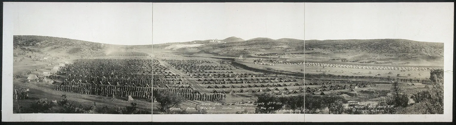
A May 1918 panoramic photograph shows reveille at the field camp of the 68th Infantry Brigade, 34th Division, at Tyrone in the Burro Mountains. Library of Congress; public domain. Resized. Holder’s record.
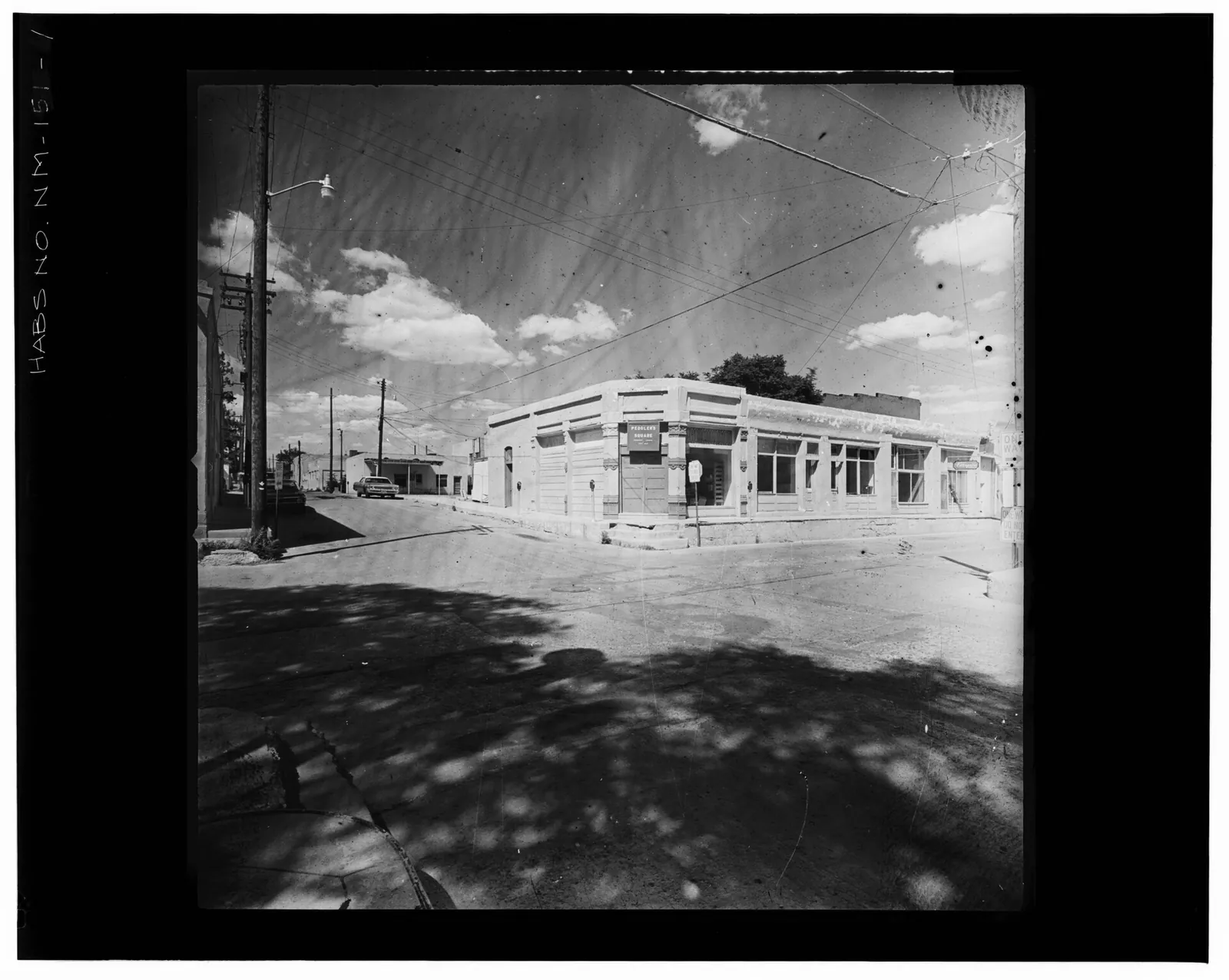
A Historic American Buildings Survey photograph shows a commercial building in what HABS labelled the ‘Chinese sector’ of Silver City. Library of Congress Prints and Photographs Division; public domain. Resized. Holder’s record.
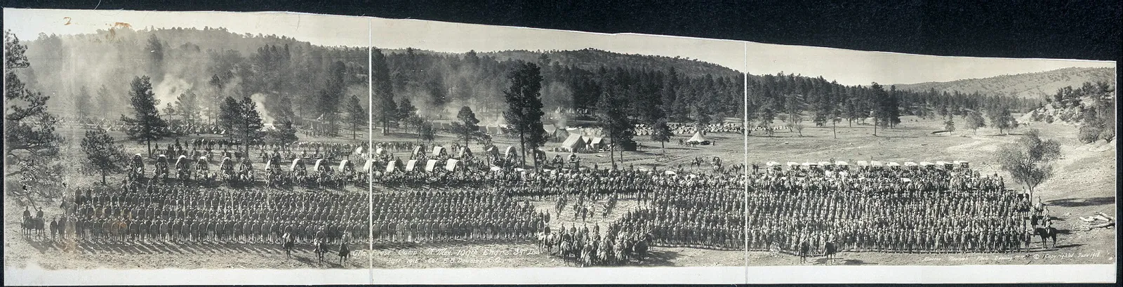
A June 1918 panorama shows the 109th Engineers of the 34th Division at a ‘Gila Forest Camp’, men at attention with covered wagons and tents behind. Library of Congress; public domain. Resized. Holder’s record.
A county of many communities
This page gathers the people of Grant County and the communities they made, told as far as possible through their own records: census tables, school directories, court opinions, a household survey and the memorials written for those who served. It looks at who lived here, how they taught their children, how they argued over their schools, and how they went to war and were remembered. Silver City and Pinos Altos have their own pages, where their people’s stories are told in more detail. Here the view is wider, across the whole county and across more than a century and a half.
Spanish and Mexican roots at Santa Rita
Geologists A. C. Spencer and Sidney Paige, writing in Geological Survey Bulletin 859, suggest that when Pike reported on his expedition of 1807, his account of a copper mine west of the Rio Grande producing 20,000 mule loads a year was really about Santa Rita, even though Pike put it in the wrong place. The same authors date Robert McKnight’s working of the mines to 1826-1834, after which the mines passed to one Siqueiros, who ran them until the late 1850s. They also describe the triangular Santa Rita fort, whose towers had walls more than 3 feet thick. Two of those towers were still standing in 1909, they write, and one had been roofed over and kept as a monument. (Sources: Geology of the Santa Rita Mining Area, p. 6.)
Traces of this older world turned up in the ground as well. A 1930 Bureau of Mines circular on the Fierro district reported that relics of Spanish operations had been found near ancient adobe furnaces and slag dumps. According to a 1931 Bureau of Mines history quoted in a 1958 circular, the Land Office commissioner denied M. D. Hayes’s application for a patent, a federal grant of title, to the Santa Rita claims on April 15, 1873, repeating a refusal of April 21, 1870. On November 6, 1873, the Secretary of the Interior reaffirmed that decision, ruling that the ground had been known for more than half a century as belonging to Elguea; in the meantime, in October 1873, Hayes and his associates had obtained title from the Elguea heirs. (Sources: Information Circular 6361, p. 2; Information Circular 7837, p. 6.)
Who the census counted, 1890 to 1910
By the early twentieth century the census showed many Grant County residents who had been born abroad or whose parents had been. The 1910 census reported that the county had the highest share of foreign-born white residents of any New Mexico county, 25.2 percent. It also had the highest share of native-born whites with at least one foreign-born parent, 27.6 percent. Of the county’s 3,731 foreign-born white residents in 1910, 3,227 had been born in Mexico. In the same year the geologist L. C. Graton noted that at Santa Rita, as in the early days, much of the mining was being done by Mexican lessees, miners who rented the right to work a piece of ground. (Sources: Thirteenth Census, p. 169, p. 176; The Ore Deposits of New Mexico, p. 306.)
The same census tables record smaller communities as well. Grant County had the largest Chinese population in New Mexico at three censuses in a row: 180 of the territory’s 361 Chinese residents in 1890, 173 of 341 in 1900, and 108 of 248 in 1910. The census counted 592 Black residents in the county in 1890, 186 in 1900 and 164 in 1910. It also counted 4 Japanese residents in 1910, up from 1 in 1900, and 3 Indians, compared with 1 in 1900 and 4 in 1890. The tables give numbers only; they do not say who these neighbors were, where they worked, or why their numbers changed. (Sources: Thirteenth Census, p. 174, p. 176.)
Teachers across a wide county
The state’s educational directories for 1913 to 1916 give a close look at the people who taught the county’s children. The 1913-14 directory announced that, at the request of the state Department of Education and by order of the county commissioners, Grant County’s school districts had been renumbered. The schools on the list were spread across a wide area, from Rodeo, Steins, Animas and Playas in the southwest to Cliff and Gila in the north. Two district schools even used the Arizona post offices of Duncan and Franklin. The Burro Mountains copper camps of Tyrone and Leopold each had a school that year, with two teachers at Leopold. (Sources: New Mexico Educational Directory, p. 59, p. 29, p. 30.)
The Grant County teacher lists grew longer in those years. The Grant County teacher lists ran to about 67 entries in 1913-14 and about 90 in 1915-16, and the Santa Rita district alone went from six teachers to about nine. Pay and the length of the school year varied a great deal from place to place. In 1913-14 the head of the Silver City schools earned $180 a month for ten months, raised to $200 by 1915-16. Many rural teachers, by contrast, earned $50 to $75 a month for terms of only five to eight months. (Sources: New Mexico Educational Directory, p. 29-30, p. 29.)
Women who led the schools
Women held some of the county’s most responsible school posts in these years. From at least 1913 to 1916 Grant County’s superintendent of schools was Isabel Lancaster Eckles of Silver City, whose salary was listed in 1915-16 as $2,000. She was not alone in the state: the 1913-14 list of county superintendents included at least four women, Mrs. Josie Lockard of Colfax County, Miss Isabel L. Eckles of Grant, Mrs. Wallace L. Gumm of Lincoln and Miss Grace G. Goebel of Luna. The 1913-14 directory also listed women as principals of the schools at Lordsburg, Pinos Altos and Santa Rita. (Sources: New Mexico Educational Directory, pp. 3-4, p. 5.)
School districts in court
How to organize the schools was sometimes settled by judges. In 1934 the New Mexico Supreme Court upheld an injunction, a court order, that stopped bonds for Grant County consolidated school district No. 18. The court ruled the district void because it stretched 37 miles long by 11 miles wide, beyond the legal limit for consolidated districts. The lower court’s judgment, which the Supreme Court affirmed, ordered the last elected directors of the four districts in the failed consolidation to go back to their duties. The Supreme Court also noted that a 1933 amendment to the law would now allow such a district to be created. (Sources: Thrall v. Grant County Board of Education.)
A later case involved the Silver City school district and New Mexico Western College. Under a 1937 law, according to the Supreme Court’s 1965 opinion, the Silver City school district sold $62,500 in bonds to help New Mexico Western College build a high school on its campus. The college ran the high school until June 1960, when the legislature stopped funding it. When the college then refused to hand over the building, the school district sued. In April 1965 the Supreme Court affirmed a writ, a court command, ordering the building, its furnishings and the land around it transferred to the district. (Sources: Silver City Consolidated School District No…..)
Service from the Union army to Bataan
Military service runs through the county’s public records from its early years. An 1869 memorial printed with the territory’s laws recommended a lawyer named Bail, noting that he had served in the Union army as a captain in an Illinois regiment. Decades later, the county’s people served in a very different war. According to the Defense POW/MIA Accounting Agency, Private First Class Richard G. Pitsor, 18, of Fort Bayard, was a member of G Company of the 200th Coast Artillery Regiment when Japanese forces invaded the Philippines in December 1941. (Sources: Laws passed by the Legislative Assembly of…, p. 29; Army Pfc. Pitsor.)
The agency’s account follows Pitsor through captivity. It says he was captured when Bataan surrendered and was among the prisoners subjected to the Bataan Death March. The agency says he was held at Cabanatuan, where he died on August 28, 1942. The agency reports that he was accounted for on March 20, 2023. (Sources: Army Pfc. Pitsor.)
Senator Jeff Bingaman’s tribute in the Congressional Record says that Thomas P. Foy, a Grant County native, earned a law degree at Notre Dame and joined the New Mexico National Guard in 1940. According to the tribute, Foy survived the Bataan Death March and imprisonment in Japan and was freed in 1945. After the war, Bingaman said, he practiced law, founded a bank and served 28 years in the New Mexico Legislature. The tribute says he died at his home in Bayard in October 2011, a few weeks short of his 97th birthday. (Sources: Remembering Thomas P. Foy.)
The state has kept this memory alive in its own words. Memorials of the New Mexico House of Representatives in 2015 and 2026 both honored the county’s veterans of the 200th Coast Artillery, many of whom were subjected to the Bataan Death March. The 2026 memorial named among them the late Representative Thomas Foy. (Sources: House Memorial 27, p. 2.)
Homes and households, 1956 to 2020
In 1956 a federal study turned to the county’s homemakers. It chose Grant County as New Mexico’s pilot county for surveying home extension work and interviewed 212 homemakers picked at random. The survey was led by the county’s home extension agent, Violet Shepherd. It found that about a quarter of the homes were adobe, mostly on farms and ranches, while rural families who did not farm, some living in rented or company houses, had the poorest housing. According to the study’s sample, over two-thirds of the homemakers were Anglo-American, over a quarter Spanish-American, and about 1 percent Indian. (Sources: Home Economics Extension Work in Grant County, p. 1, pp. 3-4, p. 5.)
Counts made in more recent times describe the county’s people in other terms. In 2020, according to Thomas Brinkhoff’s City Population compilation of Census Bureau counts, 13,466 Grant County residents, about 48 percent, were Hispanic or Latino. The 1956 survey and the 2020 count used different methods and different categories, so their figures are best read side by side rather than as a single trend. (Sources: Grant County.)
The checked facts for this part, with their quotes and locators, are on the Atlas page People and communities.
Grant County since 1970
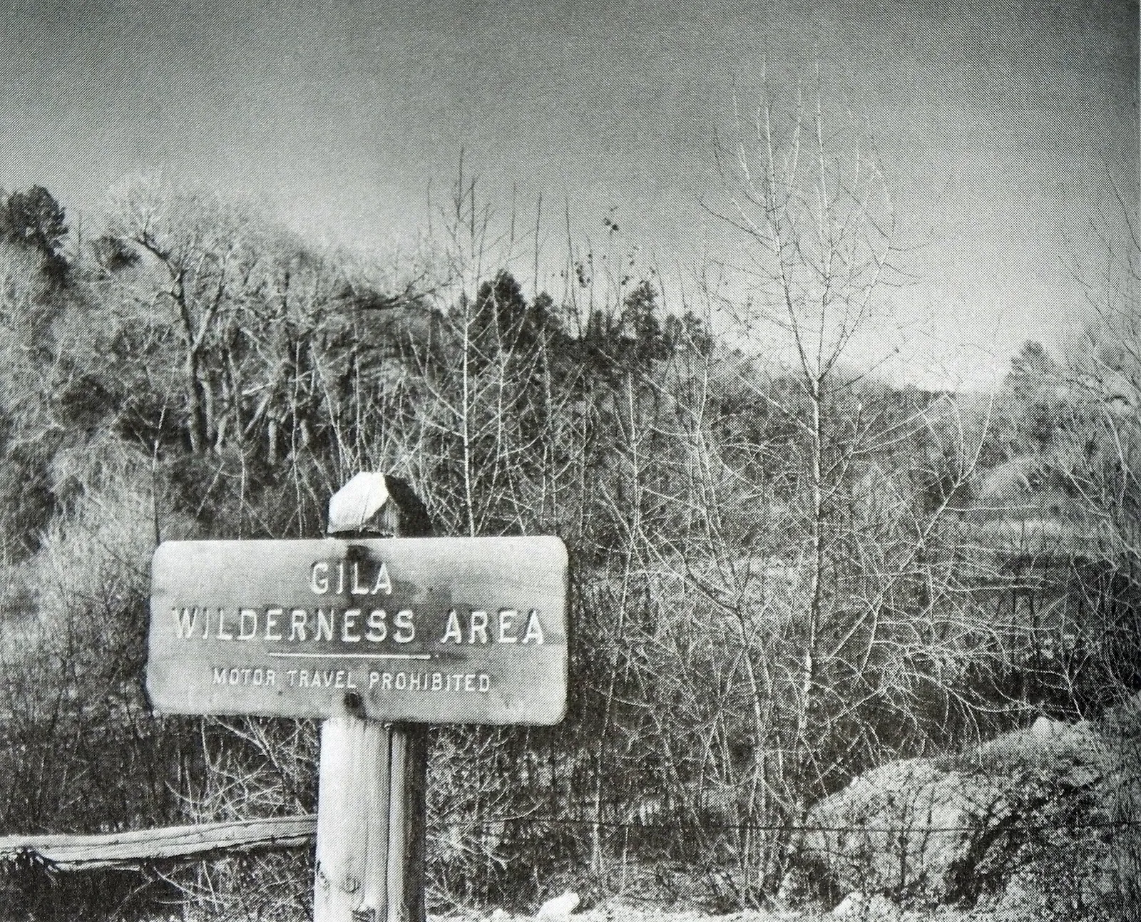
Photograph: sign at the border of the Gila Wilderness, 1960. U.S. Forest Service via Wikimedia Commons; public domain. Resized. Holder’s record.
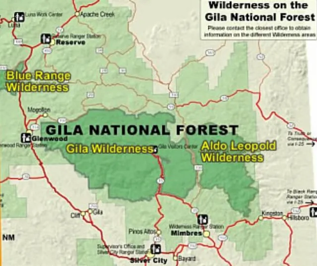
Map of the wilderness areas of the Gila National Forest: Gila, Aldo Leopold and Blue Range. Gila National Forest via Wikimedia Commons; public domain. Resized. Holder’s record.
People and government since 1970
The county’s older history is told on its own page. This page picks up the story in 1970 and follows Grant County through its people and government, its copper mines and their cleanup, its ranges and forest, its fires, its river, its wolves and trout, and the courtrooms where many of these questions were argued. The sources here are mostly public records, plans, court opinions and company reports, and each is named where it is used. Where a source speaks for one side of a dispute, the page says so.
The Census Bureau’s compiled county series shows the county growing in each decade from 1960 to 1990. It gives Grant County 18,700 people in 1960, 22,030 in 1970, 26,204 in 1980 and 27,676 in 1990. Growth continued through the 1990s, when the county grew 12.0 percent, to 31,002 people in 2000. The 2000 census made Grant the 14th largest county in New Mexico and counted 15,126 of its residents as Hispanic or Latino. The next decade reversed the trend: by 2010 the county had lost 4.8 percent of its people, falling to 29,514. (Sources: New Mexico: Population of Counties by…; New Mexico Counties; Census 2000, New Mexico, Table 5.)
In 2020 the census counted 28,185 people in Grant County, according to the official population handbook of the state’s Legislative Council Service. Nearly half of them, 13,472, lived outside the county’s four incorporated municipalities: Silver City, Bayard, Santa Clara and Hurley. Two of those municipalities had grown smaller. City Population, Thomas Brinkhoff’s compilation of census counts, shows Hurley shrinking from 1,547 people in 1990 to 1,256 in 2020, and Bayard from 2,612 to 2,116. Some unincorporated places grew instead. Arenas Valley, west of Silver City, rose from 996 people in 1990 to 1,522 in 2010 before falling to 1,291 in 2020, while Little Walnut Village rose from 918 in 2010 to 1,386 in 2020, which made it the county’s largest unincorporated census place that year. (Sources: State of New Mexico 2020 Official Census…, p. 1; Grant County.)
The same compilation follows the county’s smaller communities, which the Census Bureau counts as census-designated places. Tyrone counted 497 people in 1990, 380 in 2000, 637 in 2010 and 712 in 2020. The mining village of Hanover counted 144 people in 2020, and Pinos Altos 225, up from 146 in 2000. In the Gila valley, Cliff had 284 people and Gila 285 in 2020, while Buckhorn had 172; in the Mimbres valley the census counted Mimbres at 390, San Lorenzo at 148 and Faywood at 33. Several places with historic names had very small counts that year: Hachita 52, Cobre 17, Trout Valley 7 and Redrock 3. (Sources: Grant County.)
The population also grew older. A 2019 demographic profile of the county from New Mexico State University found that the share of residents over 65 rose from 10.5 percent in 1980 to 24.7 percent in 2017. Over the same years the share under 18 fell from 33.8 percent to 21.0 percent. City Population’s figures for 2020 carry the story forward: 8,114 residents were 65 or older, against 5,354 under 18, and 11,393 lived in rural areas. By those measures the county aged sharply. (Sources: Community Demographics: Grant County, New Mexico; Grant County.)
The way the county governs itself changed over these decades. In December 1991 the county commission, citing a 1985 state law for counties of more than 13,000 people and the county’s population at the 1990 census, divided Grant County into three single-member commission districts, each electing one commissioner, for elections from 1992. In late 2003 the county moved to enlarge its board from three to five members, under Article X, Section 7 of the New Mexico Constitution as amended, with a public hearing on December 9 and a vote on December 11. Today a five-member Board of County Commissioners governs the county. Each member is elected from a district for a four-year term, and the board appoints a county manager to run daily operations. (Sources: Resolution No. 91-12-05C; Resolution R-03-28 / Ordinance No. O-03-03; Board of County Commissioners.)
Courts helped draw the lines of local government too. On December 15, 1978, the New Mexico Municipal Boundary Commission denied the Town of Hurley’s request to annex land. Copies of the order reached the Grant County clerk and the town on December 21, but Hurley did not ask the district court to review it until February 1, 1979. In July 1980 the state Supreme Court upheld the dismissal of the town’s appeal because it was filed outside the 30-day limit. The court noted that the town had actual notice of the order about December 21. (Sources: Town of Hurley v. New Mexico Municipal….)
The county also has its own day in the state legislature. House Memorial 27 declared January 28, 2026 the fiftieth annual ‘Grant County Day’ in the New Mexico House of Representatives. The memorial noted that Silver City is the only New Mexico municipality still operating under a territorial charter, the one issued in 1878. An earlier memorial, for Grant County Day in 2015, called the county the home of the first designated Continental Divide Trail gateway community and of the Tour of the Gila, which it described as the state’s premier cycling stage race. (Sources: House Memorial 27, p. 1; House Memorial 22.)
Copper in the 1970s
The U.S. Bureau of Mines followed the county’s mines year by year in its Minerals Yearbook. In 1970, the Yearbook reported, Kennecott’s smelter at Hurley put in a modernized electrostatic precipitator to remove dust, and returned its old 500-foot smokestack to use beside the 626-foot stack, all as part of an air-pollution program. At the end of that year Phelps Dodge announced a $38 million expansion of its Tyrone open pit, a mine dug down from the surface rather than tunneled. The plan was to raise annual copper capacity from the 1970 level of 55,000 tons to about 90,000 tons by late 1972 or early 1973, adding about 200 employees. Phelps Dodge also said it had no plans for a smelter at Tyrone: its concentrate, the crushed and enriched ore, would keep going to smelters in Arizona. (Sources: Minerals Yearbook 1970, vol. 2, Area Reports.)
The 1972 Yearbook reported that New Mexico’s copper output that year was the highest in its history, with Grant County’s nine mines leading. The Tyrone expansion was finished in August 1972. That same month Phelps Dodge began building a flash smelter near Animas, in Hidalgo County, to treat about 475,000 tons of Tyrone concentrate a year, and about 60 percent of its cost was for pollution control. Kennecott, for its part, started a $21 million air-pollution control program at the Hurley smelter in 1972, including an acid plant able to handle 600 tons a day. (Sources: Minerals Yearbook 1972, vol. 2, Area Reports, pp. 483-485, p. 485.)
Paying for pollution control brought the Town of Hurley into court. In May 1972 the town agreed to issue industrial revenue bonds to acquire pollution-control facilities for Kennecott’s copper operation next to the town, which would then be leased to Kennecott. When the town balked over whether it had the authority, Kennecott sued. The district court found, as uncontested facts, that Kennecott operated a large copper mining and refining complex in Grant County, a principal portion of it adjacent to Hurley, and that the operation contributed substantially to the economic welfare of the citizens of Grant County and Hurley. In 1973 the state Supreme Court affirmed the judgment holding that the financing served a proper public purpose. (Sources: Kennecott Copper Corp. v. Town of Hurley.)
Shutdown and rebuilding in the 1980s
In 1982 the big mines stopped. According to the Minerals Yearbook for that year, Kennecott shut Chino’s concentrator, the mill that separates copper minerals from the ore, in March, closed the Hurley smelter in May and stopped stripping waste in the pit in June. The Yearbook called it Chino’s first closure for slack demand since the Depression. Phelps Dodge shut Tyrone in mid-April. At Fierro, Sharon Steel Corp., which ran an underground and open-pit mine there, had begun a series of cutbacks in mid-1981, reduced work to maintenance and stripping in early 1982, and ceased operations in May 1982. (Sources: Minerals Yearbook 1982, vol. 2, Area Reports.)
The same Yearbook reported that unemployment in Grant County peaked at 38 percent in late 1982, well above the 25 percent recorded during the Depression. Even in that year Kennecott was planning ahead. In September 1982 it announced a $100 million modernization of the Hurley smelter, replacing its old reverberatory furnace with an INCO oxygen flash furnace. (Sources: Minerals Yearbook 1982, vol. 2, Area Reports.)
Chino Mines was then a partnership of Kennecott, itself owned by Standard Oil of Ohio, and Mitsubishi Metal Corp. In late April 1984 it shipped copper concentrates to a Mitsubishi smelter in Japan. The 1984 Yearbook reported that a new concentrator, rated in 1983 at 37,500 tons of copper ore a day, had become fully operational in 1983. Hurley’s old reverberatory furnace was shut down for the last time on September 4, 1984, and the new INCO flash furnace was first charged with concentrate on October 15, capturing more than 90 percent of the sulfur dioxide gases. With the rebuilt smelter running in late 1984, the Yearbook said, Kennecott’s modernization program at Chino was complete. (Sources: Minerals Yearbook 1984, vol. 2, Area Reports, pp. 412-413, chapter, p. 413.)
Tyrone was changing too. Its new plant used solvent extraction and electrowinning, known as SX-EW, a way of recovering copper with chemicals and electricity instead of a smelter’s furnace. The 1984 Yearbook reported that electrowon copper production began at Tyrone in April 1984, 13 months after groundbreaking. The first shipment of high-purity cathodes, the finished copper plates, left the plant on April 17, and only 16 people were needed to run the plant around the clock. (Sources: Minerals Yearbook 1984, vol. 2, Area Reports, chapter, p. 413.)
Phelps Dodge takes Chino
In 1986 Chino changed hands. According to the New York Times of September 12, 1986, as quoted on UtahRails.net, Standard Oil, Kennecott’s parent, announced on September 11 that it had agreed to sell its two-thirds interest in Chino Mines to Phelps Dodge. The 1986 Minerals Yearbook reported the purchase in November for $88 million, with management passing on January 1, 1987. Under the deal Kennecott was indemnified, or shielded, against environmental and reclamation obligations from before and after the sale. Phelps Dodge expected Chino to make up for falling ore reserves at Tyrone, and the Hurley smelter to replace some of the capacity of its closing smelter at Douglas, Arizona. (Sources: Kennecott Chino Mines Division; Minerals Yearbook 1986, vol. 2, Area Reports.)
With Kennecott’s two-thirds of Chino in hand on January 1, 1987, the 1987 Yearbook said, Phelps Dodge became New Mexico’s principal copper producer; Mitsubishi held the other third. That year Phelps Dodge began a $55 million SX-EW plant at Chino and finished a $14 million upgrade of the Hurley flash smelter, rated at 25 million pounds of anode copper a month. At Tyrone, the SX-EW plant made about 35,700 metric tons of copper in 1987. Even so, Phelps Dodge expected concentrate production at Tyrone to end in the early 1990s. (Sources: Minerals Yearbook 1987, vol. 2, Area Reports.)
Mining also touched the county’s streams. The 1990 Yearbook recorded that unusually heavy rain in the summer of 1988 forced Chino Mines Co. to release stormwater runoff mixed with mine process water into Whitewater Creek. Phelps Dodge and the state Environmental Improvement Division then reached an agreement requiring Chino to improve its water storage, at an estimated cost of $2.8 million. Chino also had to contribute $301,000 to the division, New Mexico State University and the state Hazardous Waste Emergency Fund. (Sources: Minerals Yearbook 1990, vol. 2, Area Reports.)
The same Yearbook looked ahead to Tyrone’s end. It reported that a Western New Mexico University study estimated the expected closure of the Tyrone mine would cut Silver City area revenues by about $21 million a year. Late in 1990, Tyrone workers petitioned the National Labor Relations Board to decertify their unions. At Chino that year, union members approved a three-year contract effective July 1, and the mine produced about 132,800 metric tons of copper, a third of it from its SX-EW plant. (Sources: Minerals Yearbook 1990, vol. 2, Area Reports, pp. 349-350.)
Rail service to the mines changed hands in these years. According to the UtahRails.net history compilation, summarizing TrainWeb, the Hurley-based Southwestern Railroad began operating on June 15, 1990, over all the Santa Fe trackage north and west of Whitewater, including the lines serving the Santa Rita mine and the Hurley smelter. In June 1994 the Southwestern extended its trackage by buying the former Santa Fe line between Deming and Whitewater. (Sources: Kennecott Chino Mines Division.)
Closures and a new owner
For the years around 2000, the main account comes from Phelps Dodge itself, in its annual report to federal regulators, the Form 10-K, for 2006. The company reports that copper production at the Cobre mine, about seven miles northeast of Bayard and five miles north of Chino, was temporarily suspended in 1999 except for limited mining, and that Cobre’s remaining reserves lay within a proposed open-pit leaching operation. By the company’s account, the Chino concentrator shut temporarily in March 2001 and the Hurley smelter closed temporarily in January 2002. It says mining for leach material fully restarted in September 2003, and milling reached 80 percent of capacity in the third quarter of 2004. (Sources: Phelps Dodge Corporation Form 10-K for…, Item 1.)
The same report tells of Tyrone’s slowdown. It says Tyrone was partly curtailed from September 2003, and that in 2004 its mining was temporarily curtailed so the company could concentrate on reclaiming stockpiles, while the SX-EW plant continued at a declining rate. According to the report, the Chino (Hurley) smelter, kept on care-and-maintenance since 2002, was permanently closed in the second quarter of 2005, and demolition was begun. The company also reports that on December 19, 2003 it acquired the one-third share of Chino held by Heisei Minerals, a subsidiary of Mitsubishi Materials and Mitsubishi Corporation, making Chino wholly its own. (Sources: Phelps Dodge Corporation Form 10-K for…, Item 1.)
Then Phelps Dodge itself was sold. Freeport-McMoRan announced on March 19, 2007 that it had completed its $26 billion acquisition of Phelps Dodge, whose properties included the Chino and Tyrone mines. The announcement was the company’s own. (Sources: Freeport-McMoRan Copper & Gold Inc…..)
The mines in recent years
Virginia T. McLemore’s survey of New Mexico’s mining districts, published by the New Mexico Bureau of Geology and Mineral Resources, measures the scale of the county’s mines. The Santa Rita district, worked since 1801, is the state’s largest producer of copper, gold and silver, with estimated output of more than $2 billion; in 2015 alone it produced 314 million pounds of copper. The Burro Mountains district, which includes Tyrone, is credited with over $2 billion in production since 1879, and Tyrone produced 84 million pounds of copper in 2015. McLemore estimates that the Fierro-Hanover district produced more than $2 billion in metals between 1880 and 1982, and notes that it was historically counted as part of the Central district. (Sources: Mining districts and prospect areas in New….)
Smaller districts kept going too. The Steeple Rock district, discovered in 1860, produced an estimated $10 million in gold, silver and base metals between 1880 and 2014, and its Summit mine was then on standby, idle but not abandoned. Even the large mines had hard years. The county’s 2017 comprehensive plan noted that the Chino mine was out of operation altogether from 2009 to 2011, and that Tyrone’s output fell by half in 2015, when copper prices were low. The plan added that various other twentieth-century mines in the county closed in the 1990s. (Sources: Mining districts and prospect areas in New…; Grant County Comprehensive Plan, p. 96.)
Even so, the 2017 plan said mining remained the county’s largest employer, with about 1,450 combined jobs at the Chino and Tyrone mines operated by Freeport-McMoRan, followed by education with more than 1,300. Its employment table, using 2015 data, counted about 9,454 jobs in the county. Public administration and mining each held 18 percent of them, followed by education at 15 percent, retail at 12 percent and health care at 10 percent. Citing a Freeport-McMoRan company report prepared by researchers at Arizona State University, the plan said the two mines generated an estimated $176.1 million in economic benefits for the county in 2015. The plan was clear that this figure came from the mining company’s own report. (Sources: Grant County Comprehensive Plan, p. 94, p. 95, p. 96.)
Cleanup and the Copper Rule
Cleaning up after the mines and the smelter became its own long chapter. Freeport-McMoRan’s index of Chino documents dates the Chino Administrative Order on Consent, a formal agreement on investigation and cleanup, to December 23, 1994. According to that index, the documents produced under it, many of them reviewed or approved by the New Mexico Environment Department, cover investigation units including Hurley Soils, Smelter/Tailing Soils, Hanover Whitewater Creeks and Lampbright. In August 2013 the Environment Department announced its first five-year review of the cleanup in which contaminated soils near the former smelter were removed from the town of Hurley. (Sources: Chino Administrative Order on Consent…; Environment Department Announces First…, p. 1.)
Phelps Dodge’s 2006 report describes the state laws that governed closing a mine. By its account, Chino, Tyrone and Cobre were regulated under the New Mexico Water Quality Act, which requires closure plans to prevent groundwater contamination. They were also regulated under the New Mexico Mining Act of 1993, which requires approved closeout, or reclamation, plans with financial assurance, a guarantee that the money for the work will be there. The company said it had accrued about $296 million in closure costs for its New Mexico operations by the end of 2006, up from $263 million a year earlier. (Sources: Phelps Dodge Corporation Form 10-K for….)
Federal agencies pressed claims as well, the report says. In a letter of August 21, 2003, the U.S. Department of the Interior asserted natural-resource damage claims over releases of hazardous substances at the Chino, Tyrone and Continental (Cobre) mines, and the company signed a cooperative-assessment agreement on July 13, 2004. On August 30, 2005, according to the report, the federal court in New Mexico entered a plea agreement resolving Migratory Bird Treaty Act charges at Tyrone. The company’s report tied the charges to closing Tyrone’s tailings ponds, which hold the fine waste left after milling, under the approved closure permits. (Sources: Phelps Dodge Corporation Form 10-K for….)
The rules for copper mines and groundwater were fought out before the state Supreme Court. The New Mexico Water Quality Control Commission adopted the Copper Mine Rule, a regulation numbered 20.6.7 NMAC, in September 2013. The State, acting through the Attorney General, joined environmental groups and other petitioners in challenging it, in a case that carries the name of one of them, Gila Resources Information Project. On March 8, 2018 the court rejected their arguments and affirmed the rule’s adoption, concluding that it was ‘premised on a permissible construction of the statutory phrase’ at issue. The opinion gave a sense of the scale involved: it described one Grant County open-pit mine as 11,600 feet long, 8,500 feet wide and 2,000 feet deep. (Sources: Gila Resources Information Project v. New….)
Ranches and farms
In the central and southern parts of the county covered by the soil survey, most of the land was range. The Soil Conservation Service’s soil survey of central and southern Grant County, published in 1983, found copper mining and ranching the most important industries there, with ranchers keeping about 35,000 brood cows on 1,250,000 acres of rangeland. About 90 percent of the surveyed area was rangeland in the late 1970s. Yearlong cow-calf operations, ranches that keep breeding cows and raise their calves through the whole year, were dominant, and the average ranch was about 20 sections, or about 12,800 acres. (Sources: Soil Survey of Grant County.)
Farming was small by comparison. The survey counted only about 7,200 acres of irrigated and 800 acres of dry-farmed cropland, mostly alfalfa hay, pasture grasses and small grain, in the Gila and Mimbres valleys and the south of the county. It gave the land’s elevations as running from 4,000 feet on the Gila at Redrock to 8,000 feet near Pinos Altos and Jack’s Peak, and estimated Silver City’s population in 1973 at 9,000. Decades later many farms were still small in sales, though not always in land. Drawing on the 2012 Census of Agriculture, the 2017 county plan found that almost half of Grant County’s farms sold less than $2,500 a year, while about 30 percent were larger than 1,000 acres. (Sources: Soil Survey of Grant County; Grant County Comprehensive Plan, p. 96.)
Managing the Gila National Forest
The Gila National Forest is headquartered in Silver City. According to its 2024 land management plan, it covers about 3.3 million acres in six ranger districts, Quemado, Reserve, Glenwood, Silver City, Wilderness and Black Range, across Catron, Grant, Hidalgo and Sierra counties. Since 1974 the Gila has also managed the New Mexico portion of the Apache National Forest, which was divided at the state line to simplify management under two states’ laws. The plan tells the forest’s story through many peoples: the Mogollon and Apache peoples, Spaniards, Mexicans, ranchers, prospectors and miners. It names individuals as well, among them Mangas Coloradas, Geronimo, Aldo Leopold and Ben Lilly. (Sources: Gila National Forest Land Management Plan, p. 11, p. 13.)
Watching for fire was part of the forest’s work. A Forest Service history of the Southwest, published in 1988, reported that the Gila operated 12 fire lookout towers, more than any other national forest in the Southwestern Region. The same history quotes the letter Forest Supervisor Kenneth C. Scoggin sent from Silver City on May 24, 1985, with the proposed Gila National Forest Plan and its draft environmental impact statement, a study of a plan’s likely effects. Scoggin explained that national forest planning was carried out under the Multiple Use-Sustained Yield Act of 1960 and the Forest and Rangeland Renewable Resources Planning Act of 1974, as amended by the National Forest Management Act of 1976. (Sources: Timeless Heritage, Chapter 12; Timeless Heritage, Chapter 16.)
The 2024 plan also describes the people who live beside the forest. Ranching cultures and traditions, it says, are deeply rooted in the area, and many households near the forest rely on firewood gathered there as their sole source of heat. Citing a 2021 study by Borchers and others, the plan finds that Grant County’s socioeconomic adaptive capacity, its communities’ ability to adjust to change, is similar to Catron County’s, except for the area around Hurley, Bayard and over to the Mimbres Valley. Those communities, the plan says, have far less adaptive capacity than the rest of the county. (Sources: Gila National Forest Land Management Plan, p. 13, p. 26.)
Drawing wilderness lines
The Forest Service also proposed to turn part of the Black Range into wilderness. Its 1971 proposal for an Aldo Leopold Wilderness recommended 151,024 acres of the Black Range Primitive Area, an older Forest Service classification for wild country, plus 37,155 acres of neighboring forest land. Public hearings on the Black Range wilderness had been held in Silver City on December 4, 1970 and in Truth or Consequences on December 5. Local bodies had already spoken. On November 10, 1970, the Grant County Commission unanimously opposed creating the Aldo Leopold Wilderness, saying the Gila Wilderness was enough and that more wilderness would hurt the local economy, and the Grant County Farm Bureau resolved against it that month, citing hardship to ranchers whose grazing permits lay in the area. (Sources: A proposal, Aldo Leopold Wilderness.)
The Gila Wilderness itself came up for review next. The Forest Service held hearings on its Gila Wilderness proposal in Silver City on December 15, 1972 and in Albuquerque on December 16, and the record held 1,349 responses: 206 oral statements and 1,143 written ones. The 1973 proposal said a Gila Wilderness plus an Aldo Leopold Wilderness would total 731,569 acres, 15,581 acres less than the existing Gila Wilderness and the Gila and Black Range primitive areas. It also noted that a reservoir behind the planned Hooker Dam on the Gila, part of the Central Arizona Project, would flood about 520 acres of the proposed wilderness along the Gila and Turkey Creek. The dam, the proposal said, had not been funded. (Sources: A Proposal, Gila Wilderness.)
Congress drew new wilderness boundaries in 1980. The New Mexico Wilderness Act of December 19, 1980, Public Law 96-550, designated about 211,300 acres of the Gila National Forest as the Aldo Leopold Wilderness and added 140,000 acres to the Gila Wilderness. It abolished the Black Range, Blue Range (New Mexico) and Gila primitive area classifications. It also designated for wilderness review about 18,860 acres of the Gila National Forest as the Hell Hole Wilderness Study Area, and about 8,800 acres of the Apache and Gila national forests in New Mexico as the Lower San Francisco Wilderness Study Area. When the Gila Wilderness marked its centennial in 2024, a statement from the U.S. Department of Agriculture honored Aldo Leopold and also the Indigenous peoples who stewarded the Gila landscape for thousands of years. (Sources: New Mexico Wilderness Act, sec. 102, sec. 103; Gila Wilderness; Vilsack marks centennial of Gila Wilderness.)
Letting fire burn
The Gila became a place where some fires were allowed to burn. A 1974 environmental report argued that efficient fire control was letting mixed conifer forest replace aspen stands in the Gila Wilderness. On March 17, 1975 a Prescribed Natural Fire policy, under which some lightning fires could burn without being put out, was approved for a 32,300-acre block of the wilderness. According to the forest’s 1978 progress report, the Gila first let a lightning fire burn without suppression under the new policy on July 21, 1975. By 1978 the area under the policy had grown to 115,950 acres, and that season 22 such fires burned about 5,948 acres. The same report described the Gila Wilderness as holding the world’s largest stand of virgin ponderosa pine under continuous wilderness protection. (Sources: Gila National Forest Annual Report.)
Later writers looked back on that program. The Southwest Fire Science Consortium wrote that since the 1970s the Gila has had one of the nation’s most active fire-management programs, burning an average of 50,000 acres a year since 1985. Its fact sheet describes the unlogged parts of the Gila Wilderness as among the last reference sites for natural ponderosa pine forest structure and fire regimes in the Southwest. A reference site, in this sense, is a place that shows how such a forest works when people have not changed it. (Sources: 2012 Whitewater Baldy Fire, Gila National Forest, p. 1.)
Big fires came all the same. The lightning-caused Whitewater-Baldy Complex burned from May 16 to July 23, 2012, covering 297,845 acres; the consortium’s fact sheet called it then the largest fire in New Mexico history, and it forced the closure of the Gila Cliff Dwellings. Even so, the fact sheet says, its spread was restricted by the scars of earlier fires, including the 2011 Miller Fire to the southeast and the Eckleberger prescribed fire to the north. (Sources: 2012 Whitewater Baldy Fire, Gila National Forest, p. 1.)
Ten years later came the Black Fire. It started on May 13, 2022, was human-caused, and by June 10 the interagency NM Fire Info service reported it as officially the second-largest wildfire in New Mexico history. That day’s update reported NM 152 closed from Kingston to San Lorenzo and five structures lost. The Gila National Forest gives the fire’s final extent as 327,263 acres of the forest, most of it in the Aldo Leopold Wilderness. (Sources: Black Fire Daily Update - June 10, 2022; Black Fire Recovery.)
In 2025 fire came close to a Grant County community. According to a county emergency resolution, the Trout Fire ignited on the Gila National Forest on June 12, 2025, near Lake Roberts. By June 16 about 12,330 acres had burned, and the Grant County Commission declared a local emergency. (Sources: Grant County Emergency Resolution No. R-25-41.)
Cattle in court
Grazing on the forest led to a long legal fight. High Country News reported in 1996 that the Forest Service had cut the permitted cattle on the Diamond Bar allotment, a range area assigned for grazing that lies inside two wilderness areas, to 300 head. According to the magazine, ranchers Kit and Sherry Laney let their permit expire in March 1996 but kept grazing, claiming rights tied to territorial water rights from the 1880s. On December 4, 1996, the magazine reported, U.S. District Judge Howard Bratton ordered all 863 of the Laneys’ cows off national forest land and fined them $42,000. (Sources: Judge kicks out cows, para. 1.)
The case went on to the federal appeals court. On February 23, 1999, the Tenth Circuit, in Diamond Bar Cattle Co. v. United States, held that the cattle company’s owners had no vested private-property right to graze cattle in the Apache and Gila national forests without a Forest Service permit. The court described grazing on the public domain as historically a privilege allowed by an implied license, revocable at will. It held that the ranchers’ valid water right did not by itself confer a right to graze. It upheld the district court’s injunction, fees, removal order and finding of trespass. (Sources: Diamond Bar Cattle Co. v. United States.)
Grazing along the rivers was the subject of a wider agreement. High Country News reported in 2001 that an April 1998 agreement between two environmental groups and the Forest Service had removed cattle from riparian areas, the land along rivers and streams, on 75 grazing allotments in Arizona and New Mexico, including along the Gila. In the magazine’s words, the agreement ‘booted as many as 15,000 cattle off 230 miles of rivers and streams.’ The same report said the cattle actually running on the Gila National Forest fell from about 29,000 in 1990 to 23,000 in 1999, and that by 2001, 26 of the forest’s 140 grazing allotments were free of cattle. (Sources: Healing the Gila.)
Sharing the Gila River
The Arizona Water Settlements Act, signed December 10, 2004, opened a new chapter for the Gila River. It let New Mexico consume up to an average of 14,000 acre-feet a year more from the Gila and its tributaries, in exchange for Central Arizona Project water delivered to users downstream in Arizona. An acre-foot is enough water to cover one acre a foot deep. The act provided $66 million, in 2004 dollars, for a New Mexico Unit Fund in ten annual payments beginning in 2012, plus $34 million to $62 million more toward building a ‘New Mexico Unit’ to divert Gila water if conditions were met. It required the state to tell the Secretary of the Interior by December 31, 2014 whether it intended to build that unit. (Sources: Arizona Water Settlements Act, sec. 212, sec. 107.)
The state answered as the deadline neared. High Country News reported that on November 24, 2014, the Interstate Stream Commission voted, with one dissent, to build a diversion and storage project on the upper Gila. The magazine said the decision marked the beginning of the end of a contentious ten-year planning process. It reported that the act made up to $128 million in federal funds available for a diversion, or about half that for smaller water projects, and that the state had already spent $7 million studying diversion plans. (Sources: New Mexico commission votes to divert Gila River, para. 2.)
The diversion never made it through its environmental review. After a notice of intent on June 12, 2018, the Bureau of Reclamation and the Interstate Stream Commission published a draft environmental impact statement for it on April 24, 2020. On June 18, 2020, the commission voted to stop the review and not fund its completion, and the funding agreement was terminated on October 15, 2020. The Gila Conservation Coalition, which had opposed the diversion, reported the vote as 7 to 2 and urged that about $70 million in remaining settlement funds go to projects such as the Grant County Regional Water Supply Project. On April 23, 2021, a Federal Register notice formally ended the Bureau of Reclamation’s preparation of the statement, which covered Catron, Grant and Hidalgo counties. (Sources: Termination of Notice of Intent To Prepare…; Breaking: ISC votes to end Gila diversion…, para. 3.)
The Forest Service describes its 402-acre Gila River Research Natural Area, established in 1972, as New Mexico’s only well-developed example of its riparian ecosystem, home to over 100 bird species. The Bureau of Land Management’s 1992 Mimbres plan proposed the Gila Lower Box, 2,480 acres, and the Gila Middle Box, 760 acres, as Wild and Scenic River study areas. In 2007 the State Game Commission and The Nature Conservancy bought 168 acres along more than a mile of the Gila River in the Cliff-Gila valley for $600,000, to protect habitat for the spikedace and the loach minnow. The state paid 90 percent from a 2005 appropriation and the Conservancy 10 percent, and the land was to be fenced and rested to restore riparian plants as a state wildlife area. (Sources: Gila River Research Natural Area; Mimbres Resource Management Plan and…, Ch. 2; State Game Commission.)
Water on the forest also needed engineering. In July 2013 the state Department of Game and Fish announced that a $6.5 million project was about to begin at Lake Roberts, after the state engineer indicated that the dam could be vulnerable to a major flood on Sapillo Creek. The work would raise the dam eight feet, replace its spillway and add a second spillway 70 feet wide. Sportsmen paid for it, the department said, through license fees and federal excise taxes on fishing equipment and boat fuel. (Sources: Lake Roberts dam improvement project to….)
Wolves and trout
Two animals brought federal recovery rules to the forest. The Fish and Wildlife Service wrote in 1998 that the Mexican gray wolf, the ‘lobo,’ had once numbered in the thousands, but had been extirpated, or wiped out, from the southwestern United States by 1970 after eradication campaigns aimed at livestock killers. Its rule of January 12, 1998 made all of the Gila National Forest part of the Blue Range Wolf Recovery Area, but limited the first releases of captive wolves to Arizona’s Apache National Forest; the Gila was a ‘secondary recovery zone’ where wolves could spread or be moved. The plan was to release about 14 family groups over five years, with a goal of 100 wild wolves on 5,000 square miles, in a 6,854-square-mile recovery area that was about 95 percent national forest. The rule also noted that no documentation existed of Mexican wolf attacks on humans. (Sources: Establishment of a Nonessential Experimental…, p. 1752, pp. 1764-65, p. 1754, p. 1753.)
By 2015 the service had changed its approach. Its January 2015 revision explained that the 1998 rule had confined first releases to a primary zone covering only 16 percent of the recovery area, constraining the wolves’ genetics and growth. The minimum count of Mexican wolves in the wild, the rule noted, was 83 in 2013. The revision let wolves be released directly on the Gila National Forest, extended the experimental area south from Interstate 10 to the Mexican border, and set a goal of 300 to 325 wolves. (Sources: Revision to the Regulations for the…, p. 2518, p. 2541, p. 2520.)
The wolf question reached the Grant County Commission in 2025. On July 10 the commission adopted Resolution R-25-40, supporting Catron and Socorro counties’ disaster declarations over Mexican wolves and noting that wolves had been documented in Grant County. The resolution said the county had recently asked to join, and been admitted to, the County Livestock Loss Authority, and it called livestock production a critical economic and cultural foundation of the county. In an op-ed published that July, Luke Koenig, Gila grassroots organizer for New Mexico Wild, a group that supports wolf recovery, reported the commission’s vote as 4 to 1. (Sources: Grant County Resolution No. R-25-40; It’s the same.)
A 1987 proposal to downgrade the trout from endangered to threatened was withdrawn in 1991, the Fish and Wildlife Service recorded, after flooding in 1988 cut the McKnight Creek population by about 80 percent and wildfires in 1989 wiped trout out of Main Diamond Creek. McKnight Creek, in Grant County’s Mimbres drainage and outside the trout’s historical range, kept the Main Diamond Creek lineage alive after that fire. In 1998 a population was established in Black Canyon, in the East Fork Gila drainage in Grant County, as a replicate of the Main Diamond lineage. The service published the trout’s reclassification to threatened on July 18, 2006, effective August 17, with a special rule letting New Mexico and Arizona allow recreational fishing for it. That same year, fish from McKnight Creek were used to maintain the genetic variability of the captive broodstock at the Mora hatchery. (Sources: Reclassification of the Gila Trout, p. 40658, p. 40660, p. 40659, p. 40657.)
Monuments and memory
A cooperative agreement signed on April 14, 1975, returned daily management of Gila Cliff Dwellings to the Forest Service, while the National Park Service kept jurisdiction. Peter Russell’s 1992 administrative history of the monument, written for the Park Service, records the signing that completed the transfer. A 1987 National Register nomination for the NAN Ranch in the Mimbres Valley recorded that the ranch’s servants’ quarters housed Texas A&M University summer archaeology teams digging on the ranch. The story of the people who built the dwellings is told on the Atlas’s pages about the ancient peoples. (Sources: Gila Cliff Dwellings National Monument, Chapter III, p. 65; NAN Ranch, National Register nomination, pp. 55-56.)
At Fort Bayard, the cemetery has its own history. According to the Department of Veterans Affairs, it was established in 1930 under the new Veterans Administration and joined the National Cemetery System in 1973, when its administration passed from the Army to the VA. In the 1990s the State of New Mexico donated 3.95 acres to it. Fort Bayard National Cemetery was listed on the National Register of Historic Places on July 7, 2002. Ten years before that, in 1992, a Buffalo Soldier Memorial statue was dedicated at the center of the Fort Bayard parade ground, recognizing those soldiers for their bravery. (Sources: Fort Bayard National Cemetery; Fort Bayard Historic District, Section 8, p. 27.)
The fort as a whole was recognized in stages. Its historic district was nominated to the National Register at the state level, under Criteria A and C, with a period of significance of 1866 to 1951 and 88 contributing resources: 70 buildings, 10 sites and 8 structures. Congress then took it up. A Senate report on the bill S. 214 notes that Senators Bingaman and Domenici introduced it on January 23, 2003, after a hearing on September 19, 2002, on similar legislation, S. 2880. The Congressional Budget Office called the cost uncertain because the National Park Service had not evaluated the landmark’s resources, and estimated assistance at about $100,000 over three to four years. (Sources: Fort Bayard Historic District, pp. 2-3; Senate Report 108-8.)
The Fort Bayard National Historic Landmark Act, Public Law 108-209, approved March 19, 2004, designated the Fort Bayard Historic District a National Historic Landmark and left its administration with the State of New Mexico. The act lets the Secretary of the Interior make cooperative agreements to protect the fort’s historic resources and to provide interpretation. It also sets a limit: no agreement or assistance may affect Fort Bayard State Hospital without the State’s concurrence. (Sources: Public Law 108-209, Sec. 1.)
These records carry the county’s story into the present. They are the newest layer of a long record. The older chapters of that record are told on the county’s other pages.
The checked facts for this part, with their quotes and locators, are on the Atlas page Grant County since 1970.
What the record has not settled
Some basic questions remain open in the sources checked so far. The Newberry Library’s county boundary atlas dates the act creating the county to January 30, 1868, while booster reports of 1881 and 1895 say it was organized in 1870, and the act’s own text has not yet been read in a clean copy. The Army’s report of the death of Mangas Coloradas in January 1863, an 1869 Indian Affairs report, Geronimo’s account and later histories disagree. Mining at Steeple Rock is dated by an 1860 Army report and by later surveys to about 1880, and the Carlisle mine’s closing is given as 1890 and as 1897, though governors’ reports describe it working in 1888 and 1896. The Chino Copper Company is said to have been organized in May or in June 1909. Leopold wrote in 1921 of nearly half a million acres for the first wilderness, the Department of Agriculture gives 755,000 acres set aside in 1924, and two Forest Service documents date the 1933 division of the area to May 8 and to June 8. These questions stay open here until a better source settles them.
The Atlas Grant County pages list every checked fact behind this chapter, a timeline of dated events, and the sources themselves. The pictures here are free to reuse; select one to view it full size and step through the others.
Loading comments…